The National Geologic Map Database is migrating to a new infrastructure. We apologize for any service disruptions during this process.
|
|---|


- Usage in publication:
-
- Amalia formation
- Modifications:
-
- Original reference
- Dominant lithology:
-
- Basalt
- Tuff
- AAPG geologic province:
-
- San Luis basin
Summary:
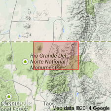
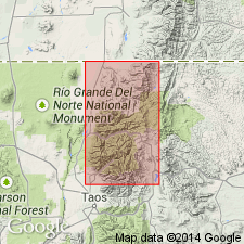
Pg. 16-18, pl. 1. Amalia formation. Includes interbedded arkosic sedimentary rocks, basalt flows, and rhyolite tuffs. Beds and flows are often lenticular and irregular. Thick flows of olivine basalt occur near base. These are overlain by beds of siltstone, tuff, and pumice, 50 to 200 feet thick. A 40- to 150-foot layer of welded tuff lies above the siltstones. This unit is silicified and forms conspicuous outcrops for more than 7 miles along strike. Welded tuff is overlain by 200 to 600 feet of semiconsolidated sandstones and conglomerates. The total exposed thickness approximately 2,000 feet. Upper beds of formation grade into, or are overlain by, thick Tertiary gravels. South and east of Costilla, Amalia lies above andesite and andesite tuffs. South of Rito de los Cedros, appears to overlap onto Precambrian granite and metamorphic rocks. Age is middle or late Tertiary.
Named from Amalia [New Mexico] Post Office which lies on west side of Costilla Valley, 5 mi southeast of town of Costilla, Taos Co., northern NM. Unit is best exposed east of the Rio Costilla [now Costilla Creek], 4 or 5 mi south of Costilla [approx. Lat. 36 deg. 56 min. 45 sec. N., Long. 105 deg. 27 min. 45 sec. W., Amalia 7.5-min quadrangle], and on north side of canyon formed by Rito de los Cedros [now Cedro Canyon; approx. Lat. 36 deg. 55 min. 45 sec. N., Long. 105 deg. 31 min. 20 sec. W., Costilla 7.5-min quadrangle], Sangre de Cristo Mountains, Taos Co., northern NM. Extends into Costilla Co., southern CO.
[Additional locality information from USGS GNIS database, Montana State Univ. Graphical Locator, and ACME Mapper 2.0; accessed November 28, 2011.]
Source: US geologic names lexicon (USGS Bull. 1200, p. 72-73).
- Usage in publication:
-
- Amalia Tuff*
- Modifications:
-
- Principal reference
- Redescribed
- Dominant lithology:
-
- Tuff
- AAPG geologic province:
-
- San Luis basin
Summary:
Amalia Formation (McKinlay, 1956) adopted and renamed Amalia Tuff, as it is restricted in this report to the ash-flow sheet from the Questa caldera in northern part of Latir volcanic field, San Luis basin. Is a distinctive high-silica alkali rhyolite characterized by phenocrysts of smoky quartz and chatoyant microperthitic sodic sanidine, 2-3 km thick. Extends beyond margins of the caldera as discontinuous erosional remnants several tens of meters thick. Other units included in Amalia now recognized as early Tertiary sedimentary rocks, precaldera andesitic sequence, Latir Peak Quartz Latite, and postcaldera sedimentary rocks of the Santa Fe Group. Principal reference locality set up along State Hwy 196, 0.5 km west of Amalia. Reference section designated south of pass between upper Costilla Valley and Underwood Lakes. Densely welded parts of Amalia recognized 25 km northeast of caldera in Underwood Lakes area and 45 km to southwest near Petaca, Tusas Mountains. Is of early Miocene or latest Oligocene, or about 23 m.y. K-Ar and fission-track ages.
Source: GNU records (USGS DDS-6; Denver GNULEX).
- Usage in publication:
-
- Amalia Tuff*
- Modifications:
-
- Age modified
- AAPG geologic province:
-
- San Luis basin
Summary:
Age changed from latest Oligocene or early Miocene, about 23 m.y. to Oligocene only. Radiometric ages vary from 23-26; only the older dates are considered reliable. A main unit and lithic-rich lower facies. Map area is south of the town of Costilla, east of the towns of Questa and Arroyo Hondo, north of 36 deg 30 min, and west of 105 deg in Taos Co, NM in the San Juan basin.
Source: GNU records (USGS DDS-6; Denver GNULEX).
For more information, please contact Nancy Stamm, Geologic Names Committee Secretary.
Asterisk (*) indicates published by U.S. Geological Survey authors.
"No current usage" (†) implies that a name has been abandoned or has fallen into disuse. Former usage and, if known, replacement name given in parentheses ( ).
Slash (/) indicates name conflicts with nomenclatural guidelines (CSN, 1933; ACSN, 1961, 1970; NACSN, 1983, 2005, 2021). May be explained within brackets ([ ]).