- Usage in publication:
-
- Altamaha grit*
- Modifications:
-
- Named
- Dominant lithology:
-
- Grit
- Sand
- AAPG geologic province:
-
- South GA-North FL sedimentary province
- South Georgia sedimentary province
Summary:
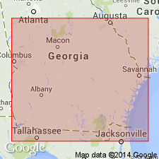
The bluffs of Altamaha River at Rocky Hammock exhibit first example on the river of a formation to which name Altamaha grit may be applied. The last bluff of the grit is only a few rods above the bridge across Altamaha River at Doctor Town. Between Rocky Hammock and Doctor Town all bluffs of Altamaha River (which are mostly on right bank of river and sometimes reach elevations of 70 feet above river) are composed of the grit, sometimes extremely hard and flinty and at others crumbly, but always composed of angular grains of slightly worn quartz mixed with more or less clay as a matrix and with water-worn quartz pebbles. Though the contact with the oyster-bearing Hawthorne beds of House Creek was not observed by Mr. Burns, there can be little doubt that the latter are overlain by the grit where they join, and that the grits, which contain no fossils except a little silicified wood, are consequently of Miocene age.
Source: GNU records (USGS DDS-6; Reston GNULEX).

- Usage in publication:
-
- Altamaha Formation
- Modifications:
-
- Principal reference
- Reinstated
- Revised
- Redescribed
- Dominant lithology:
-
- Sandstone
- Clay
- Claystone
- AAPG geologic province:
-
- South GA-North FL sedimentary province
Summary:
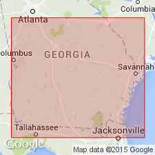
Altamaha grit is here reintroduced as Altamaha Formation. As defined in this report, the unit is largely the same as that of Dall and Harris (1982). Various names have been applied to these rocks since the term was abandoned by Stephenson and Veatch (1915). A principal reference section is designated at Upper Sister Bluff in Appling Co., GA. The Altamaha is recognized as a formation separate from the Hawthorne and Alum Bluff Groups because of its distinctive lithology and deposition. Described as thin to thick bedded or cross-bedded, well-sorted to very poorly sorted, variably feldspathic, sporadically pebbly or gravelly, argillaceous sand, sandstone, sandy clay, clay, and claystone with a fluvial to upper estuary depositional environment. The newly named Screven Member of the upper Altamaha is a prominently cross-bedded, feldspathic, gravelly sand. Grades laterally eastward into the Tiger Leap Member (new name) of the Parachucla Formation and the Ebenezer Member (new name) of the Coosawhatchie Formation; grades laterally southward into the Statenville Formation (new name) of the Hawthorne Group. Unit is widespread and disconformably overlies various formations in GA including the Tobacco Road Sand, Ocmulgee Formation and several Oligocene limestone units. Generally at the top of sections, but locally disconformably underlies the Cypresshead Formation (new name). Age is early and middle Miocene based on correlation and stratigraphic position.
Source: GNU records (USGS DDS-6; Reston GNULEX).

- Usage in publication:
-
- Altamaha Formation
- Modifications:
-
- Overview
- AAPG geologic province:
-
- Atlantic Coast basin
Summary:
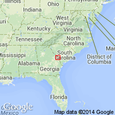
Altamaha occurs at the surface at higher elevations in many places around and within the Savannah River site, Barnwell Co., SC. Up to 70 ft thick in places. "Upland" unit, an informal term applied to deposits at higher elevations in the southwestern SC Coastal Plain, is an extension of the Altamaha Formation of GA. Sediments are red, purple, gray, orange, yellow, and tan, poorly-sorted, clayey and silty, fine to coarse sands, with lenses and layers of gravels, pebbly sands, and oxidized, massive clays. Cross-bedding is prominent. These deposits have been mapped as Hawthorn by Siple (1967), as Lafayette by McGee (1891), and as Citronelle by Doering (1976). Unconformably overlies the Tobacco Road Sand or the older Dry Branch Formation. Age according to Nystrom and Willoughby (1992) is late middle to early late Miocene. Fluvial deposition indicated by conglomerates, poorly sorted sands, and clay lenses.
Source: GNU records (USGS DDS-6; Reston GNULEX).

- Usage in publication:
-
- Altamaha Formation
- Modifications:
-
- Overview
- AAPG geologic province:
-
- Atlantic Coast basin
Summary:
Miocene Altamaha is lithologically most similar to the Late Cretaceous Pio Nono Formation in central and west-central GA. Grades laterally into the Hawthorne Group. Deposited during two phases: an early Miocene, Aquitanian phase and a middle Miocene, lower Serravallian phase. Lateral facies changes occur in both phases. No fossil vertebrates have been found in the unit even though its depositional environment is fluvial.
Source: GNU records (USGS DDS-6; Reston GNULEX).
For more information, please contact Nancy Stamm, Geologic Names Committee Secretary.
Asterisk (*) indicates published by U.S. Geological Survey authors.
"No current usage" (†) implies that a name has been abandoned or has fallen into disuse. Former usage and, if known, replacement name given in parentheses ( ).
Slash (/) indicates name conflicts with nomenclatural guidelines (CSN, 1933; ACSN, 1961, 1970; NACSN, 1983, 2005, 2021). May be explained within brackets ([ ]).

