

- Usage in publication:
-
- Aldridge formation
- Modifications:
-
- Original reference
- AAPG geologic province:
-
- Northern Rocky Mountain region
Summary:
Pg. 3. Aldridge formation. Included in Purcell series [= Belt series in U.S.] Age is Precambrian.
Source: US geologic names lexicon (USGS Bull. 896, p. 29).

- Usage in publication:
-
- Aldridge Formation
- Modifications:
-
- Not used
- AAPG geologic province:
-
- Northern Rocky Mountain region
Summary:
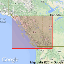
Figs. 3, 4, 5, 6. [Aldridge Formation of Purcell Supergroup recognized in Dewar Creek and Nelson areas, British Columbia, Canada. Equivalent rocks in Idaho and adjacent areas of Montana are included in Prichard Formation of Belt Supergroup; in Glacier National Park and areas to south, in central western Montana, rocks are included in (alphabetical) Altyn Limestone, Chamberlain Shale, and Newland Limestone; all of Belt Supergroup.]
Source: Publication.
For more information, please contact Nancy Stamm, Geologic Names Committee Secretary.
Asterisk (*) indicates published by U.S. Geological Survey authors.
"No current usage" (†) implies that a name has been abandoned or has fallen into disuse. Former usage and, if known, replacement name given in parentheses ( ).
Slash (/) indicates name conflicts with nomenclatural guidelines (CSN, 1933; ACSN, 1961, 1970; NACSN, 1983, 2005, 2021). May be explained within brackets ([ ]).