The National Geologic Map Database is migrating to a new infrastructure. We apologize for any service disruptions during this process.
|
|---|


- Usage in publication:
-
- Alderton formation*
- Modifications:
-
- Original reference
- Adopted
- AAPG geologic province:
-
- Puget Sound province
Summary:
Pg. 389-391. Alderton formation (or Alderton interglaciation). Consists of alluvial and lacustrine sediments, peat, volcanic ash, and mudflows from Mount Rainier. Alluvial sediments, composed chiefly of andesite fragments, range from sand to pebble and cobble gravel. Lacustrine sediments are mostly silt and fine to medium sand. Volcanic ash occurs both as distinct layers and disseminated throughout formation. Mudflows, which occur at several horizons, range from less than 10 feet to several tens of feet in thickness and are lenticular in cross section. Exposed thickness at type section 52 feet [base not exposed]; probable total thickness more than 130 feet. Considered to have been deposited during a nonglacial interval that followed Ortiz glaciation and preceded Stuck glaciation. Separated from overlying Stuck drift (new) by erosional unconformity. Age is Pleistocene. [Adopted by the USGS.]
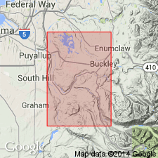
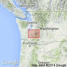
[Type section:] in west wall of Puyallup-Duwamish Valley in gullies under transmission line of Bonneville Power Administration, in center sec. 1, T. 19 N., R. 4 E., about 0.5 mi southwest of Alderton, Pierce Co., northwestern WA. [Named from Alderton.]
Source: US geologic names lexicon (USGS Bull. 1200, p. 46); supplemental information from GNU records (USGS DDS-6; Menlo GNULEX).
- Usage in publication:
-
- Alderton Formation*
- Modifications:
-
- Age modified
- AAPG geologic province:
-
- Puget Sound province
Summary:
Mapped in Lake Tapps 15' quad, Pierce Co, WA. Composite measured section on west wall of Puyallup River valley, NW/4 sec.12 T19N R4E about .75 mi northwest of McMillin where overlies Orting drift. Also occurs in walls of South Prairie Creek valley, east of Orting. Underlies Stuck drift. Age is early(?) and middle(?) Pleistocene (Alderton interglacial time).
Source: GNU records (USGS DDS-6; Menlo GNULEX).
- Usage in publication:
-
- Alderton Formation*
- Modifications:
-
- Age modified
- AAPG geologic province:
-
- Puget Sound province
Summary:
Correlation chart shows approximately 550,000 to 450,000 years [middle] Pleistocene age. [based on Richmond and Fullerton, 1986]
Source: GNU records (USGS DDS-6; Menlo GNULEX).
- Usage in publication:
-
- Alderton Formation*
- Modifications:
-
- Age modified
- AAPG geologic province:
-
- Puget Sound province
Summary:
Table 3 shows early to middle Pleistocene age (greater than 325,000? years). Correlated with part of Lily Creek Formation in Carbon and Puyallup River drainage basin. Underlies Stuck Drift and overlies Orting Drift.
Source: GNU records (USGS DDS-6; Menlo GNULEX).
- Usage in publication:
-
- Alderton Formation*
- Modifications:
-
- Paleomagnetics
- AAPG geologic province:
-
- Puget Sound province
Summary:
Reversed remanent magnetism and its stratigraphic position below Salmon Springs Drift and its approximately 800,000 yr fission-track date places Alderton Formation within Matuyama Reversed Polarity Chron between 2.4 and 0.8 Ma.
Source: GNU records (USGS DDS-6; Menlo GNULEX).
For more information, please contact Nancy Stamm, Geologic Names Committee Secretary.
Asterisk (*) indicates published by U.S. Geological Survey authors.
"No current usage" (†) implies that a name has been abandoned or has fallen into disuse. Former usage and, if known, replacement name given in parentheses ( ).
Slash (/) indicates name conflicts with nomenclatural guidelines (CSN, 1933; ACSN, 1961, 1970; NACSN, 1983, 2005, 2021). May be explained within brackets ([ ]).