The National Geologic Map Database is migrating to a new infrastructure. We apologize for any service disruptions during this process.
|
|---|


- Usage in publication:
-
- Albee formation
- Modifications:
-
- Mapped
- AAPG geologic province:
-
- New England province
Summary:
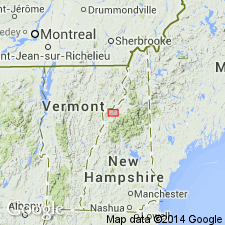
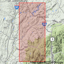
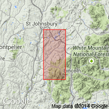
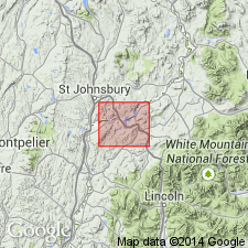
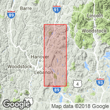
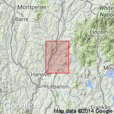
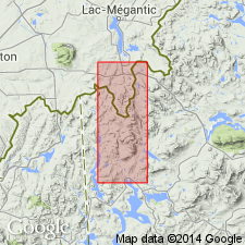
Pg. 413-415. Mapped Albee formation (pre-Silurian, Upper Ordovician?) at and around Albee Hill, Littleton quadrangle and other parts of Littleton and Moosilauke quadrangles, [Ammonoosuc River region, northwestern New Hampshire].
Source: US geologic names lexicon (USGS Bull. 896, p. 25).
- Usage in publication:
-
- Albee quartzite
- Modifications:
-
- Original reference
- Dominant lithology:
-
- Quartzite
- Slate
- AAPG geologic province:
-
- New England province
Summary:
Albee quartzite. Quartzite and slate, 4,000 feet thick, underlying Ammonoosuc volcanics in Littleton and Moosilauke quadrangles, [Ammonoosuc River region, northwestern New Hampshire]. No fossils, but are pre-Silurian and probably Upper Ordovician. [The name appears to replace Lisbon quartzite of his Feb. 1933 paper in Amer. Jour. Sci., 5th ser., v. 25, no. 146, p. 149.]
Source: US geologic names lexicon (USGS Bull. 896, p. 25).
- Usage in publication:
-
- Albee formation
- Modifications:
-
- Principal reference
- Dominant lithology:
-
- Quartzite
- Slate
- AAPG geologic province:
-
- New England province
Summary:
(Geology of Littleton and Moosilauke quadrangles, New Hampshire, maps and p. 9.) Albee formation. A group of black and green slates, argillaceous quartzite, and quartzite typically exposed on Gardner Mountain Thickness estimated to be about 4,000 feet. Age is probably Late Ordovician.
Type locality: exposures on that part of Gardner Mountain which lies between Hunt Mountain (just southwest of Littleton 15-min quandrangle) and Albee Hill [in Littleton 15-min quadrangle], northern NH. Named from Albee Hill.
Source: US geologic names lexicon (USGS Bull. 896, p. 25); supplemental information from GNU records (USGS DDS-6; Reston GNULEX).
- Usage in publication:
-
- Albee formation
- Modifications:
-
- Mapped
- AAPG geologic province:
-
- New England province
Summary:
Pg. 472-475, pl. 1 (geol. map). Four belts of Albee formation cross area [Littleton-Moosilauke, New Hampshire], one near Gardner Mountain (Littleton quadrangle), second near Towns Mountain (Littleton quadrangle), third near village of Littleton, and fourth near villages of Lisbon and Bath. Thickness about 4,000 feet. Base not exposed in area. Not everywhere possible to establish precise boundary between Albee and overlying Ammonoosuc volcanics. Pre-Silurian, probably Upper Ordovician.
[Typographical error (US geologic names lexicon, USGS Bull. 1200, p. 40): the Albee is pre-Silurian, probably Upper Ordovician; not probably Upper Devonian.]
Source: Publication; US geologic names lexicon (USGS Bull. 1200, p. 40).
- Usage in publication:
-
- Albee formation
- Modifications:
-
- Revised
- AAPG geologic province:
-
- New England province
Summary:
(J.B. Hadley, 1938, Geologic map and structure sections of the New Hampshire portion of the Mt. Cube quadrangle).
Albee formation. In Grafton County, northwestern New Hampshire, includes Piermont member (new). Thickness about 5,000 feet. Age is Ordovician.
Source: US geologic names lexicon (USGS Bull. 1200, p. 40).
- Usage in publication:
-
- Albee formation
- Modifications:
-
- Areal extent
- AAPG geologic province:
-
- New England province
Summary:
Pg. 17. Albee formation. Geographically extended into Orange County, eastern Vermont. Two narrow tongues of formation extend on either side of Orfordville formation just south of village of Bradford. [Age is Ordovician.]
Source: Publication; US geologic names lexicon (USGS Bull. 1200, p. 40).
- Usage in publication:
-
- Albee formation
- Modifications:
-
- Areal extent
- AAPG geologic province:
-
- New England province
Summary:
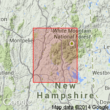
Albee type area is a band over 40 mi long, from Albee Hill continuously southward through NH and eastern VT to Haverhill, and from Albee Hill northeastward through eastern VT and western NH to 3 mi north of Whitefield. A second area extends from Northumberland, NH, to near the ME border, and is 40 mi long and 18 mi wide. A third belt extends from near Orfordville north-northeast to 25 mi north of Lisbon. Isolated patches appear for 15 mi to the northeast. Considerable variation in lithology exists due to occurrences in five metamorphic zones. Approximate thickness is 5,000 ft; difficult to estimate because of extensive folding.
Source: GNU records (USGS DDS-6; Reston GNULEX).
- Usage in publication:
-
- Albee Formation
- Modifications:
-
- Age modified
- AAPG geologic province:
-
- New England province
Summary:
Area of coverage is Boundary Mountains anticlinorium where Albee and Aziscohos Formations are both exposed at base of section in Boundary Mountains. Aziscohos is apparently lower in section and differs from Albee by its lack of pinstriped micaceous quartzite. Evidence from the Errol 15-min quad (Green, 1964) suggests that type Aziscohos underlies Albee, but exposures to the east and northeast indicate Aziscohos-like rocks overlying Albee. Solution to the problem lies in lateral facies changes involving eastward "lensing out" of the Albee pinstripe quartzite. No identifiable fossils found in Albee. Age of Early or Middle Ordovician of Albee is constrained by fossiliferous Middle Ordovician Dixville Formation above and Cambrian or Ordovician Aziscohos below.
Source: GNU records (USGS DDS-6; Reston GNULEX).
- Usage in publication:
-
- Albee Formation*
- Modifications:
-
- Revised
- Age modified
- Areal extent
- Biostratigraphic dating
- AAPG geologic province:
-
- New England province
Summary:
In Cupsuptic and Arnold Pond 15-min quads, west-central ME, Albee is divided into (ascending) Portage Brook Member, consisting of finely laminated, gray to light-green quartzite and feldspathic quartzite (6,000 ft); Kennebago Member, consisting of red, maroon, purplish-gray, and minor green slate, quartzite, and greenstone (4,500 ft); and Deer Mountain Member, consisting of green slate and phyllite with thin quartz stringers and feldspathic quartzite (2,500 ft). Albee has been correlated with Moretown Formation in eastern VT by Billings (1956). Moretown is equivalent to Beauceville Formation that contains late Middle Ordovician graptolites at Magog, Quebec. Moretown also correlates with B and C members of Poultney Slate (Zen, 1967) in northern Taconic Mountains, VT. Poultney contains late Early Ordovician to early Middle Ordovician graptolite assemblages (Berry, 1959). B and C members lithologically resemble the Albee and part of the Aziscohos Formation. Both the Poultney and Albee underlie black slate containing fossils of equivalent age. Therefore, Albee ranges in age from Early to Middle Ordovician.
Source: GNU records (USGS DDS-6; Reston GNULEX).
- Usage in publication:
-
- Albee Formation
- Modifications:
-
- Not used
- AAPG geologic province:
-
- New England province
Summary:
Albee in its type area not used. Instead, its strata are reassigned to the Silurian Rangeley, Perry Mountain, Smalls Falls, and Madrid Formations, and, at one locality, to the Early Devonian Littleton Formation. Albee strata outside the Piermont allochthon are reassigned to Cambrian(?) and Early Ordovician Dead River Formation. Rocks previously mapped as Albee in northern NH are divided into two parts. The first is a pre-Middle Ordovician quartz-schist turbidite assemblage lying below Ammonoosuc Volcanics that conforms to the original definition of Albee but doesn't occur in the type area or in the Piermont allochthon. The second part is Silurian volcanic and reworked metavolcanic rocks, schist, and quartzite including rocks of Albee type area. Rocks mapped as Albee near Piermont and Bradford Village, NH, are reassigned to the (ascending) Late Ordovician(?) Quimby Formation, Early Silurian(?) Greenvale Cove Formation, Silurian Rangeley, Perry Mountain, Smalls Falls, and Madrid Formations, and Early Devonian Littleton Formation. Type localities of all except Littleton are near Rangeley, ME. Report includes correlation chart. [Note: Albee is not abandoned in this report.]
Source: GNU records (USGS DDS-6; Reston GNULEX).
- Usage in publication:
-
- Albee Formation
- Modifications:
-
- Not used
- AAPG geologic province:
-
- New England province
Summary:
Stratigraphy differs radically from that of Hadley (1942, 1950), White and Billings (1952), in Mt. Cube and Woodsville 15-min quads, respectively, and revisions of Rumble (1942) east of Connecticut River. Fundamental difference is that Moench recognizes seven formations (plus members) that constitute Piermont allochthon. Hadley (1942) mapped all of these as Albee Formation, a name not used in this report. Rocks previously mapped as Albee are reassigned to stratigraphic equivalents of Quimby (Upper Ordovician?), Greenvale Cove (Lower Silurian), Rangeley (Lower Silurian), Perry Mountain (Silurian), Smalls Falls (Upper Silurian), Madrid (Upper Silurian?), and Littleton (Lower Devonian) Formations, whose type localities, except for Littleton, are near Rangeley, ME (Moench and Boudette, 1987). Report includes geologic map and correlation chart of revised stratigraphy.
Source: GNU records (USGS DDS-6; Reston GNULEX).
- Usage in publication:
-
- Albee Formation
- Modifications:
-
- Age modified
- AAPG geologic province:
-
- New England province
Summary:
Author disagrees with recent proposal by Moench that a large overthrust he calls the Piermont allochthon exists in west-central NH. Billings stands by his original definition of the Albee Formation, which consists of interbedded slate and quartzite and underlies the Ammonoosuc Volcanics. Author contends that there has been considerable misunderstanding concerning the type area of the Albee. Though he admits assigning various ages to the pre-Littleton formations, he now accepts the Silurian age proposed by Hatch and others (1983). Author insists that the Dead River Formation is the true correlative of the type Albee Formation and states that lithologic similarity is not sufficient evidence to correlate the rocks on Gardner Mountain with the western Maine sequence. Billings concludes from structural evidence that the "allochthon" of Moench and associates is beneath the "autochthon," and that the "allochthon" is stratigraphically beneath the Ammonoosuc Volcanics. The Albee Formation is therefore probably Middle Ordovician and is not correlative with the Perry Mountain and Rangely Formations, but with the Dead River Formation and with the Moretown Formation of VT, as suggested by Hatch (1991).
Source: GNU records (USGS DDS-6; Reston GNULEX).

- Usage in publication:
-
- Albee Formation
- Modifications:
-
- Not used
- AAPG geologic province:
-
- New England province
Summary:
Rocks previously mapped as Albee Formation in NH outside of the Piermont-Frontenac allochthon are reassigned to Upper Cambrian(?) and Ordovician (lower part) Dead River Formation (Boone, 1973; Osberg and others, 1985). Remaining Albee exposed within allochthon between Piermont, NH, and Magalloway Mountain, ME, is reassigned to Quimby and Greenvale Cove Formations (outside of map area), and to the Rangeley, Perry Mountain, Smalls Falls, and Madrid Formations, all of Piermont sequence, and to Frontenac Formation of Frontenac sequence, Guildhall, VT, 15-min quad. These units collectively range in age from latest Ordovician to latest Silurian(?). Type localities of the Piermont sequence units are in ME. Mapping done from 1983 to 1992 indicates that rocks mapped as Albee by Billings (1956) in NH and by Doll and others (1961) in VT can be divided into two assemblages. One includes metamorphosed volcanic and volcaniclastic rocks of the strike belt that extends across the type area of Albee. Although Moench (1984) tentatively correlated this assemblage with Cambrian(?) Jim Pond and Hurricane Mountain Formations, felsic metavolcanic and hypabyssal intrusive rocks of the assemblage subsequently yielded Silurian U-Pb zircon ages. Furthermore, assemblage was found to be divisible into six Ordovician, Silurian, and Silurian(?) formations (listed above). Also, Foster Hill fault separates this assemblage of allochthonous formations from autochthonous sequence that contains Ammonoosuc Volcanics. It was found, therefore, that type Albee does not lie stratigraphically below type Ammonoosuc and that all rocks exposed within type area of Albee could be assigned to other formations. The second assemblage composed of quartzite and metashale actually lies below the Ammonoosuc Volcanics and Partridge Formation and conforms more closely to original Albee definition; however, rocks represented by this second assemblage are not present in Albee type area. They are widely exposed astride the NH-ME border and are coextensive with and identical to the Upper Cambrian(?) and Ordovician (lower part) Dead River Formation of Osberg and others (1985), who reassigned rocks originally mapped as Albee in westernmost ME to the Dead River. Because of precedence set by Osberg and others (1985), and because type area of Albee is no longer viable, Dead River Formation is here applied to rocks of quartz-metashale assemblage in NH known to lie stratigraphically below Ammonoosuc Volcanics or Partridge Formation.
Source: GNU records (USGS DDS-6; Reston GNULEX).
For more information, please contact Nancy Stamm, Geologic Names Committee Secretary.
Asterisk (*) indicates published by U.S. Geological Survey authors.
"No current usage" (†) implies that a name has been abandoned or has fallen into disuse. Former usage and, if known, replacement name given in parentheses ( ).
Slash (/) indicates name conflicts with nomenclatural guidelines (CSN, 1933; ACSN, 1961, 1970; NACSN, 1983, 2005, 2021). May be explained within brackets ([ ]).