The National Geologic Map Database is migrating to a new infrastructure. We apologize for any service disruptions during this process.
|
|---|


- Usage in publication:
-
- Coleman-Albany series
- Modifications:
-
- Overview
- Dominant lithology:
-
- Shale
- Clay
- Limestone
- AAPG geologic province:
-
- Bend arch
Summary:
Pl. 3, p. lxvii. Coleman-Albany series. Shales, clays, and limestones, barren of coal, overlying Waldrip-Cisco series and underlying Wichita beds. Age is Carboniferous (Coal Measures).
Source: US geologic names lexicon (USGS Bull. 896, p. 24); supplemental information from GNU records (USGS DDS-6; Denver GNULEX).
- Usage in publication:
-
- Albany division
- Modifications:
-
- Principal reference
- Dominant lithology:
-
- Limestone
- Shale
- Sandstone
- AAPG geologic province:
-
- Bend arch
- Llano uplift
Summary:
Pg. 361-402. Albany division, uppermost of 6 divisions of Carboniferous "Coal Measures." Largely limestones and shales, with some sandstone at base. Thickness 1,180 feet. Overlies Cisco beds and underlies Permian Clear Fork beds. [See 1891 entry under Wichita formation.] Age is Carboniferous (Coal Measures). Carboniferous area of Texas stretches from below Colorado River northward to Red River, average width about 75 miles; comprises Brazos coal field (north) and Colorado coal field (south), separated by Cretaceous rocks. Report includes measured sections, fossils.
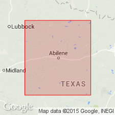
Well developed in vicinity of Albany, Shackelford Co., north-central TX. Several sections measured, beginning near western line of Callahan Co. and running southeasterly to town of San Saba, San Saba Co., TX. Absent north of Brazos River.
Source: US geologic names lexicon (USGS Bull. 896, p. 24); supplemental information from GNU records (USGS DDS-6; Denver GNULEX).

- Usage in publication:
-
- Albany division
- Modifications:
-
- Revised
- AAPG geologic province:
-
- Bend arch
- Llano uplift
Summary:
Pg. 371-372, geol. map. Albany division, uppermost of 5 Carboniferous divisions of Cummins (1891). Massive beds of blue, gray, and yellowish colored limestone, alternating with beds of blue clay, black or gray shale. Sandstone and conglomerate are almost entirely lacking. Divided into (descending) Paint Rock, Talpa, Grape Creek, Bed No. 12, Bead Mountain, Valera, Jagger Bend, Bed No. 8, Elm Creek, Coleman, Bed No. 5, Indian Creek, Hordes Creek, Lost Creek, and Coleman Junction beds. Overlies Cisco division. Age is possibly Permian, based on stratigraphic relations and fossils (footnote, p. 371).
Source: Publication.

- Usage in publication:
-
- Albany formation†
- Modifications:
-
- Abandoned
- AAPG geologic province:
-
- Bend arch
- Llano uplift
Summary:
Permian †Albany formation of northern Texas and southwestern Oklahoma abandoned. Has for many years been considered same as Wichita formation, better established name. See further explanation under Wichita formation.
Source: US geologic names lexicon (USGS Bull. 896, p. 24).
- Usage in publication:
-
- Wichita-Albany groups
- Modifications:
-
- Incidental mention
- AAPG geologic province:
-
- Bend arch
- Llano uplift
Summary:
Pg. 1677. Wichita-Albany groups. Incidental mention in discussion of Wolfcamp and Leonard series equivalents in central Texas.
Source: Publication; US geologic names lexicon (USGS Bull. 1200, p. 39).

- Usage in publication:
-
- Albany Group
- Modifications:
-
- Revised
- Areal extent
- AAPG geologic province:
-
- Bend arch
- Palo Duro basin
- Permian basin
Summary:
Albany Group revised to include (descending): Lueders Formation, Talpa Formation, Grape Creek Formation, Bead Mountain Formation, Jagger Bend and Valera Formations (undivided), Elm Creek Formation, Admiral Formation (revised), and Coleman Junction Formation (revised). Overlies Cisco Group and underlies Clear Fork Group. Equivalent to most of Wichita Group. Age is Early Permian (Wolfcamp and Leonard).
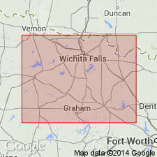
[Geographic extent arbitrarily placed. In general, recognized south of Wichita River, in Baylor and Throckmorton Cos.]
Source: Publication.
- Usage in publication:
-
- Albany Group
- Modifications:
-
- Overview
- AAPG geologic province:
-
- Bend arch
- Palo Duro basin
- Permian basin
Summary:
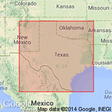
Albany "reinstated" as a group; includes strata between base of Coleman Junction Limestone and top of Lueders Formation (top of Lake Kemp Limestone in Brazos and Wichita River drainage areas). These boundaries approximate those of the original Albany division of Cummins (1891) and coincide with those of [/]Wichita-Albany Group of Brown and Goodson (1972) and Kier and others (1976). Nearly continuous outcrop for 155 to 170 miles from Brady Mountains (Colorado River drainage) to its northernmost extent in Brazos River drainage and upper reaches of North Fork of Little Wichita River (Bend arch, Palo Duro and Permian basins). Equivalent subsurface strata extend westward to Midland basin. Continuous exposure interrupted by overlying Cretaceous rocks in Callahan Divide area. Westward-dipping Albany Group thins from about 1,270 feet in the south to 1,050 feet at Brazos River. Wichita Group (revised) is the continental and minor marine equivalent of the shallow-shelf marine Albany Group. Wichita Group is used to the northeast in the Little Wichita, Wichita, and Red River drainage areas of northern Archer, eastern Baylor, southeast Wilbarger, Wichita, northern Clay and northern Montague Counties, Texas. Abrupt lateral transition between Albany and Wichita, marked by stratigraphic cutoffs coinciding with northern terminations of limestone marker beds; facies transitions are gradational. Age is Early Permian (Wolfcamp and Leonard age). Albany overlies Cisco Group; underlies Clear Fork Group. Report includes geologic map.
[The use of a hyphen between undifferentiated [members] is not considered proper notation (CSN, 1933).]
Source: Modified from GNU records (USGS DDS-6; Denver GNULEX).
For more information, please contact Nancy Stamm, Geologic Names Committee Secretary.
Asterisk (*) indicates published by U.S. Geological Survey authors.
"No current usage" (†) implies that a name has been abandoned or has fallen into disuse. Former usage and, if known, replacement name given in parentheses ( ).
Slash (/) indicates name conflicts with nomenclatural guidelines (CSN, 1933; ACSN, 1961, 1970; NACSN, 1983, 2005, 2021). May be explained within brackets ([ ]).