The National Geologic Map Database is migrating to a new infrastructure. We apologize for any service disruptions during this process.
|
|---|


- Usage in publication:
-
- Agua sandstone member
- Modifications:
-
- Original reference
- Dominant lithology:
-
- Sandstone
- AAPG geologic province:
-
- San Joaquin basin
Summary:
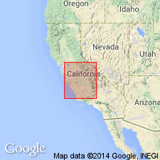
Pg. 137. Agua sandstone member of Santos shale. A sandstone member in upper part of Santos shale, that is traceable from vicinity of Carneros Creek to south of Cedar Canyon, Temblor Range, California, several miles farther northwest, and in places reaches thickness of 300+ feet, is here referred to as "Agua sandstone." It contains Vaqueros fossils at several localities (OSTREA VAQUEROSENSIS and PECTEN MAGNOLIA). Age is Early Miocene.
Source: US geologic names lexicon (USGS Bull. 896, p. 18); supplemental information from GNU records (USGS DDS-6; Menlo GNULEX).
- Usage in publication:
-
- Agua sandstone member
- Modifications:
-
- Areal extent
- AAPG geologic province:
-
- San Joaquin basin
Summary:
Pg. 4 (table 1), 5 (table 2), 8, pl. 1. Agua sandstone member of Temblor formation. Described in Bitterwater Creek area, where it is treated as basal member of Temblor formation. Consists of gray to buff fine- to medium-grained friable sandstone with abundant fragments of pectens. Thickness as much as 48 feet. Unconformably overlies Point of Rocks sandstone; overlapped by upper Santos shale. [Age is early Miocene.]
Source: US geologic names lexicon (USGS Bull. 1200, p. 26).
- Usage in publication:
-
- Agua Sandstone Member*
- Modifications:
-
- Principal reference
- Revised
- Adopted
- AAPG geologic province:
-
- San Joaquin basin
Summary:
Agua Sandstone Member of Temblor Formation. In Temblor Range, the Agua Sandstone [Member] of Santos Shale of Clark and Clark (1935) is revised to the Agua Sandstone Member of Temblor Formation. Occurs in subsurface in North Belridge, North and South Antelope Hills, McDonald anticline oil fields and vicinity. Is light-gray, arkosic, and locally pebbly. Thickness at Cedar Creek is 48 feet. Disconformably overlies Point of Rocks Sandstone. Underlies Santos Shale Member of Temblor Formation. In subsurface separates lower and upper parts of Santos Shale member. Age is late Oligocene. Assigned to top of Zemorrian stage (Foss and Blaisdell, 1968) in subsurface. At mouth of Cedar Creek contains PECTEN MAGNOLIA and is assigned late "Vaqueros age" (W.O. Addicott, oral commun., 1968). Agua Sandstone Member of Temblor Formation adopted by the USGS.
Type locality: outcrop at mouth of Cedar Creek [in sec. 28, T. 27 S., R. 18 E., Packwood Creek 7.5-min quadrangle, Kern Co., southern CA].
Reference section is at Zemorra Creek.
Source: Modified from GNU records (USGS DDS-6; Menlo GNULEX); Changes in stratigraphic nomenclature, 1973 (USGS Bull. 1395-A, p. A2-A3).
- Usage in publication:
-
- Agua Sandstone Bed*
- Modifications:
-
- Revised
- AAPG geologic province:
-
- San Joaquin basin
Summary:
Agua Sandstone Member of Dibblee (1973) is reinterpreted as sandstone bed within Santos Shale Member of Temblor Formation. Age remains Oligocene.
Source: GNU records (USGS DDS-6; Menlo GNULEX).
- Usage in publication:
-
- Agua Sandstone Bed*
- Modifications:
-
- Age modified
- AAPG geologic province:
-
- San Joaquin basin
Summary:
Agua Sandstone Bed shown as late Oligocene and early Miocene in age. [No new age information; late Zemorrian age now known to be late Oligocene and early Miocene (time transgressive) based on Poore, 1980 (USGS PP162-C)].
Source: GNU records (USGS DDS-6; Menlo GNULEX).
For more information, please contact Nancy Stamm, Geologic Names Committee Secretary.
Asterisk (*) indicates published by U.S. Geological Survey authors.
"No current usage" (†) implies that a name has been abandoned or has fallen into disuse. Former usage and, if known, replacement name given in parentheses ( ).
Slash (/) indicates name conflicts with nomenclatural guidelines (CSN, 1933; ACSN, 1961, 1970; NACSN, 1983, 2005, 2021). May be explained within brackets ([ ]).