

- Usage in publication:
-
- Pilot shale*
- Modifications:
-
- Named
- Dominant lithology:
-
- Shale
- AAPG geologic province:
-
- Great Basin province
Summary:
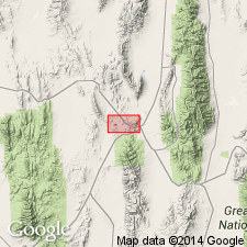
Named for Pilot Knob, western part of Ely quad in sec 8, T16N, R62E, White Pine Co, NV in the Great Basin province. No type locality designated. Ranges from 100 ft thick at Lyon Springs to about 400 ft thick near Pilot Knob. Has few good exposures. Made up entirely of soft carbonaceous drab to black shale. No fossils found. Geologic map; mapped in the southeast and northwest part of map area. Overlies Nevada limestone; underlies Joana limestone (new). Assigned to the Mississippian.
Source: GNU records (USGS DDS-6; Denver GNULEX).
- Usage in publication:
-
- Pilot Shale*
- Modifications:
-
- Revised
- AAPG geologic province:
-
- Great Basin province
Summary:
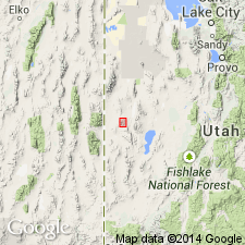
Leatham reduced in stratigraphic rank from formation to middle member of Pilot Shale in the Confusion Range, Millard Co, UT, Great Basin province. Section measured at Little Mile-and-a-Half Canyon, N1/2 sec 29, T18S, R16W described. Pilot divided into: lower member (Frasnian and early Fammenian)--a broad carbonate platform deposit; Leatham Member (Fammenian)--a deep-water organic-rich and very shallow water deposit; and upper member (Kinderhookian)--a moderately deep-water deposit. The lower member consists of deep-water protoflysch calcareous and noncalcareous siltstone, conglomeratic nodular gravity-flow and debris-flow limestones, deep-water basinal organic-rich mudstone with limestone concretions, deep-water mudstone, and interbeds of gravity-flow sandstone, siltstone, limestone and mudstone 933+ ft thick. The unconformably overlying Leatham consists of mudstone, siltstone and limestone 5-59 ft thick. The upper member (Kinderhookian) consists of thin, planar clinoform calcareous and noncalcareous siltstone 174-197 ft thick. Overlies Guilmette Formation; underlies Joana Limestone. Columnar section.
Source: GNU records (USGS DDS-6; Denver GNULEX).
- Usage in publication:
-
- Pilot Shale*
- Modifications:
-
- Mapped 1:24k
- Dominant lithology:
-
- Shale
- Siltstone
- Limestone
- AAPG geologic province:
-
- Great Basin Province
Summary:
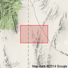
Is Lower Mississippian (Kinderhookian) and Upper Devonian (Famennian) formation mapped in northern part of the Mountain Home Range in western Millard Co, southwestern UT (Great Basin province). Overlies Guilmette Formation (Devonian) and is overlain by Joana Limestone (Lower Mississippian). Map unit described as rarely exposed, ordinarily forms smooth covered slope between adjacent resistant formations. Best exposure is in center of section 13, T 25 S, R 19 W where 30 percent exposure is obtained. Formation characterized by yellowish soil and yellowish silty limestone chips. Thin-bedded siltstone and limestone beds locally form low outcrops. Thickness fairly constant at about 110 m. Sandberg and others (1980) list conodont zones and give lithofacies interpretation.
Source: GNU records (USGS DDS-6; Denver GNULEX).

- Usage in publication:
-
- Pilot Shale*
- Modifications:
-
- Mapped 1:24k
- Dominant lithology:
-
- Shale
- Siltstone
- Limestone
- AAPG geologic province:
-
- Great Basin province
Summary:
Is Lower Mississippian (Kinderhookian) and Upper Devonian (Famennian and Frasnian) formation mapped in southern part of the Mountain Home Range in western Millard and Beaver Cos, southwestern UT (Great Basin province). Overlies Guilmette Formation (Devonian) and is overlain by Joana Limestone (Lower Mississippian). Map unit described as rarely exposed, generally forms smooth covered slope between overlying and underlying resistant formations. Characterized by yellowish soil and yellowish silty limestone chips. Thin-bedded siltstone and limestone beds locally form low outcrops. Thickness fairly constant at about 110 m. Sandberg and others (1980) list conodont zones and give lithofacies interpretation for the formation.
Source: GNU records (USGS DDS-6; Denver GNULEX).
For more information, please contact Nancy Stamm, Geologic Names Committee Secretary.
Asterisk (*) indicates published by U.S. Geological Survey authors.
"No current usage" (†) implies that a name has been abandoned or has fallen into disuse. Former usage and, if known, replacement name given in parentheses ( ).
Slash (/) indicates name conflicts with nomenclatural guidelines (CSN, 1933; ACSN, 1961, 1970; NACSN, 1983, 2005, 2021). May be explained within brackets ([ ]).