

- Usage in publication:
-
- Cap Mountain formation*
- Modifications:
-
- Named
- Dominant lithology:
-
- Limestone
- Sandstone
- AAPG geologic province:
-
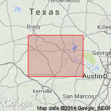
- Llano uplift
Summary:
Named for Cap Mountain, Llano quad, Llano Co, TX on Llano uplift. No type locality designated. Consists of, at base, a gradual transition from sandstone to limestone but predominantly limestone, capped by 15-75 ft of cross-bedded, glauconitic sandstone. Thickness is 90 ft. Underlies Wilberns formation; overlies Hickory sandstone. Correlates with Reagan sandstone in OK. Age is Late Cambrian.
Source: GNU records (USGS DDS-6; Denver GNULEX).
- Usage in publication:
-
- Cap Mountain formation
- Modifications:
-
- Areal extent
- Dominant lithology:
-
- Dolomite
- AAPG geologic province:
-
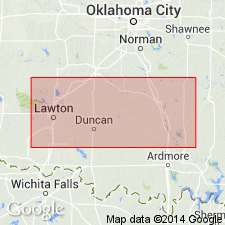
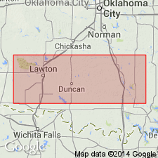
- South Oklahoma folded belt
Summary:
One exposure of sandy dolomite--gray to greenish-pink, 126 ft thick, near east end of Arbuckle Mountains, OK, in South Oklahoma folded belt province--is identified as a local extension of Cap Mountain formation. Age is Late Cambrian.
Source: GNU records (USGS DDS-6; Denver GNULEX).
- Usage in publication:
-
- Cap Mountain sandstone
- Modifications:
-
- Revised
- AAPG geologic province:
-
- South Oklahoma folded belt
Summary:
Cap Mountain sandstone of Timbered Hills group. = Honey Creek of western part of mountains. Age is Late Cambrian.
Source: US geologic names lexicon (USGS Bull. 896, Timbered Hills entry p. 2150).
- Usage in publication:
-
- Cap Mountain formation*
- Modifications:
-
- Revised
- Areal extent
- AAPG geologic province:
-
- Llano uplift
Summary:
In central Texas, Llano uplift, the thick glauconitic sandstone at top of Cap Mountain formation is named Lion Mountain sandstone member. Named from Lion Mountain, Burnet quadrangle, Texas. Underlies Wilberns formation. In Missouri, the Bonneterre dolomite corresponds to uppermost Hickory sandstone and basal Cap Mountain formation. Age is Late Cambrian. Report includes correlation chart.
Source: GNU records (USGS DDS-6; Denver GNULEX).
- Usage in publication:
-
- Cap Mountain formation*
- Modifications:
-
- Biostratigraphic dating
- AAPG geologic province:
-
- Llano uplift
Summary:
In Burnett County, Texas, on Llano uplift, Cap Mountain formation consists of a 220 feet of gray, crystalline limestone containing glauconite, overlain by a persistent 30 feet-thick sandstone called the Lion Mountain sandstone member. Basal beds are arenaceous and grade downward into Hickory sandstone. Cap Mountain characterized by CEDARIA, CREPICEPHALUS, and APHELASPIS; is equivalent to Eau Claire member of Dresbach formation of Wisconsin. Dresbach-Franconia break occurs in the barren, Lion Mountain sandstone member. Sandstone grades upward into limestones of Wilberns formation. Age is Late Cambrian. Report includes cross section.
Source: GNU records (USGS DDS-6; Denver GNULEX).
- Usage in publication:
-
- Cap Mountain formation
- Modifications:
-
- Revised
- AAPG geologic province:
-
- South Oklahoma folded belt
Summary:
In Arbuckle and Wichita Mountains, OK, South Oklahoma folded belt province, the name Timbered Hills group is introduced with the Cap Mountain formation as the middle unit. Cap Mountain overlies Reagan sandstone and underlies Honey Creek formation, both of Timbered Hills group. Is present in only one locality in OK, a sandy, pinkish-green dolomite 125 ft thick. Age is Late Cambrian.
Source: GNU records (USGS DDS-6; Denver GNULEX).
- Usage in publication:
-
- Cap Mountain limestone member*
- Modifications:
-
- Revised
- AAPG geologic province:
-
- Llano uplift
Summary:
In central TX, Llano uplift, revised as Cap Mountain limestone member of Riley formation (new). Consists of 1) a lower portion of alternating dark-brown, impure limestone and calcareous sandstone, becoming more calcareous upward, and 2) an upper portion of brownish-gray, thick-bedded to massive limestone. Includes beds formerly included in underlying Hickory sandstone member of Riley. Is overlain by Lion Mountain sandstone member of Riley, which was formerly part of Cap Mountain formation. Thickness is 400 ft in Blanco Co, TX. Age is Late Cambrian.
Source: GNU records (USGS DDS-6; Denver GNULEX).

- Usage in publication:
-
- Cap Mountain limestone member*
- Modifications:
-
- Revised
- AAPG geologic province:
-
- Llano uplift
Summary:
Riley formation in the study area (Llano uplift of central TX) ranges from about 600 to nearly 800 ft thick; it is thickest in southeast Llano Co. and thinnest in northwest corner of uplift; it overlies pre-Cambrian rocks; it underlies Wilberns formation; it is assigned a Late Cambrian age. Cross sections. Riley is divisible into the Hickory sandstone member, at base, Cap Mountain limestone member, in middle, and Lion Mountain sandstone member, at top. Upper boundary of Hickory modified; contact with overlying Cap Mountain placed at top of a noncalcareous sandstone beneath a zone of alternating impure dark brown limestone and calcareous sandstone; this contact is also a distinct topographic and vegetational break. The Hickory-Cap Mountain contact was previously placed at an indefinite point or thin the sequence. The upper contact of the Lion Mountain is revised in that Lion Mountain underlies the newly named Welge sandstone member of the Wilberns.
Source: GNU records (USGS DDS-6; Denver GNULEX).
- Usage in publication:
-
- Cap Mountain formation
- Modifications:
-
- Not used
Summary:
In Wichita and Arbuckle Mountains, OK, in South Oklahoma folded belt province, on basis of faunal evidence and stratigraphic position, Cap Mountain formation is included as part of Honey Creek formation. Cap Mountain not used. Age is Late Cambrian.
Source: GNU records (USGS DDS-6; Denver GNULEX).
- Usage in publication:
-
- Cap Mountain limestone member*
- Modifications:
-
- Biostratigraphic dating
- AAPG geologic province:
-
- Llano uplift
Summary:
In central TX, Llano uplift, faunal zones established do not correspond to lithic boundaries. Some fauna in basal portion may be late Middle Cambrian age. Age is Middle to Late Cambrian.
Source: GNU records (USGS DDS-6; Denver GNULEX).
- Usage in publication:
-
- Cap Mountain Limestone Member
- Modifications:
-
- Revised
- Overview
- AAPG geologic province:
-
- Llano uplift
- Kerr basin
- Bend arch
Summary:
In central TX, Llano uplift, revised as middle member of Riley Formation of Moore Hollow Group (new). Moore Hollow Group includes Riley Formation below and Wilberns Formation above, and ranges in age from Middle Cambrian to Early Ordovician. Cap Mountain underlies Lion Mountain Sandstone Member with gradational boundary. To north in subsurface boundary placed where terrigenous material disappears and limestone dominant; to south boundary is at top of oolitic, massive, yellow-gray to light-olive-gray limestone. Thickness at surface 170-497 ft, thickening to southeast. In subsurface exceeds 500 ft to south in Kerr Co, south TX; to north it feathers out. To northwest across Llano uplift lower sandy unit of Cap Mountain replaced laterally by underlying Hickory sandstone. In subsurface all units grade laterally into Hickory Sandstone. Isopach map. Correlation chart. Geologic maps. Based on paleontology, age is Late Cambrian, Dresbachian.
Source: GNU records (USGS DDS-6; Denver GNULEX).
For more information, please contact Nancy Stamm, Geologic Names Committee Secretary.
Asterisk (*) indicates published by U.S. Geological Survey authors.
"No current usage" (†) implies that a name has been abandoned or has fallen into disuse. Former usage and, if known, replacement name given in parentheses ( ).
Slash (/) indicates name conflicts with nomenclatural guidelines (CSN, 1933; ACSN, 1961, 1970; NACSN, 1983, 2005, 2021). May be explained within brackets ([ ]).