

- Usage in publication:
-
- Bloomsburg red shale
- Modifications:
-
- Named
- Dominant lithology:
-
- Shale
- AAPG geologic province:
-
- Appalachian basin
Summary:
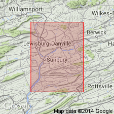
Named the Bloomsburg red shale for Bloomsburg, Columbia Co., PA. Consists of a series of dark, deep or dull red shales, somewhat sandy and blotched with a few thin layers of bright green shale. Unit is 245 to 750 feet thick; about 440 feet is visible at the type locality. The Bloomsburg represents the basal member of the Salina series. It underlies the Middle Salina group and overlies the Clinton series. The Bloomsburg is of Late Silurian age.
Source: GNU records (USGS DDS-6; Reston GNULEX).
- Usage in publication:
-
- Bloomsburg red beds
- Modifications:
-
- Areal extent
- AAPG geologic province:
-
- Appalachian basin
Summary:
Geographically extended the Bloomsburg red beds to southeastern NY, as far as Otisville, Orange Co. The Bloomsburg is equivalent to the upper part of the McKenzie formation, Wills Creek shale, and lower part of the Tonoloway limestone.
Source: GNU records (USGS DDS-6; Reston GNULEX).
- Usage in publication:
-
- Bloomsburg Formation
- Modifications:
-
- Overview
- AAPG geologic province:
-
- Appalachian basin
Summary:
The Bloomsburg red beds form a westward-thinning clastic wedge, represented in the study area by a thin red-bed sequence above the Mifflintown Formation (as well as the Rabble Run Member of the Mifflintown). Siltstone, which constitutes approximately 40 percent of the Bloomsburg, is grayish red and very thin to very thick bedded. Beds are parallel, flat, and poorly fissile. The siltstone is noncalcareous to slightly calcareous and contains grayish-red clay clasts and burrows perpendicular to bedding. Mudstone, which makes up about 30 percent of the formation, is grayish red and generally thick bedded. Sandstone constitutes about 10 percent of the formation and is grayish red, very fine grained, silty, and very thin to thin bedded. Gray shale and limestone occur in the lower part, interbedded with red mudstone and siltstone. The shale is grayish green to light olive gray, fissile and thick to very thick bedded. Limestone is light-olive-gray, argillaceous, and very thin bedded calcisiltite. Lower contact with the Mifflintown is conformable and is placed at the first red bed above the Mifflintown limestone and shale. Upper contact is conformable and is placed at the top of the uppermost red bed below the gray shale of the Wills Creek Formation. Thickness, as measured along U.S. Route 22, 2.3 km northeast of Canoe Creek, is 26+/-2 m. Age is Late Silurian.
Source: GNU records (USGS DDS-6; Reston GNULEX).
- Usage in publication:
-
- Bloomsburg Formation
- Modifications:
-
- Overview
- AAPG geologic province:
-
- Appalachian basin
Summary:
Bloomsburg Formation thins westward from more than 600 m at the eastern border of PA to about 15 m at the western margin of the Valley and Ridge in central PA. Age ranges from late Ludlovian to early Pridolian in the Late Silurian. In study area, unit is largely red mudrock, with the exception of the resistant Moyer Ridge Member, a sandstone toward the top. At many localities, the mudrock has numerous small-scale, 1 to 5-m cyclic alternations of marine and nonmarine facies. Cycle begins with thin, wave-rippled, very fine-grained sandstone. This is overlain by bioturbated mudrock containing an ostracod-dominated sparse marine or brackish fauna. Top consists of red claystone with fine root marks, some weakly developed carbonate nodules, and abundant pedogenic slickensides. These cycles indicate that depositional setting in central PA was a broad, low-gradient coastal plain or deltaic plain. Toward the east, unit contains increasing proportions of sandstone and some conglomerate. At Lehigh Gap near the NJ border, includes the Lehigh Gap clay paleosol.
Source: GNU records (USGS DDS-6; Reston GNULEX).
- Usage in publication:
-
- Bloomsburg Formation
- Modifications:
-
- Overview
- AAPG geologic province:
-
- Appalachian basin
Summary:
Bloomsburg paleosol "cycles" consist of a basal, sharp marine erosional surface that truncates the subjacent paleosol, followed by a red interval that includes symmetrical wave ripple-laminated sandstone and bioturbated siltstone, which is then succeeded upward by red claystone with abundant pedogenic slickensides. Cycle 6 at the North Milton locality is designated North Milton paleosol. Soil is a 3.4-m-thick claystone. Age of the Bloomsburg and its North Milton paleosol is Late Silurian.
Source: GNU records (USGS DDS-6; Reston GNULEX).
- Usage in publication:
-
- Bloomsburg Red Beds*
- Modifications:
-
- Revised
- AAPG geologic province:
-
- Appalachian basin
Summary:
The Bloomsburg Red Beds in southeastern NY is revised to include two intervening tongues, the lower Wurtsboro Tongue and the upper Basher Kill Tongue. These two tongues are separated by the Ellenville Tongue of the Shawangunk Formation. The Wurtsboro Tongue at its type section consists of 115 ft of interbedded red, green, and gray, cross bedded polymictic conglomerate, sandstone, siltstone, and shale. These lithologies occur in fining-upward cycles as much as 12 ft thick. The thickness of the Wurtsboro ranges from 300 ft north of Port Jervis, NY, to 75 ft at Accord, NY. The Wurtsboro Tongue grades upward into the Ellenville Tongue of the Shawangunk Formation. The Basher Kill Tongue overlies the Ellenville Tongue and its type section consists of 33 ft of olive-gray, brownish-gray, very fine-grained to granular, thin- to medium-bedded quartzite, and grayish-red to red-purple shaly siltstone. Near Port Jervis the Basher Kill is 330 ft thick. The Bloomsburg overlies the Shawangunk Formation and underlies either the Poxono Island Formation or the High View Tongue of the Shawangunk Formation. The Bloomsburg Red Beds is of Late Silurian age.
Source: GNU records (USGS DDS-6; Reston GNULEX).
For more information, please contact Nancy Stamm, Geologic Names Committee Secretary.
Asterisk (*) indicates published by U.S. Geological Survey authors.
"No current usage" (†) implies that a name has been abandoned or has fallen into disuse. Former usage and, if known, replacement name given in parentheses ( ).
Slash (/) indicates name conflicts with nomenclatural guidelines (CSN, 1933; ACSN, 1961, 1970; NACSN, 1983, 2005, 2021). May be explained within brackets ([ ]).