

- Usage in publication:
-
- Yonna formation*
- Modifications:
-
- Named
- Biostratigraphic dating
- Dominant lithology:
-
- Diatomite
- Sandstone
- Siltstone
- Ash
- Tuff
- AAPG geologic province:
-
- Great Basin province
Summary:
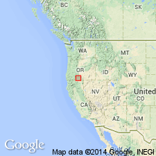
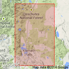
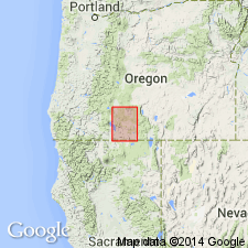
Type locality designated along west side of Yonna Valley, T38S R11.5E, Klamath Co, OR. Crops out in large areas in Yonna, Swan Lake, Sprague River, Williamson River, Poe, and Klamath Valleys and adjacent Lost River Basin. In type area consists of (1) lower sedimentary (lacustrine) section of ashy diatomite, stratified sandstone, laminated siltstone, waterlaid volcanic ash, pumice, and semiconsolidated gravel, and (2) rather thick upper unit of basaltic lapilli tuff, part of which was deposited in water. Is as much as 2000 ft thick. Cut by dikes and sills of generally basaltic composition and is broken by intricate system of block faulting. Overlies unnamed lava rocks; underlies with minor erosional unconformity lava rocks (Pliocene?), Quaternary lava or alluvium. Age is Pliocene on basis of fresh-water mollusks identified by Ten-Chien Yen (USGS), diatoms identified by K.E. Lohman (Geological Survey), and peccary skull, PROSTHENOPS OREGONSIS Colbert (middle Pliocene) identified by Jean Hough (USGS).
Source: GNU records (USGS DDS-6; Menlo GNULEX).
- Usage in publication:
-
- Yonna Formation*
- Modifications:
-
- Age modified
- Geochronologic dating
- AAPG geologic province:
-
- Great Basin province
Summary:
Unit age modified to: latest Miocene to early Pliocene based on K-Ar ages of underlying and overlying basalt lava flows between 5.5 and 3.6 Ma. "This indicates a latest Miocene to early Pliocene age for mammalian and fish fossil localities of Newcomb (1958)."
Source: GNU records (USGS DDS-6; Menlo GNULEX).
- Usage in publication:
-
- Yonna Formation†
- Modifications:
-
- Abandoned
- AAPG geologic province:
-
- Great Basin province
Summary:
Unit is abandoned and its strata are reassigned to several unnamed units.
Source: GNU records (USGS DDS-6; Menlo GNULEX).
For more information, please contact Nancy Stamm, Geologic Names Committee Secretary.
Asterisk (*) indicates published by U.S. Geological Survey authors.
"No current usage" (†) implies that a name has been abandoned or has fallen into disuse. Former usage and, if known, replacement name given in parentheses ( ).
Slash (/) indicates name conflicts with nomenclatural guidelines (CSN, 1933; ACSN, 1961, 1970; NACSN, 1983, 2005, 2021). May be explained within brackets ([ ]).