

- Usage in publication:
-
- Yakataga formation
- Modifications:
-
- Named
- Biostratigraphic dating
- Dominant lithology:
-
- Sandstone
- Shale
- Conglomerate
- AAPG geologic province:
-
- Alaska Southern region
Summary:
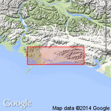
Is well exposed at Yakataga Reef and on north and south flanks of Yakataga anticline, Controller Bay-Yakataga region, southern AK. Consists of series of sandstones, dark shales, and conglomerates. Thickness is in excess of 5000 ft. Partial measured section of unit at Yakataga Reef is 1538 ft thick. Conformably overlies Poul Creek formation (new). Fauna obtained from both Poul Creek and Yakataga formations are of late Oligocene age according to B.L. Clark.
Source: GNU records (USGS DDS-6; Menlo GNULEX).
- Usage in publication:
-
- Yakataga formation*
- Modifications:
-
- Adopted
- Revised
- Age modified
- Biostratigraphic dating
- AAPG geologic province:
-
- Alaska Southern region
Summary:
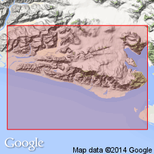
Yakataga formation of Taliaferro (1932) [adopted]. Lower part of Yakataga Reef section is reassigned to Poul Creek formation. Yakataga in southeastern part of Robinson Mountain is at least 10,000 ft and possibly 15,000 ft thick. Stratigraphic section included in report. There is diversity of opinion regarding age. F.S. MacNeil regards age as middle and late Miocene and possibly early Pliocene.
Source: GNU records (USGS DDS-6; Menlo GNULEX).
- Usage in publication:
-
- Yakataga Formation*
- Modifications:
-
- Age modified
- Biostratigraphic dating
- AAPG geologic province:
-
- Alaska Southern region
Summary:
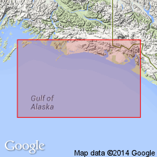
Age of unit in Gulf of Alaska Tertiary province is early Miocene through Holocene based on macrofossils and microfossils of Saucesian to Relizian Stages.
Source: GNU records (USGS DDS-6; Menlo GNULEX).
For more information, please contact Nancy Stamm, Geologic Names Committee Secretary.
Asterisk (*) indicates published by U.S. Geological Survey authors.
"No current usage" (†) implies that a name has been abandoned or has fallen into disuse. Former usage and, if known, replacement name given in parentheses ( ).
Slash (/) indicates name conflicts with nomenclatural guidelines (CSN, 1933; ACSN, 1961, 1970; NACSN, 1983, 2005, 2021). May be explained within brackets ([ ]).