

- Usage in publication:
-
- Windy Gap Volcanic Member*
- Modifications:
-
- Original reference
- Dominant lithology:
-
- Breccia
- Sandstone
- Conglomerate
- AAPG geologic province:
-
- North Park basin
Summary:
E36-E39. Windy Gap Volcanic Member of Middle Park Formation. Name applied to sequence of andesitic and trachyandesitic volcaniclastic rocks at or near base of Middle Park Formation. Thickness 1,143 feet at type section. In most areas unconfonnably overlies Pierre Shale of Late Cretaceous age, but locally the unconformity cuts across the Pierre, and Windy Gap rests on Niobrara Formation of Late Cretaceous age. Contact between Windy Gap and older rocks is sharp and marked by a few feet of reworked shale overlain by poorly sorted volcaniclastic rocks. In areas where Windy Gap Member pinches out into lower part of Middle Park, volcanic conglomerates interfinger with arkosic conglomerates. Upper contact of member gradational. Pollen from bed of carbonaceous debris that overlies member is of Late Cretaceous age. Age is considered Late Cretaceous.
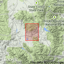
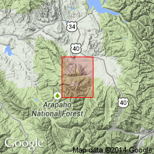
Type locality: on north side of U.S. Highway 40 at Windy Gap, 4 mi west of Granby. Section measured in NE/4 sec. 27, T. 1 N., R. 77 W., Grand Co., northwestern CO. Named from Windy Gap.
designated and measured on north side of Hwy 40 at Windy Gap, 4 mi west of Granby, CO in NE1/4 sec 27, T1N, R77W, Grand Co, CO in the North Park basin. Is 1,143 ft thick at type where it overlies Pierre Shale and underlies unnamed part of Middle Park. Consists of a breccia (at base) of fragments of granite, quartz, microcline, trachyte, trachyandesite, and andesite up to 5 ft in diameter, dark brown, volcanic, conglomeratic sandstone (in middle), and volcanic conglomerate (at top) of well-rounded, reddish-brown, greenish-gray, and grayish-red andesite fragments as much as 2 ft in diameter in a matrix of brown, volcanic, sandy mudstone. Also includes some tuff. Ranges from 0-1,150 ft thick. Averages 600 ft thick. Clastic material in upper part is well sorted, and ranges from thin to thick bedded. Middle and lower parts are poorly sorted. Beds are massive, form prominent ridges. No fossils found in member. Of Late Cretaceous age.
Source: GNU records (USGS DDS-6; Denver GNULEX).
- Usage in publication:
-
- Windy Gap Volcanic Member*
- Modifications:
-
- Age modified
- AAPG geologic province:
-
- North Park basin
Summary:
Is basal member of Middle Park Formation. Probably formed from destruction of andesitic volcanic domes that were active in and along east margin of North-Middle Park basin in Late Cretaceous time. Accumulated from near Fraser to head of Willow Creek, central-east side of quad (geologic map). Forms bold cliffs and ridges. Is 625 ft thick northeast of Hot Sulphur Springs. Thins to northwest. Silicified logs, casts of EQUISETUM, fragment of fern pinnules found near top. Paleobotanical evidence conflicting. Late Cretaceous? age assigned.
Source: GNU records (USGS DDS-6; Denver GNULEX).
- Usage in publication:
-
- Windy Gap Volcanic Member*
- Modifications:
-
- Overview
- AAPG geologic province:
-
- North Park basin
Summary:
Is Upper Cretaceous(?) member mapped at base of Middle Park Formation (Paleocene and Upper Cretaceous?) in central and northwest parts of quadrangle in Grand Co., CO (North Park basin). Unconformably overlies Pierre Shale (Upper Cretaceous) and older bedrock units. Is overlain by main body of Middle Park Formation. Map unit described as medium- to dark-gray, greenish-gray, or purplish-gray volcanic breccia and conglomerate; trachyandesite flow near base at Pole Creek; beds vary from massive laharic breccia containing boulders as much as 4 ft in diameter and composed almost entirely of andesite and trachyandesite fragments, to bedded fluviatile boulder and pebble conglomerates and volcanic sandstone containing a substantial proportion of Precambrian debris. Thickness 0-700 ft.
Source: GNU records (USGS DDS-6; Denver GNULEX).
For more information, please contact Nancy Stamm, Geologic Names Committee Secretary.
Asterisk (*) indicates published by U.S. Geological Survey authors.
"No current usage" (†) implies that a name has been abandoned or has fallen into disuse. Former usage and, if known, replacement name given in parentheses ( ).
Slash (/) indicates name conflicts with nomenclatural guidelines (CSN, 1933; ACSN, 1961, 1970; NACSN, 1983, 2005, 2021). May be explained within brackets ([ ]).