- Usage in publication:
-
- Windy Flats Group*
- Modifications:
-
- Original reference
- Dominant lithology:
-
- Greenstone
- Slate
- Metabasalt
- Schist
- AAPG geologic province:
-
- Midcontinent region
Summary:
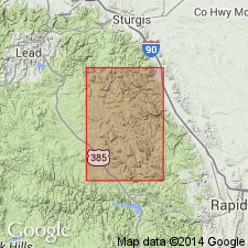
Windy Flats Group. Metabasalt, slate, schist, and chert. Includes (descending) Reausaw Slate and Hay Creek Greenstone (both new). Lies below Roubaix Formation and above Gingrass Draw Slate (new). Mapped in Pennington and Lawrence Cos., SD. Age is middle Precambrian (Precambrian X).
Named from exposures on Windy Flats, in SW/4 T. 4 N., R. 4 E., Galena-Roubaix district, 1 mi west of map area, [Deadwood South 7.5-min quadrangle, Lawrence Co., SD].
[Type locality (composite; Reausaw Slate and Hay Creek Greenstone): in sec. 1, T. 3 N., R. 4 E., and in secs. 34 and 35, T. 4 N., R. 4 E., Black Hills, Lawrence Co., SD.]
Source: Publication; US geologic names lexicon (USGS Bull. 1520, p. 338).
For more information, please contact Nancy Stamm, Geologic Names Committee Secretary.
Asterisk (*) indicates published by U.S. Geological Survey authors.
"No current usage" (†) implies that a name has been abandoned or has fallen into disuse. Former usage and, if known, replacement name given in parentheses ( ).
Slash (/) indicates name conflicts with nomenclatural guidelines (CSN, 1933; ACSN, 1961, 1970; NACSN, 1983, 2005, 2021). May be explained within brackets ([ ]).

