

- Usage in publication:
-
- Williams Fork formation*
- Modifications:
-
- Named
- Dominant lithology:
-
- Sandstone
- Shale
- Coal
- AAPG geologic province:
-
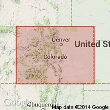
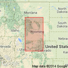
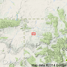
- Green River basin
Summary:
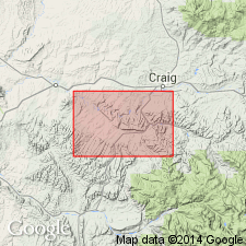
Named as the upper formation of the Mesaverde group for exposures along Williams Fork near its junction with the Yampa River and in the Williams Fork Mountains, Moffat Co, CO in the Greater Green River basin. Is present in a belt extending from middle of Axial quad southeast and east across Monument Butte quad, and on north flank Danforth Hills. Base chosen as base of coal beds of Williams Fork and at top of Trout Creek sandstone member of underlying newly named Iles formation of Mesaverde group. Consists of sandstone, sandy shale, carbonaceous shale, and coal. Sandstone beds not as persistent as they are in underlying Iles. About 900-1,050 ft above base, a persistent sandstone continuous with Twentymile sandstone is recognized and designated as a member of Williams Fork. Locally another persistent white sandstone present near top of Williams Fork. Has zones of baked brick-red sandstone and shale produced by burning of coal. Coal beds extend in the formation to within 200 ft of top. Overall thickness approximately 1,600 ft. Underlies Lewis shale. Fossils (marine and brackish water invertebrates, plants listed). A marine, estuarine and swamp deposit. Cretaceous age.
Source: GNU records (USGS DDS-6; Denver GNULEX).
- Usage in publication:
-
- Williams Fork formation*
- Modifications:
-
- Revised
- Overview
- AAPG geologic province:
-
- Green River basin
- Piceance basin
Summary:
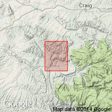
Revised in Moffat and Rio Blanco Cos, CO, Green River and Piceance basins in that three coal units and a sandstone member are named and assigned to Williams Fork. In ascending order these newly named units are: Fairfield coal group, Goff coal group, Lion Canyon sandstone member and Lion Canyon coal group. Measured section; geologic map. Conformably overlies Iles formation; unconformably underlies Wasatch formation. Thickness ranges from 4540-5050 ft. Various fossil invertebrates of wide stratigraphic range. Late Cretaceous age.
Source: GNU records (USGS DDS-6; Denver GNULEX).
- Usage in publication:
-
- Williams Fork formation
- Modifications:
-
- Contact revised
- AAPG geologic province:
-
- Piceance basin
Summary:
Lower contact revised at Rangely anticline, Rio Blanco Co, CO in the Piceance basin where Williams Fork formation, upper formation of Mesaverde group underlies Rim Rock sandstone (new), middle formation of Mesaverde. Section 2,614 ft thick measured at Rangely anticline. Contact is a gray, soft, thin-bedded sandstone (Rim Rock) with dark brown and black shale (Williams Fork). The lower boundary of Williams Fork is the top of Trout Creek sandstone. Such a bed located 800 ft above base at Rangely. If sandstone is Trout Creek equivalent, base of Williams Fork placed too low. Deposited on a broad coastal plain near sea level. Extensive swamps present where coal deposited. Late Cretaceous age.
Source: GNU records (USGS DDS-6; Denver GNULEX).
- Usage in publication:
-
- Williams Fork Formation*
- Modifications:
-
- Overview
- AAPG geologic province:
-
- Green River basin
Summary:
Correlation of Upper Cretaceous Pierre Shale (and its Hygiene, Terry, Rocky Ridge, and Larimer Sandstone Members) near Boulder, CO with Pierre Shale (and its Sharon Springs, Kremmling, Muddy Buttes, Hygiene, Carter and Gunsight Pass Members) near Kremmling, CO, and with upper part of Mancos Shale (and its Morapos and Loyd Sandstone Members) and with Iles Formation (and its Tow Creek and Trout Creek Sandstone Members) and Williams Fork Formation (and its Twentymile Sandstone member); the last two are formations of Mesaverde Group of Hamilton area, Moffat Co in Greater Green River basin shown on fig. 2.
Source: GNU records (USGS DDS-6; Denver GNULEX).
- Usage in publication:
-
- Williams Fork Formation
- Modifications:
-
- Revised
- Overview
- AAPG geologic province:
-
- Piceance basin
- Eagle basin
Summary:
Cretaceous Mesaverde Group divided into the Iles Formation (at base) and Williams Fork Formation (at top). Mesaverde overlies and intertongues with the Mancos Shale, and underlies Ohio Creek Conglomerate. Correlation chart. Geologic map. The Iles is 890 to 1,600 ft thick and divisible into four named units--"Sego Sandstone," "Corcoran Sandstone," Cozzette Sandstone, and the "Rollins-Trout Creek Sandstone" --each one is separated from the other by unnamed interval. The Williams Fork is divided into the Bowie Shale Member, Paonia Shale Member, and the "upper Mesaverde undifferentiated." Bowie and Paonia were formerly assigned to the Mesaverde Formation. Term Bowie used for the lower 680 ft of the Williams Fork for a: 1) fresh to brackish water, coal channel sandstone, siltstone, shale; 2) marine siltstone and shale; 3) bar-beach-delta front sandstone; 4) brackish water coal; 5) nonmarine sandstone, siltstone, shale, local coal. Uppermost unit of Bowie is a sandstone. The Paonia is a nonmarine sandstone, siltstone, shale, and coal bed unit about 500 ft thick. The top of Paonia is gradational. Bowie and Paonia can be recognized in this study from T11S, Rs88 and 89W, Gunnison Co, CO, Piceance basin to as far as North Thompson Creek, T8S, Rs88 and 89W, Pitkin Co, CO, Eagle basin. The upper Mesaverde is a 2,000 to 4,000 ft thick series of "conglomeratic," siltstone, shale, and lenticular coal beds.
Source: GNU records (USGS DDS-6; Denver GNULEX).

- Usage in publication:
-
- Williams Fork Formation*
- Modifications:
-
- Revised
- AAPG geologic province:
-
- Green River basin
Summary:
An ash bed, altered to claystone, that lies 0-250 ft above base of Upper Cretaceous Williams Fork Formation of Mesaverde Group, named Yampa bed for occurrences along Yampa River Valley near Craig, Moffat Co, CO in Greater Green River basin. The bed is a regionally persistent marker.
Source: GNU records (USGS DDS-6; Denver GNULEX).
- Usage in publication:
-
- Williams Fork Formation*
- Modifications:
-
- Overview
- AAPG geologic province:
-
- Green River basin
Summary:
Is upper formation of Mesaverde Group in southeast Sand Wash basin, Moffat and Routt Cos, CO (part of Greater Green River basin). Includes Twentymile Sandstone Member in upper part. [Change in nomenclature of units within Mesaverde occurs in Sand Wash basin due to facies changes from nonmarine to marginal marine strata southeastward.] Approximate geographic boundary of nomenclature change located between gas well (station 6, sec 13, T10N, R94W) and dry oil and gas drillhole (station 7, sec 13, T8N, R93W) in Moffat Co, CO. Williams Fork is shown correlative with Ericson Sandstone (in part), Pine Ridge Sandstone, and Almond Formation. Late Cretaceous age.
Source: GNU records (USGS DDS-6; Denver GNULEX).
- Usage in publication:
-
- Williams Fork Formation*
- Modifications:
-
- Geochronologic dating
- AAPG geologic province:
-
- Green River basin
Summary:
Pg. 14, geologic time scale (inside front cover). Sample from tonstein in Williams Fork Formation of Mesaverde Group. [K-Ar] age on plagioclase 72.2 +/-5.1 Ma [Late Cretaceous]. Sample no. USGS(D)SS1. Sample locality: near abandoned coal mine, Lat. 40 deg. 25 min. N., Long. 107 deg. 39 min. W., in sec. 6, T. 5 N., R. 91 W., Round Bottom 7.5-min quadrangle, Moffat Co., CO. Submitted by E. Johnson. Ages determined by USGS personnel in Denver, CO (R.F. Marvin, H.H. Mehnert, E.A. Brandt). Decay constants, recommended by the IUGS Subcommission on Geochronology (Steiger and Jager, 1977, Earth and Planetary Science Letters, v. 36, p. 359-362) are used.
Source: Publication.
- Usage in publication:
-
- Williams Fork Formation*
- Modifications:
-
- Areal extent
- Biostratigraphic dating
- AAPG geologic province:
-
- Piceance basin
Summary:
Unit previously mapped by author (GQ-1131, 1973, and GQ-1195, 1974) as Ohio Creek? Formation in lower Yellow Creek area, Moffat and Rio Blanco Cos, CO, Piceance basin, is not used in this report. Most of rocks occupying interval previously assigned to Ohio Creek? are tentatively included as part of Upper Cretaceous Williams Fork Formation of Mesaverde Group. Biostratigraphic dating based on fossil paleobotany locality D4773--about 450 ft below top of formation--and from USGS paleobotany locality D4777--about 80 ft below top of formation--indicate Late Cretaceous age no older than Campanian. Fossils listed. Paleobotany localities are respectively in Moffat and Rio Blanco Cos, CO in Piceance basin. Same author in previous study (GQ-1131, 1973) assigned same age as above to formation; however, fossils not listed.
Source: GNU records (USGS DDS-6; Denver GNULEX).
For more information, please contact Nancy Stamm, Geologic Names Committee Secretary.
Asterisk (*) indicates published by U.S. Geological Survey authors.
"No current usage" (†) implies that a name has been abandoned or has fallen into disuse. Former usage and, if known, replacement name given in parentheses ( ).
Slash (/) indicates name conflicts with nomenclatural guidelines (CSN, 1933; ACSN, 1961, 1970; NACSN, 1983, 2005, 2021). May be explained within brackets ([ ]).