- Usage in publication:
-
- Wheelock Member
- Modifications:
-
- Areal extent
- AAPG geologic province:
-
- East Texas basin
- Gulf Coast basin
Summary:
Wheelock Member of Cook Mountain Formation. Marly clay, some glauconitic calcareous ironstone, very abundant marine megafossils. Thickness about 70 feet. Lies above Stone City Formation and below Landrum Member of Cook Mountain. Age is Eocene.
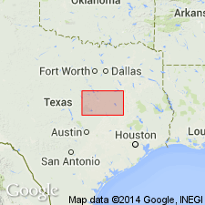
Not separately mapped. (Cook Mountain [undivided] mapped in southeastern corner of map sheet in Madison and Leon Cos., eastern TX.)
Source: Publication.
For more information, please contact Nancy Stamm, Geologic Names Committee Secretary.
Asterisk (*) indicates published by U.S. Geological Survey authors.
"No current usage" (†) implies that a name has been abandoned or has fallen into disuse. Former usage and, if known, replacement name given in parentheses ( ).
Slash (/) indicates name conflicts with nomenclatural guidelines (CSN, 1933; ACSN, 1961, 1970; NACSN, 1983, 2005, 2021). May be explained within brackets ([ ]).

