- Usage in publication:
-
- Wetumka shale*
- Modifications:
-
- First used
- Dominant lithology:
-
- Shale
- Sandstone
- AAPG geologic province:
-
- Arkoma basin
Summary:
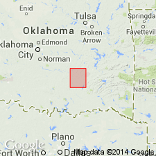
First published use of name; intent to name not stated, and no type locality designated. Origin of name not stated. Is composed of friable, laminated clay shales except for thin, shaly sandstone layers near center. Estimated to be about 120 ft thick throughout area of occurrence, Coalgate quad, Coal Co, OK in Arkoma basin. Shaly beds of the underlying Calvin sandstone (new) grade into Wetumka so that the dividing line between the formations cannot be easily determined stratigraphically, nor very accurately mapped. Is overlain by Wewoka formation (new). From the head of Big Creek to Canadian River Valley this shale crops out in gently rolling prairie land. Beds near top are exposed in many places in the escarpment beneath the sandstone beds of succeeding Wewoka. In western part of its occurrence, the Wetumka lies in the nearly level plain of Muddy Boggy Creek Valley. Carboniferous age. Geologic map, columnar section.
Source: GNU records (USGS DDS-6; Denver GNULEX).
For more information, please contact Nancy Stamm, Geologic Names Committee Secretary.
Asterisk (*) indicates published by U.S. Geological Survey authors.
"No current usage" (†) implies that a name has been abandoned or has fallen into disuse. Former usage and, if known, replacement name given in parentheses ( ).
Slash (/) indicates name conflicts with nomenclatural guidelines (CSN, 1933; ACSN, 1961, 1970; NACSN, 1983, 2005, 2021). May be explained within brackets ([ ]).

