

- Usage in publication:
-
- Waterfall Formation
- Modifications:
-
- Named
- Dominant lithology:
-
- Conglomerate
- Sandstone
- Shale
- AAPG geologic province:
-
- Piedmont-Blue Ridge province
Summary:
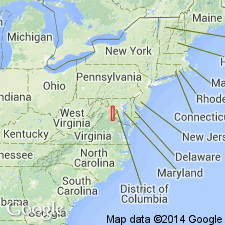
The Waterfall Formation of the Culpeper Group is here named for exposures near Waterfall, Prince William Co., VA. It consists of interbedded conglomerate, sandstone, and shale, and lies adjacent to the western border fault of the Culpeper basin, extending for 18 km (11 mi) in Fauquier and Prince William Cos. Fish-bearing lacustrine beds are present in the upper half of the unit. Overlies the Buckland Formation. Maximum thickness is 1,500 m (5,000 ft). Age is Early Jurassic.
Source: GNU records (USGS DDS-6; Reston GNULEX).

- Usage in publication:
-
- Waterfall Formation*
- Modifications:
-
- Revised
- Age modified
- AAPG geologic province:
-
- Piedmont-Blue Ridge province
Summary:
The Waterfall Formation of Lindholm (1979) is here revised and accepted by the U.S. Geological Survey. The upper conglomerate unit, here named the Millbrook Quarry Member, consists of interbedded sandstone, siltstone, mudstone, shale, and conglomerate. Gray to black calcareous shale beds contain fish, invertebrate, and plant fossils, spores, and pollen. The Waterfall conformably or paraconformably overlies the Sander Basalt. Age is Sinemurian to Pliensbachian (Cornet, 1977).
Source: GNU records (USGS DDS-6; Reston GNULEX).
For more information, please contact Nancy Stamm, Geologic Names Committee Secretary.
Asterisk (*) indicates published by U.S. Geological Survey authors.
"No current usage" (†) implies that a name has been abandoned or has fallen into disuse. Former usage and, if known, replacement name given in parentheses ( ).
Slash (/) indicates name conflicts with nomenclatural guidelines (CSN, 1933; ACSN, 1961, 1970; NACSN, 1983, 2005, 2021). May be explained within brackets ([ ]).