

- Usage in publication:
-
- Waterboot basalt*
- Modifications:
-
- Named
- Dominant lithology:
-
- Basalt
- AAPG geologic province:
-
- Alaska Southwestern region
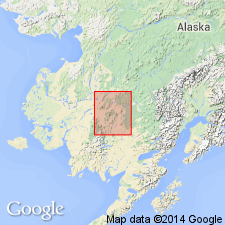
Summary:
Named for Waterboot Creek. Type exposure [locality] is basalt forming horizontal caprock of Flat Top Mountain east of upper-middle course of Aniak River, central Kuskokwim region, southwestern AK. Mountain lies between Atsaksovluk Creek, easterly tributary of Aniak River and Waterboot Creek which flows west at south foot of mountain and then north into Atsaksovluk Creek. Basalt covers area of 7 sq mi. Unit is black porphyritic scoriaceous and vesicular olivine basalt. Total thickness is probably not much more than 100 ft. It is inferred that Waterboot basalt succeeds Holokuk basalt (new) in stratigraphic position. Gemuk group (new) probably forms footing of basalt on eastern side of mountain. Unit is probably late Miocene(?) or Pliocene(?) age as shown on geologic map of central Kuskokwim region.
Source: GNU records (USGS DDS-6; Menlo GNULEX).
For more information, please contact Nancy Stamm, Geologic Names Committee Secretary.
Asterisk (*) indicates published by U.S. Geological Survey authors.
"No current usage" (†) implies that a name has been abandoned or has fallen into disuse. Former usage and, if known, replacement name given in parentheses ( ).
Slash (/) indicates name conflicts with nomenclatural guidelines (CSN, 1933; ACSN, 1961, 1970; NACSN, 1983, 2005, 2021). May be explained within brackets ([ ]).