

- Usage in publication:
-
- Vantage Sandstone Member
- Modifications:
-
- Original reference
- Dominant lithology:
-
- Sand
- Silt
- Clay
- AAPG geologic province:
-
- Eastern Columbia basin
Summary:
Pg. 5, 7-8, 12. Vantage Sandstone Member of Yakima Basalt. In Vantage-Priest Rapids area is 30 +/-10 feet thick and consists chiefly of quartz-feldspar-mica sand and (or) tuffaceous sand of hornblende andesite composition. Includes massive or laminated ailt or clay which may be bentonitic and may include leaf impressions and peat layers. Overlies Museum Basalt Member (new) and underlies Frenchman Springs Basalt Member (new); both of Yakima Basalt. [Age is late Miocene.]
Source: US geologic names lexicon (USGS Bull. 1350, p. 795); GNU records (USGS DDS-6; Menlo GNULEX).
- Usage in publication:
-
- Vantage Sandstone Member*
- Modifications:
-
- Revised
- Adopted
- AAPG geologic province:
-
- Eastern Columbia basin
Summary:
Pg. G6, G7 (fig. 4). Vantage Sandstone Member of Yakima Basalt of Columbia River Group. Consists of a distinctive medium friable quartz-feldspar-mica sand, or of a weakly cemented tuffaceous sand, silt, or clay containing hornblende. About 35 feet thick in Vantage-Priest Rapids area and thins northeastward to about 2 feet near Bacon siding, about 10 miles northeast of Soap Lake. Overlies lower basalt flows and underlies Frenchman Springs Member. Note type locality. Age is late Miocene [based on stratigraphic relations].
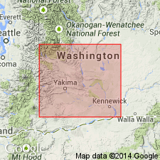
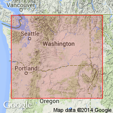
Type locality: in roadcuts along old U.S. Highway 10 at mouth of Schnebly Coulee, in SW/4 NW/4 sec. 19, T. 17 N., R. 23 E., 1 mi west of old Vantage bridge, Kittitas Co., WA.
Source: US geologic names lexicon (USGS Bull. 1350, p. 795); Changes in stratigraphic nomenclature, 1966 (USGS Bull. 1254-A, p. A7); GNU records (USGS DDS-6; Menlo GNULEX).
- Usage in publication:
-
- Vantage Member*
- Modifications:
-
- Revised
- Redescribed
- Age modified
- AAPG geologic province:
-
- Columbia basin
Summary:
Vantage Sandstone Member renamed Vantage Member because it commonly contains only fine-grained rocks and is reassigned to Ellensburg Formation because its westward deposits cannot be separated from Ellensburg Formation with which it merges. Age is middle Miocene [based on stratigraphic relations].
Source: GNU records (USGS DDS-6; Menlo GNULEX).
- Usage in publication:
-
- Vantage Member*
- Modifications:
-
- Revised
- AAPG geologic province:
-
- Eastern Columbia basin
Summary:
Vantage Member of Latah Formation. Vantage Member assigned to Latah Formation in subsurface of Moscow-Pullman area, Latah County, western Idaho, and Whitman County, southeastern Washington. Earlier workers (Siems and others, 1974, GSA Bull., v. 85, p. 1061-1068) correlated the Vantage into this area as a member of the Yakima Basalt. Consists of interlayered sand, silt, and clay. Wood fragments common. Sand units are poorly sorted with high clay content. Thickness 300+ feet beneath Moscow; thins to less than 20 feet beneath Pullman. Is a sedimentary interbed separating flows of the Columbia River Basalt Group; underlies Priest Rapids Member [of Wanapam Basalt] and overlies Grande Ronde Basalt. Shown in cross section. All data from water well logs. Age is Miocene.
[See also cross sections in Bush and Provant, 1998, Geol. map Viola quadrangle, Latah Co., ID, and Whitman Co., WA, Idaho Geol. Survey Geol. Map GM-25, scale 1:24,000, and Duncan and Bush, 1999, Geol. map Palouse quadrangle, Whitman Co., WA, and Latah Co., ID, Idaho Geol. Survey Tech. Rpt. T-99-7, scale 1:24,000.]
Source: Publication.
For more information, please contact Nancy Stamm, Geologic Names Committee Secretary.
Asterisk (*) indicates published by U.S. Geological Survey authors.
"No current usage" (†) implies that a name has been abandoned or has fallen into disuse. Former usage and, if known, replacement name given in parentheses ( ).
Slash (/) indicates name conflicts with nomenclatural guidelines (CSN, 1933; ACSN, 1961, 1970; NACSN, 1983, 2005, 2021). May be explained within brackets ([ ]).