

- Usage in publication:
-
- Umatilla flow
- Modifications:
-
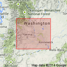
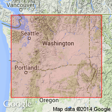
- Areal extent
- Dominant lithology:
-
- Basalt
- AAPG geologic province:
-
- Eastern Columbia basin
Summary:
Pg. 25. Umatilla flow Priest Rapids Basalt Member of Yakima Basalt. Flow about 285 feet thick in Priest Rapids Basalt Member. Named credited to Laval (1956, unpub. thesis). [Age is Miocene.]
Forms Umatilla Rapids of Columbia River, [no longer exist; covered by Lake Wallula, in T. 5 N., R. 28 E., WA-OR State line, Benton and Umatilla Cos., Umatilla quadrangle (scale 1:125,000), northeast of Umatilla, Umatilla Co., OR (USGS historical topographic map collection TopoView, accessed August 24, 2013)].
Source: US geologic names lexicon (USGS Bull. 1350, p. 788-789).

- Usage in publication:
-
- Umatilla Basalt
- Modifications:
-
- Revised
- AAPG geologic province:
-
- Eastern Columbia basin
Summary:
Pg. 6541. Umatilla Basalt, Pomona Basalt, Elephant Mountain Basalt, and Ward Gap Basalt, the four youngest flows of Yakima Basalt in area, intertongue with volcaniclastic and arkosic sedimentary rocks of Ellensburg Formation. Selah Member of Ellensburg separates the Umatilla and Pomona Basalts. [Age is Miocene.]
Source: US geologic names lexicon (USGS Bull. 1350, p. 788-789); GNU records (USGS DDS-6; Menlo GNULEX).
- Usage in publication:
-
- Umatilla flow
- Modifications:
-
- Areal extent
- AAPG geologic province:
-
- Eastern Columbia basin
Summary:
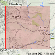
Pg. 95. Umatilla flow of Priest Rapids Member of Yakima Basalt. In eastern part of Toppenish Ridge and Horse Heaven Hills, [west and south of Mabton, Zillah quadrangle (scale 1:125,000), Yakima County, south-central Washington], the Priest Rapids Member includes: Basal flows, Mabton interbed, and the Upper (Umatilla and Sillusi) flows. Both the Umatilla and Sillusi flows are well exposed upstream from McNary Dam in walls of Wallula Gap. Umatilla is especially noted for massive columnar structure that is commonly intersected by slabs and plates at random angles near base of flow. Maximum thickness 100 to well over 200 feet. [Age is Miocene.]
Flow forms Umatilla Rapids of Columbia River, [no longer exist; covered by Lake Wallula, in T. 5 N., R. 28 E., WA-OR State line, Benton and Umatilla Cos., Umatilla quadrangle (scale 1:125,000), northeast of Umatilla, Umatilla Co., OR (USGS historical topographic map collection TopoView, accessed August 24, 2013)].
Source: US geologic names lexicon (USGS Bull. 1350, p. 788-789).
- Usage in publication:
-
- Umatilla Basalt Member
- Modifications:
-
- Revised
- AAPG geologic province:
-
- Eastern Columbia basin
Summary:
Stratigraphic section shows unit as member Yakima Basalt Formation, although text refers to unit as Umatilla Basalt. Detailed study of petrography, modal composition included. Separated from underlying Priest Rapids Basalt Member by thick sediments of Mabton bed along Horse Heaven Hills (south of Mabton) and in Glade Creek Valley. Underlies Selah Member of Ellensburg Formation.
Source: GNU records (USGS DDS-6; Menlo GNULEX).
- Usage in publication:
-
- Umatilla Basalt Member*
- Modifications:
-
- Adopted
- AAPG geologic province:
-
- Eastern Columbia basin
Summary:
Stratigraphic nomenclature of upper Yakima section of Schmincke (1967) and Wright and others (1973) adopted. At Wallula Gap small isolated outcrop of Ice Harbor lava unconformably overlies stream gravel and Umatilla Basalt Member.
Source: GNU records (USGS DDS-6; Menlo GNULEX).
- Usage in publication:
-
- Umatilla Member*
- Modifications:
-
- Principal reference
- Revised
- AAPG geologic province:
-
- Eastern Columbia basin
Summary:
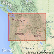
Pg. G6-G7 (fig. 2), 40-G41. Umatilla Member of Saddle Mountains Basalt of Yakima basalt subgroup [informal] of Columbia River Basalt Group. Geographically extended from south-central Washington into southeastern Washington, northeastern Oregon, and northwestern Idaho. Consists of two fine grained basalt flows that in places have an almost "porcellanite" appearance. Thickness 100 m in subsurface at damsite. Overlies sedimentary deposits; underlies Pomona Member of Saddle Mountains. Has normal magnetic polarity. Age is middle Miocene.
Type locality (pl. 1, fig. H): exposures and cuts along an abandoned railroad 1 km west of the north abutment of McNary Dam, in extreme SE/4 SE/4 SE/4 sec. 4, T. 5 N., R. 28 E., Umatilla quadrangle, Benton Co., WA.
Reference localities: (1) near top of bluff on west side of Wallula Gap, [Wallula quadrangle, Walla Walla Co.], WA (Atlantic Richfield Hanford Company, 1976); (2) Puffer Butte, [Fields Spring quadrangle, Asotin Co.], in extreme southeast WA (Price, 1974, 1977; Swanson and others, 1977, 1979).
References cited:
Atlantic Richfield Hanford Company, 1976, ERDA Rpt. ARH-ST-137, v. 1, text, 168 p., v. 2, App., 264 p.
S.M. Price, 1974, Atlantic Richfield Hanford Company, US Atomic Energy Comm. Rpt. ARH-SA-202, 29 p.
S.M. Price, 1977, Idaho Univ., Moscow, PhD Dissert., 320 p.
D.A. Swanson and others, 1977, USGS Open-file Rpt. OFR-77-100
D.A. Swanson and others, 1979, USGS Misc. Geol. Inv. Map I-1139
[Yakima basalt subgroup considered informal and should not be capitalized. "Subgroup" not recognized as a formal stratigraphic rank term (CSN, 1933; ACSN, 1961, 1970; NACSN, 1983, 2005, 2021). Columbia River Basalt Group adopted by the ID, OR, and WA Geol. Surveys, and the USGS.]
Source: Publication; Changes in stratigraphic nomenclature, 1979 (USGS Bull. 1502-A, p. A80).
For more information, please contact Nancy Stamm, Geologic Names Committee Secretary.
Asterisk (*) indicates published by U.S. Geological Survey authors.
"No current usage" (†) implies that a name has been abandoned or has fallen into disuse. Former usage and, if known, replacement name given in parentheses ( ).
Slash (/) indicates name conflicts with nomenclatural guidelines (CSN, 1933; ACSN, 1961, 1970; NACSN, 1983, 2005, 2021). May be explained within brackets ([ ]).