

- Usage in publication:
-
- Tuscher formation*
- Modifications:
-
- Named
- Dominant lithology:
-
- Sandstone
- Shale
- AAPG geologic province:
-
- Paradox basin
Summary:
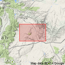
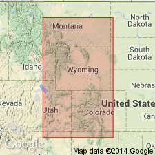
Named after Tuscher Canyon east of the Green River in T20S, Rs16 and 17E, Grand Co, UT in the Paradox basin. Lies disconformably above the Farrer non-coal-bearing member (new) of the Price River formation and disconformably beneath the Wasatch formation. No type locality designated. Mapped along north edge of area from Soulier Mesa near headwaters of Tuscher Creek east to T17S, R24E, Grand Co, UT. Composed of light-gray sandstone separated by thin shale beds. Sandstone predominates. The sandstone is quartz, typically massive, cross-bedded, friable and weathers to rounded surfaces. A few layers are conglomeratic with a few pebbles of quartz and black chert. Probably equivalent to Ohio Creek conglomerate of CO. Regarded as Tertiary(?) because of presence of conglomerate and sandstone that resemble the Wasatch. Geologic maps.
Source: GNU records (USGS DDS-6; Denver GNULEX).
- Usage in publication:
-
- Tuscher formation*
- Modifications:
-
- Age modified
- AAPG geologic province:
-
- Paradox basin
Summary:
Age changed from Tertiary? to Late Cretaceous, Maestrichtian and Danian age. [No reason given]. Overlies Farrer formation (rank raised) of Maestrichtian age. Unconformably underlies Eocene rocks. Occurs in the central Book Cliffs, UT in the Paradox basin. Correlation chart.
Source: GNU records (USGS DDS-6; Denver GNULEX).
- Usage in publication:
-
- Tuscher formation*
- Modifications:
-
- Revised
- AAPG geologic province:
-
- Paradox basin
Summary:
Included arbitrarily as upper formation of Mesaverde group in central Book Cliffs, UT east of Green River in Paradox basin. Is probably equivalent to the Hunter Canyon formation of western CO, Piceance basin, and older than North Horn and Flagstaff formations. Overlies Farrer formation. Makes a continuous unit standing out as somber-appearing. Individual beds thicken and thin, and cannot be traced very far. Composed mostly of massive sandstone separated by buff to gray shale. Six measured sections described. Ranges from 207 to 800 +/-ft thick in these sections. No significant fossils. Could be latest Cretaceous or earliest Tertiary. Assigned arbitrarily to Mesaverde and to Cretaceous. Columnar sections.
Source: GNU records (USGS DDS-6; Denver GNULEX).

- Usage in publication:
-
- Tuscher Formation*
- Modifications:
-
- Overview
- AAPG geologic province:
-
- Paradox basin
- Uinta basin
Summary:
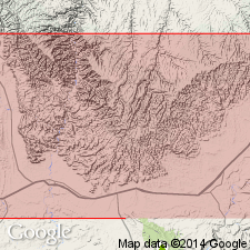
Assignment of boundaries of Tuscher Formation has been inconsistent. Restricted in this paper to white, buff, rarely pink, fine- to coarse-grained, thick and cross-bedded, lenticular sandstones that locally contain some resistant siliceous pebbles. Contains a minor amount of gray, green to red claystone. Is unconformably overlain by conglomeratic sandstone beds of Dark Canyon of Paleocene age. System and upper contact of formation marked locally by a well-developed white zone of kaolinite-bearing sandstone. Is of Campanian age. Fossils found in Grand and Carbon Cos, UT in the Uinta and Paradox basins respectively. Mapped in Grand and Emery Cos, UT of the Paradox basin in this paper.
Source: GNU records (USGS DDS-6; Denver GNULEX).
- Usage in publication:
-
- Tuscher Formation*
- Modifications:
-
- Overview
- AAPG geologic province:
-
- Paradox basin
Summary:
Tertiary-Cretaceous boundary placed above a bleached zone, a distinctive, well-developed, easily recognized, and readily traceable zone of kaolinite-rich beds. Rocks west of Desolation Canyon above the bleached zone assigned to the Paleocene North Horn Formation and Flagstaff Member of Green River Formation undivided. This zone is recognized also in Piceance basin, CO, between the Upper Cretaceous Ohio Creek Member of Mesaverde Formation, or Ohio Creek Member of Hunter Canyon Formation of Mesaverde Group, and the overlying Paleocene and Eocene Wasatch Formation. Underlying Upper Cretaceous rocks belong to Price River Formation of Mesaverde Group. Flagstaff and Price River mapped in northeast corner of map area south of the Roan Cliffs, Emery Co, UT in Paradox basin. Rocks east of Desolation Canyon above the bleached zone assigned to Paleocene North Horn Formation and Flagstaff Member of Green River Formation. Underlying rocks assigned to Upper Cretaceous Tuscher Formation of Mesaverde Group. Tuscher mapped along east-central edge of map.
Source: GNU records (USGS DDS-6; Denver GNULEX).
- Usage in publication:
-
- Tuscher Formation*
- Modifications:
-
- Biostratigraphic dating
- Overview
- Dominant lithology:
-
- Sandstone
- AAPG geologic province:
-
- Paradox basin
Summary:
Palynomorph assemblage resembling the Judith River Formation of MT recovered from both Tuscher and Farrer Formations along the Book Cliffs of UT, Uinta basin. No important biostratigraphic differences evident between Tuscher and Farrer. Both formations are within the AQUILAPOLLENITES QUADRILOBUS Interval Zone of Nichols and others (1982). Presence of KUYLISPORITES SCUTATUS 10 m below the Cretaceous-Tertiary unconformity in Jim, Sego, and Bryson Canyons along the eastern Book Cliffs indicates that the uppermost part of the Tuscher is no younger than middle late Campanian. In the subsurface in the Natural Buttes field, where the Tuscher and Farrer are undifferentiated, the uppermost part of the sequence may be as young as early Maastrichtian. The palynomorphs ILEXOPOLLENITES COMPACTUS and MANCICORPUS STRIATUS found in that field indicate early Maastrichtian. Measured sections; correlation chart. Area studied includes the Tuscher, Sego, and Cottonwood Canyons, and Bitter Creek, Grand Co, UT in the Paradox basin. Type section designated in Tusher [sic] Canyon, secs 9, 13, 16, T20S, R17E; sec 1, T20S, R18E; sec 19, T19S, R19E, Grand Co where formation is about 250 ft thick, stacked, sheet-like cliff-forming sandstone. Has more channel-form units than the underlying Farrer.
Source: GNU records (USGS DDS-6; Denver GNULEX).
- Usage in publication:
-
- Tuscher Formation*
- Modifications:
-
- Age modified
- Biostratigraphic dating
- AAPG geologic province:
-
- Uinta basin
Summary:
Newly defined palynostratigraphic zone MANCICORPUS STRIATUS Interval Zone is present in undifferentiated Tuscher and Farrer Formations in subsurface of Uinta Basin, UT. M. STRIATUS is assigned latest Campanian through early Maastrichtian age (73 to 69 Ma). M. STRIATUS is equivalent to interval including zones of ammonites BACULITES REESIDEI through B. CLINOLOBATUS. Tuscher and Farrer which were previously interpreted to be late Campanian or Campanian and Maastrichtian in age are now reinterpreted as early Maastrichtian in age.
Source: GNU records (USGS DDS-6; Denver GNULEX).
For more information, please contact Nancy Stamm, Geologic Names Committee Secretary.
Asterisk (*) indicates published by U.S. Geological Survey authors.
"No current usage" (†) implies that a name has been abandoned or has fallen into disuse. Former usage and, if known, replacement name given in parentheses ( ).
Slash (/) indicates name conflicts with nomenclatural guidelines (CSN, 1933; ACSN, 1961, 1970; NACSN, 1983, 2005, 2021). May be explained within brackets ([ ]).