- Usage in publication:
-
- Turners Falls sandstone*
- Modifications:
-
- Named
- Dominant lithology:
-
- Sandstone
- AAPG geologic province:
-
- New England province
- Deerfield basin
- Northfield basin
Summary:
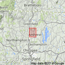
Thin-bedded brick red shaly sandstone, locally micaceous, thickening from 15 ft (4.5 m) at the south to 200 ft (60 m) at the north end of the Mount Toby quadrangle, is here named the Turners Falls Sandstone. Where it is finer-grained it contains fossil fish and dinosaur tracks. Rocks previously mapped by Emerson (1898; 1917) as Longmeadow Sandstone and Chicopee Shale in the north, and as Mount Toby Conglomerate in the south. Overlies Deerfield Diabase; unconformably underlies Mount Toby Conglomerate. Age is Late Triassic.
Source: GNU records (USGS DDS-6; Reston GNULEX).

- Usage in publication:
-
- Turners Falls Sandstone*
- Modifications:
-
- Overview
- AAPG geologic province:
-
- New England province
- Deerfield basin
Summary:
The Turners Falls Sandstone contains a massive slump and breccia zone as much as 256 ft (78 m) thick in the upper part, which represents a significant disconformity and hiatus. It contains fossil fish older than the Shuttle Meadow (Hettangian) and palynoflora as young as the lower Portland (Sinemurian), which it resembles above the slump zone. The Turners Falls below the slump zone could be treated as a separate formation from the strata above the slump.
Source: GNU records (USGS DDS-6; Reston GNULEX).

- Usage in publication:
-
- Turner Falls Sandstone*
- Modifications:
-
- Overview
- AAPG geologic province:
-
- New England province
Summary:
Used incorrectly as Turner Falls Sandstone of Early Jurassic age. [Correct spelling is Turners Falls Sandstone.] Main part of unit consists of reddish-brown to pale-red arkosic sandstone, and gray sandstone, gray siltstone, and black shale interpreted as lake beds. Pale-red conglomerate and arkosic sandstone separately mapped.
Source: GNU records (USGS DDS-6; Reston GNULEX).

- Usage in publication:
-
- Turners Falls Sandstone*
- Modifications:
-
- Revised
- Biostratigraphic dating
- AAPG geologic province:
-
- New England province
- Deerfield basin
- Northfield basin
Summary:
The Turners Falls Sandstone of the Newark Supergroup is revised to include only strata between the top of the Deerfield Basalt and the slump zone unconformity defined by Cornet (1977). The hiatus represented by the unconformity is equivalent to a large portion of the section of the adjacent Hartford basin and includes the time of eruption of the Holyoke and Hampden Basalts and the Granby Basaltic Tuff. Previously all of the conglomeratic strata were referred to as Mount Toby Conglomerate (Willard, 1951), but those below the projected unconformity are now assigned to a conglomerate facies member of the Turners Falls. Age is Hettangian, based on fossil fish.
Source: GNU records (USGS DDS-6; Reston GNULEX).
For more information, please contact Nancy Stamm, Geologic Names Committee Secretary.
Asterisk (*) indicates published by U.S. Geological Survey authors.
"No current usage" (†) implies that a name has been abandoned or has fallen into disuse. Former usage and, if known, replacement name given in parentheses ( ).
Slash (/) indicates name conflicts with nomenclatural guidelines (CSN, 1933; ACSN, 1961, 1970; NACSN, 1983, 2005, 2021). May be explained within brackets ([ ]).

