

- Usage in publication:
-
- Tulare formation
- Modifications:
-
- Named
- Biostratigraphic dating
- Dominant lithology:
-
- Sand
- Clay
- AAPG geologic province:
-
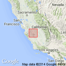
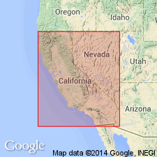
- San Joaquin basin
Summary:
Pg. 181. Tulare formation. Fresh-water deposits of gypsiferous sands and clays exposed at intervals along west border of Great Valley. In Kettleman Hills, 10 to 15 miles southeast of Coalinga, and near west shore of Tulare Lake these beds aggregate fully 1,000 feet in thickness. Conformably overlies San Joaquin clays (upper division of Etchegoin formation) which they in some respects resemble. Age is Pliocene(?) in part based on fresh-water mollusks (list included) identified by J.G. Cooper and in part based on stratigraphic position. [Fossils listed.]
Named from Tulare Lake, San Joaquin Valley, CA.
Source: US geologic names lexicon (USGS Bull. 896, p. 2191); GNU records (USGS DDS-6; Menlo GNULEX).
- Usage in publication:
-
- Tulare formation*
- Modifications:
-
- Adopted
- Age modified
- Biostratigraphic dating
- Areal extent
- AAPG geologic province:
-
- San Joaquin basin
Summary:
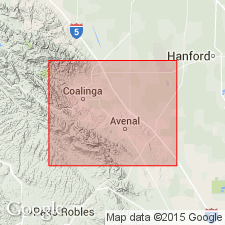
Tulare formation of Anderson (1905) is adopted. Authors noted that rocks of Tulare had been referred to as "Paso Robles" by Fairbanks (1904); in Salinas Valley Paso Robles formation was found to be marine in origin in its lower part which is equivalent to Jacalitos and Etchegoin formations. Area in Kettleman Hills may be considered type locality of Tulare formation. Measured section, 9 mi northwest of Avenal Gap is 2400 ft thick; section along Dudley-Lamoore road is 3100 ft thick. Tulare also described in Kreyenhagen, Jacalitos, and Guijarral Hills. List of molluscan fossils of Anodonte zone collected from Coalinga district are compared to list by G.J. Cooper from Kettleman Hills. Age of Tulare is Pliocene and Pleistocene.
Source: GNU records (USGS DDS-6; Menlo GNULEX).

- Usage in publication:
-
- Tulare formation*
- Modifications:
-
- Overview
- AAPG geologic province:
-
- San Joaquin basin
Summary:
Tulare formation contemporaneous with part of Paso Robles formation, but deposited in separate basin, according to B.L. Clark (personal communication Dec. 1932).
Source: US geologic names lexicon (USGS Bull. 896, p. 2191).
- Usage in publication:
-
- Tulare formation*
- Modifications:
-
- Age modified
- Biostratigraphic dating
- Overview
- AAPG geologic province:
-
- San Joaquin basin
Summary:
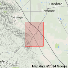
Type section suggested as exposures on La Ceja on east side of northern North Dome, Kettleman Hills, sec.35 T21S R17E, Kings Co, CA, where only basal part of Tulare formation is exposed owing to overlap of alluvium. Detailed lithology, columnar sections, measured sections, list of fossils (gastropods, pelecypods, ostracods, fish remains, horse tooth, and numerous diatoms) with localities included in report. Age given as Pliocene and Pleistocene(?).
Source: GNU records (USGS DDS-6; Menlo GNULEX).
- Usage in publication:
-
- Tulare formation*
- Modifications:
-
- Revised
- Biostratigraphic dating
- AAPG geologic province:
-
- San Joaquin basin
Summary:
Corcoran clay of Frink and Kues (1954) is reduced in rank and adopted as member of Tulare formation. Corcoran clay member which occurs in subsurface serves as geologic marker. Age of member is late Pliocene and Pleistocene(?) on basis of fossil diatom assemblages (K.E. Lohman, personal commun., 1954).
Source: GNU records (USGS DDS-6; Menlo GNULEX).
- Usage in publication:
-
- Tulare Formation*
- Modifications:
-
- Overview
- Age modified
- Biostratigraphic dating
- Geochronologic dating
- AAPG geologic province:
-
- San Joaquin basin
Summary:
Tulare Formation is described in surface and subsurface of Los Banos-Kettleman Hills area. Detailed lithology; maps; thickness; sections; descriptions of fan, flood-plain, deltaic, and lacustrine deposits; and discussion of ages included in report as well as map showing thickness of Corcoran Clay Member. Age is Pliocene and Pleistocene based on fresh-water mollusks, fossil mammal bones, diatom floras, and K-Ar age of 0.6 +/-0.02 Ma on volcanic ash just overlying Corcoran Clay Member (G.B. Dalrymple IN Janda, 1965).
Source: GNU records (USGS DDS-6; Menlo GNULEX).
- Usage in publication:
-
- Tulare Formation*
- Modifications:
-
- Geochronologic dating
- AAPG geologic province:
-
- San Joaquin basin
Summary:
Fission-track age on zircon yielded 2.2 +/-0.3 Ma from Tulare Formation.
Source: GNU records (USGS DDS-6; Menlo GNULEX).
For more information, please contact Nancy Stamm, Geologic Names Committee Secretary.
Asterisk (*) indicates published by U.S. Geological Survey authors.
"No current usage" (†) implies that a name has been abandoned or has fallen into disuse. Former usage and, if known, replacement name given in parentheses ( ).
Slash (/) indicates name conflicts with nomenclatural guidelines (CSN, 1933; ACSN, 1961, 1970; NACSN, 1983, 2005, 2021). May be explained within brackets ([ ]).