

- Usage in publication:
-
- Topsfield Granodiorite*
- Modifications:
-
- Age modified
- Geochronologic dating
- AAPG geologic province:
-
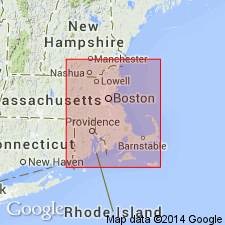
- New England province
Summary:
Age changed from middle Paleozoic to Proterozoic Z on basis of K-Ar age of 640 m.y. on hornblende obtained from dioritic phase of Topsfield (Zartman and Naylor, 1972, GSA Abstract; Shride, 1976).
Source: GNU records (USGS DDS-6; Reston GNULEX).

- Usage in publication:
-
- Topsfield Granodiorite*
- Modifications:
-
- Overview
- AAPG geologic province:
-
- New England province
Summary:
Used as Topsfield Granodiorite of Proterozoic Z age. Intrudes Proterozoic Z diorite at Rowley and unnamed Proterozoic Z metamorphosed mafic to felsic flow, and volcaniclastic and hypabyssal intrusive rocks (including diorite and gabbro north and northwest of Boston).
Source: GNU records (USGS DDS-6; Reston GNULEX).
- Usage in publication:
-
- Topsfield Granodiorite*
- Modifications:
-
- Overview
- AAPG geologic province:
-
- New England province
Summary:
Topsfield Granite occupies area of 80 sq km between Middleton and Newbury, eastern MA. Occurs as part of Dedham batholith. Composition ranges from granite to tonalite. Intrudes unnamed diorite and gabbro unit, and unnamed mafic and felsic metavolcanic rocks. Bounded on northwest by faults bordering Newbury and Middleton basins and by northwest extensions of Bloody Bluff (and Mystic?) faults, and on southeast by a splay(?) of Bloody Bluff fault. Probably overlain by Silurian and Devonian Newbury Volcanic Complex (Dennen, 1975), but contact is now a fault. Although not radiometrically dated, considered to be Proterozoic Z in age because it is similar in mineralogy to Dedham Granite and it intrudes Proterozoic Z mafic complex. Report includes geologic maps. [Papers presented as chapters in U.S. Geological Survey Professional Paper 1366 are intended as explanations and (or) revisions to MA State bedrock geologic map of Zen and others (1983) at scale of 1:250,000.]
Source: GNU records (USGS DDS-6; Reston GNULEX).
For more information, please contact Nancy Stamm, Geologic Names Committee Secretary.
Asterisk (*) indicates published by U.S. Geological Survey authors.
"No current usage" (†) implies that a name has been abandoned or has fallen into disuse. Former usage and, if known, replacement name given in parentheses ( ).
Slash (/) indicates name conflicts with nomenclatural guidelines (CSN, 1933; ACSN, 1961, 1970; NACSN, 1983, 2005, 2021). May be explained within brackets ([ ]).