


- Usage in publication:
-
- Toledo division
- Modifications:
-
- Original reference
- Dominant lithology:
-
- Shale
- Sandstone
- AAPG geologic province:
-
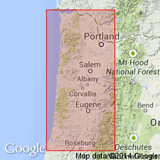
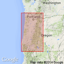
- Western Columbia basin
Summary:
Toledo division. Tuffaceous sandstone and shales, green gray on unweathered surfaces, but weathers white, yellow, and red. The sandstone is rather thinly bedded, and sandy shale makes up greater part of series. Thickness 2,800 feet. Underlies Yaquina sandstone and overlies Coaledo formation.
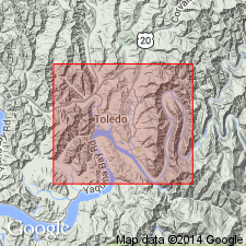
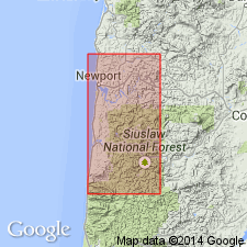
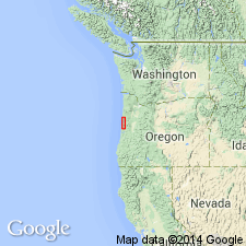
Type locality: 3 mi south of Toledo, Lincoln Co., northwestern OR.
Source: US geologic names lexicon (USGS Bull. 896, p. 2160).
- Usage in publication:
-
- [Toledo division]
- Modifications:
-
- Overview
- AAPG geologic province:
-
- Western Columbia basin
Summary:
Pg. 458. Gave thickness as 3,000 feet.
Source: US geologic names lexicon (USGS Bull. 896, p. 2160).
- Usage in publication:
-
- Toledo formation
- Modifications:
-
- Revised
- AAPG geologic province:
-
- Western Columbia basin
Summary:
It is possible to divide Toledo formation into at least 2 members, the upper consisting of 1,000+/- feet of sandstones and the lower 1,200+/- feet of concretionary shale of [early] Oligocene age, here named Moody shale. It is believed there is no angular unconformably between Toledo formation and overlying Yaquina formation.
Source: US geologic names lexicon (USGS Bull. 896, p. 2160).
- Usage in publication:
-
- Toledo formation
- Modifications:
-
- Overview
- AAPG geologic province:
-
- Western Columbia basin
Summary:
Pg. 22-31. Toledo formation unconformably overlies Burpee formation. [Age is Oligocene.]
Source: US geologic names lexicon (USGS Bull. 896, p. 2160).
- Usage in publication:
-
- Toledo formation*
- Modifications:
-
- Areal extent
- AAPG geologic province:
-
- Western Columbia basin
Summary:
Toledo formation. Consists of two members: Moody shale at base and unnamed upper member. Thickness 2,500 to 3,000 feet. Underlies Yaquina sandstone; overlies Burpee formation. Present study establishes [late] Eocene age for Moody member and middle Oligocene age for greater part of upper member; future work may raise Moody member to rank of formation and permit restricting of name Toledo to strata of upper member.
Source: US geologic names lexicon (USGS Bull. 1200, p. 3909).
- Usage in publication:
-
- Toledo Formation†
- Modifications:
-
- Abandoned
- AAPG geologic province:
-
- Western Columbia basin
Summary:
Toledo Formation abandoned; its rocks now assigned to (ascending): Yamhill Forma-
tion, Nestucca Formation, and Alsea Formation (new).
Source: Changes in stratigraphic nomenclature, 1975 (USGS Bull. 1422-A, p. A40-A41).
For more information, please contact Nancy Stamm, Geologic Names Committee Secretary.
Asterisk (*) indicates published by U.S. Geological Survey authors.
"No current usage" (†) implies that a name has been abandoned or has fallen into disuse. Former usage and, if known, replacement name given in parentheses ( ).
Slash (/) indicates name conflicts with nomenclatural guidelines (CSN, 1933; ACSN, 1961, 1970; NACSN, 1983, 2005, 2021). May be explained within brackets ([ ]).