

- Usage in publication:
-
- Tohachi shale*
- Modifications:
-
- First used
- Dominant lithology:
-
- Shale
- Sandstone
- AAPG geologic province:
-
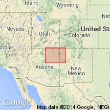
- San Juan basin
- Black Mesa basin
Summary:
Given credit in USGS Bulletin 896 as the naming paper. However, intent to name, source of geographic name, type locality, areal distribution not discussed. One can surmise that Tohachi was named for the town of Tohachi, McKinley Co, NM in the San Juan basin where unit is shown on geologic map. Also mapped in Apache and Navajo Cos, AZ in Black Mesa basin south and west of Ganado. Composed of 200-1,100 ft of dark-brown and white shale and subordinate sandstone. Overlies Mesaverde and younger formations unconformably. Underlies Chuska sandstone (new) unconformably. Of Eocene? age. Generalized columnar section.
Source: GNU records (USGS DDS-6; Denver GNULEX).
- Usage in publication:
-
- Tohatchi formation
- Modifications:
-
- Redescribed
- AAPG geologic province:
-
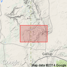
- San Juan basin
Summary:
Spelling of Tohachi changed to Tohatchi (spelling of place name revised by the Board of Geographic Names) and stratigraphic rank term changed from shale to formation because of its diverse lithology. Is uppermost formation (of six formations) of Mesaverde Group in Tohatchi quad, NM, San Juan basin. Divided into a lower 400-850 ft thick cross-bedded, cross-laminated, medium- to fine-grained sandstone interbedded with gray silty claystones, carbonaceous shale and lignite and an upper 500 ft thick thin-bedded, bentonitic, fossiliferous (dinosaurs, turtles, alligator scales) shale which has a few thin layers of dark brown modular iron-cemented sandstone. Overlies Menefee formation conformably; underlies Chuska sandstone. Assigned to Late Cretaceous.
Source: GNU records (USGS DDS-6; Denver GNULEX).
- Usage in publication:
-
- Tohatchi shale
- Modifications:
-
- Revised
- AAPG geologic province:
-
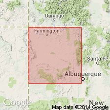
- San Juan basin
Summary:
Considered to be uppermost formation of the Upper Cretaceous Mesaverde group, unconformably underlying Deza formation. Deza is a new name applied to a 242 ft sequence of middle Tertiary age (on Deza Bluffs in the Chuska Mountains, McKinley Co., NM in the San Juan basin) that was thought to be the lower part of Chuska sandstone by some, and Tohatchi shale by others.
Source: GNU records (USGS DDS-6; Denver GNULEX).
- Usage in publication:
-
- Tohachi formation*
- Modifications:
-
- Overview
- AAPG geologic province:
-
- San Juan basin
Summary:
Tohatchi shale changed to Tohachi (original spelling of place name reinstated) formation. Is the uppermost formation (of six) of Mesaverde group in a limited area in the southern Chuska Mountains on the west side of the San Juan basin. Term Mesaverde raised to group rank throughout San Juan basin of southwest CO and northwest NM. Overlies Menefee formation. Correlation of Tohachi with other formations (such as Pictured Cliffs, Cliff House, Fruitland, and Kirtland) is uncertain because of erosion of nonmarine rocks of this age in area between the Chuska Mountains and the Chaco River where the main Upper Cretaceous outcrop belt is located. Of Late Cretaceous age. Not shown on geologic map or cross section.
Source: GNU records (USGS DDS-6; Denver GNULEX).
For more information, please contact Nancy Stamm, Geologic Names Committee Secretary.
Asterisk (*) indicates published by U.S. Geological Survey authors.
"No current usage" (†) implies that a name has been abandoned or has fallen into disuse. Former usage and, if known, replacement name given in parentheses ( ).
Slash (/) indicates name conflicts with nomenclatural guidelines (CSN, 1933; ACSN, 1961, 1970; NACSN, 1983, 2005, 2021). May be explained within brackets ([ ]).