

- Usage in publication:
-
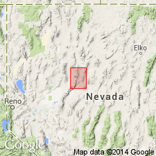
- Tobin formation*
- Modifications:
-
- Original reference
- Dominant lithology:
-
- Conglomerate
- Dolomite
- Shale
- Volcanics
- AAPG geologic province:
-
- Great Basin province
Summary:
Tobin formation. Coarse conglomerate, at base locally fanglomerate, followed by about 50 feet of massive sandy dolomite and several hundred feet of shales with occasional calcareous nodules and thin seams of shaly limestone. Andesite lava flow 100 feet thick near base at south end of Tobin Range. Thickness variable, generally about 500 feet thick. Maximum thickness of 1000 feet in northwest part of Augusta Mountain. Underlies Dixie Valley formation (new); overlies Koipato formation with angular unconformity. Assigned to Lower Triassic.
Type locality: south end of Tobin Range, north-central NV.
Source: US geologic names lexicon (USGS Bull. 1200, p. 3903).
For more information, please contact Nancy Stamm, Geologic Names Committee Secretary.
Asterisk (*) indicates published by U.S. Geological Survey authors.
"No current usage" (†) implies that a name has been abandoned or has fallen into disuse. Former usage and, if known, replacement name given in parentheses ( ).
Slash (/) indicates name conflicts with nomenclatural guidelines (CSN, 1933; ACSN, 1961, 1970; NACSN, 1983, 2005, 2021). May be explained within brackets ([ ]).