

- Usage in publication:
-
- Temblor
- Modifications:
-
- Revised
- AAPG geologic province:
-
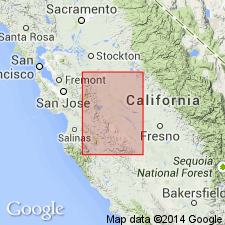
- San Joaquin basin
Summary:
Includes Big Blue serpentinous member (new).
Source: US geologic names lexicon (USGS Bull. 1200, p. 3845-3846).
- Usage in publication:
-
- Temblor stage
- Modifications:
-
- Revised
- AAPG geologic province:
-
- Coastal basins
- Los Angeles basin
- San Joaquin basin
Summary:
Pg. 196 (fig. 1), 204-205 (fig. 3), 212-213, 217 (fig. 4), 224-230. Temblor stage. Discussion of Miocene of Caliente Range and environs. Marine Miocene is a transgressive series, essentially conformable basinward, but revealing, strandward, the occurrence of two oscillations which respectively inaugurate and divide its upper third. It comprises three nearly equal divisions, Vaqueros, Temblor, and Monterey stages, which approximate lower, middle, and upper Miocene. Each of these has more or less distinctive epeiorgenic history, fauna, and average physical aspect. At Caliente Mountain, a homoclinal section exposes about 1,100 feet of upper Oligocene(?), 4,500 feet of Vaqueros, 4,700 feet of Temblor, and 4,600 feet of Monterey strata.
Source: US geologic names lexicon (USGS Bull. 1200, p. 3845-3846).
- Usage in publication:
-
- [Temblor formation]
- Modifications:
-
- Mapped
- AAPG geologic province:
-
- San Joaquin basin
Summary:
Pg. 25-60. Correlation chart of Kern River area shows Temblor comprises (ascending) Pyramid Hill sand, Freeman-Jewett silts, Olcese sand, and Round Mountain silt members. Principal cartographic unit in area is Round Mountain silt member; less widespread are Olcese sand and the Freeman-Jewett silt. Additional members of Temblor underlie the area but outcrop beyond borders of map.
Source: US geologic names lexicon (USGS Bull. 1200, p. 3845-3846).
- Usage in publication:
-
- Temblor group
- Modifications:
-
- Revised
- AAPG geologic province:
-
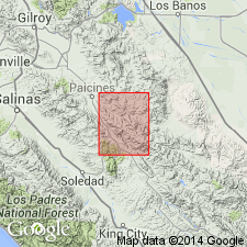
- San Joaquin basin
Summary:
Pg. 213-215, 226 (fig. 5). Temblor group, in San Benito quadrangle, is represented by three mappable units: lower sandstone, 100 to 500 feet thick; shale in middle of section, 300 to 1,000 feet thick; and upper sandstone, 400 feet thick. They are exposed along axis of Butts Ranch syncline and are youngest rocks affected by the folding. Disconformably overlies Kreyenhagen shale. Age is middle Miocene.
Source: US geologic names lexicon (USGS Bull. 1200, p. 3845-3846).
- Usage in publication:
-
- Temblor formation
- Modifications:
-
- Mapped 1:62.5k
- AAPG geologic province:
-
- Northern Coast Range province
Summary:
Pg. 22 (fig. 4), 35-36, pl. 1. Temblor formation. Fine-grained yellowish sandstone; cross-bedded, fossiliferous interbedded sandstone and pebbly sandstone, 50 to 100 feet; and basal conglomerate. Total thickness 500 to 1,000 feet; continuous section not measured. Exposed in small areas north and east of Calaveras Reservoir, Santa Clara and Alameda Counties, western California. Unconformably overlies Jurassic Franciscan formation. Grades upward into Monterey shale; where Monterey is absent, unconformably underlies Briones sandstone. Formation is limited on west by fault of the Calaveras system. [Age is late Miocene.]
[Misprint (US geologic names lexicon, USGS Bull. 1200, p. 3846): the Temblor unconformably overlies Franciscan, not conformably overlies.]
Source: Publication; US geologic names lexicon (USGS Bull. 1200, p. 3845-3846).
- Usage in publication:
-
- Temblor formation
- Modifications:
-
- Areal extent
- AAPG geologic province:
-
- San Joaquin basin
Summary:
Pg. 4 (table 1), 5 (table 2), 7-11, pl. 1. Temblor formation. In Bitterwater Creek area, Kern County, southern California, comprises (ascending) Agua sandstone, Santos undifferentiated, upper Santos shale, Carneros sandstone, and Media shale members, and unit termed "Button bed." Thickness as much as 5,350 feet. Overlies Point of Rocks formation; underlies Monterey shale. Age is early and middle Miocene.
Source: US geologic names lexicon (USGS Bull. 1200, p. 3845-3846).
- Usage in publication:
-
- [Temblor formation]
- Modifications:
-
- Mapped
- AAPG geologic province:
-
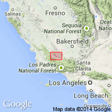
- San Joaquin basin
Summary:
Pg. 68 (fig. 2), 71-72, geol. map. In Devils Den district, overlies Wagonwheel formation.
Source: US geologic names lexicon (USGS Bull. 1200, p. 3845-3846).
- Usage in publication:
-
- Temblor formation*
- Modifications:
-
- Revised
- AAPG geologic province:
-
- [California Coast Ranges province]
Summary:
Pg. 2986, 2989. Upper 900 feet of unit herein named Painted Rock sandstone member of Vaqueros formation was included by Eaton and others (1941) in their Temblor. Saltos shale member (new) of Monterey was mapped by Eaton and others as upper part of Temblor.
Source: US geologic names lexicon (USGS Bull. 1200, p. 3845-3846).
For more information, please contact Nancy Stamm, Geologic Names Committee Secretary.
Asterisk (*) indicates published by U.S. Geological Survey authors.
"No current usage" (†) implies that a name has been abandoned or has fallen into disuse. Former usage and, if known, replacement name given in parentheses ( ).
Slash (/) indicates name conflicts with nomenclatural guidelines (CSN, 1933; ACSN, 1961, 1970; NACSN, 1983, 2005, 2021). May be explained within brackets ([ ]).