

- Usage in publication:
-
- Telegraph Creek formation*
- Modifications:
-
- Original reference
- Dominant lithology:
-
- Shale
- Sandstone
- AAPG geologic province:
-
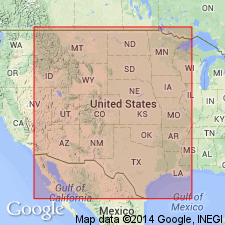
- Central Montana uplift
Summary:
(July 6, 1922) p. 38. Telegraph Creek formation. Yellow sandy shale parted in middle by a thin bed of concretionary sandstone, which caps an escarpment. Less prominent layers of concretionary sandstone occur in upper half of formation. Thickness 320 feet. Underlies Virgelle sandstone member of Eagle sandstone, and overlies Niobrara shale. Fossils predominantly Montana types. They include several species found in Eagle sandstone, mingled with forms usually found in Niobrara shale, of latest Colorado age.
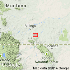
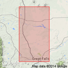
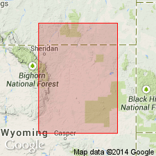
Typically developed at head of Telegraph Creek, in T. 2 S., R. 28 and 29 E., Crow Indian Reservation, Yellowstone Co., central southern MT.
[GNC remark (ca. 1938): Telegraph Creek considered formation of Montana group. Age is Late Cretaceous. Recognized in central southern Montana (Stillwater to Rosebud Counties region).]
Source: US geologic names lexicon (USGS Bull. 896, p. 2124).
- Usage in publication:
-
- Telegraph Creek formation*
- Modifications:
-
- Areal extent
- AAPG geologic province:
-
- Sweetgrass arch
Summary:
Telegraph Creek formation. Extended into Sweetgrass arch area, Montana. Unit has been included into Virgelle sandstone, mapped as separate formation and referred to as Transition zone, and Telegraph Creek(?). Fossil evidence defintely establishes Telegraph Creek age, and term can be used without query in this area. Age is Late Cretaceous.
Source: US geologic names lexicon (USGS Bull. 1200, p. 3842).
- Usage in publication:
-
- Telegraph Creek member*
- Modifications:
-
- Revised
- AAPG geologic province:
-
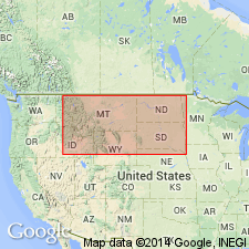
- Powder River basin
Summary:
Telegraph Creek member of Cody shale. Rank reduced to member status in Cody shale. Upper part is dark gray shale; lower part is interbedded sandstone and shale; weathers to buff soil. Thickness 867 feet. Overlies Niobrara shale member; underlies shale member equivalent to Eagle sandstone. Report covers Hardin area, Big Horn, and Yellowstone Counties, central southern Montana. Age is Late Cretaceous.
Source: US geologic names lexicon (USGS Bull. 1200, p. 3842); supplemental information from GNU records (USGS DDS-6; Denver GNULEX).
- Usage in publication:
-
- Telegraph Creek formation*
- Modifications:
-
- Areal extent
- AAPG geologic province:
-
- Powder River basin
Summary:
Telegraph Creek formation of Montana group. Montana group as mapped in northwestern Wyoming includes Telegraph Creek, Eagle sandstone, Claggett shale, and Judith River formation. Age is Late Cretaceous.
Source: US geologic names lexicon (USGS Bull. 1200, p. 3842).
- Usage in publication:
-
- Telegraph Creek formation*
- Modifications:
-
- Areal extent
- AAPG geologic province:
-
- Sweetgrass arch
Summary:
Pg. 2792 (fig. 3), 2793. Telegraph Creek formation. In Sweetgrass arch and East Glacier-Marias Pass areas, Montana, overlies Kevin shale member of Marias River shale (both new) of Colorado group. Age is Late Cretaceous.
Source: US geologic names lexicon (USGS Bull. 1200, p. 3842); supplemental information from GNU records (USGS DDS-6; Denver GNULEX).
- Usage in publication:
-
- Telegraph Creek formation*
- Modifications:
-
- Areal extent
- AAPG geologic province:
-
- Montana folded belt
Summary:
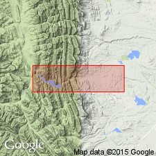
Pg. 19. Telegraph Creek formation. Described in Sun River Canyon area, Montana, where it is 340 feet thick, underlies Virgelle sandstone and overlies Kevin shale member of Marias River formation. Divisible into three parts: lower fine-grained calcareous dark-gray sandstone with many 1- to 3-inch-thick beds of fine-grained calcareous dark-gray sandstone and sandy shale partings; middle, mostly beds of calcareous hard dense dark-gray sandstone, 0.4 to 1 foot thick, in places ripple marked and cross-bedded; upper, beds (as much as 4 feet thick) of light-gray calcareous poorly indurated sandstone alternating with beds of equal thickness of gray calcareous sandy shale. Age is Late Cretaceous.
Source: US geologic names lexicon (USGS Bull. 1200, p. 3842).

- Usage in publication:
-
- Telegraph Creek member*
- Modifications:
-
- Overview
- AAPG geologic province:
-
- Sweetgrass arch
- Central Montana uplift
Summary:
The USGS currently [ca. 1960] classifies the Telegraph Creek as a member of the Colorado shale in the Bearpaw Mountains area, Montana, on the basis of a study now in progress.
Source: US geologic names lexicon (USGS Bull. 1200, p. 3842).
- Usage in publication:
-
- Telegraph Creek Formation
- Modifications:
-
- Overview
- AAPG geologic province:
-
- Montana folded belt
Summary:
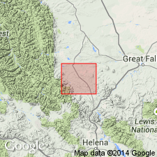
Is mapped with Virgelle Sandstone in Lewis and Clark Co, MT in Montana folded belt province. In report area the Telegraph Creek and Virgelle crop out along ridges running parallel with valleys of Flat and Auchard Creeks. Thickness ranges from 240 to 297 ft. Lower part of unit is olive-gray (5Y 5/2) shale interstratified with yellowish gray (5Y 7/2), calcareous, sandy mudstones only locally exceeding an inch thick. Higher in the section, shales are interstratified with thin sandstone beds that comprise more than two-thirds of the strata in the upper part. Sandstone is very fine to fine grained subangular quartz and feldspar with subordinate hexagonal or partly hexagonal biotite and is cemented by patches of authigenic spar calcite. Flakes of carbonaceous matter occur commonly along bedding planes. Telegraph Creek-Virgelle contact placed where thin- to medium-bedded sandstone first grades upward to very thick bedded, massive sandstone. Poorly preserved pelecypod molds occur in upper part and one specimen of the ammonite CLIOSCAPHITES MONTANENSIS found 35 ft below top of formation. Age is Late Cretaceous.
Source: GNU records (USGS DDS-6; Denver GNULEX).
- Usage in publication:
-
- Telegraph Creek Formation*
- Modifications:
-
- Mapped
- AAPG geologic province:
-
- Montana folded belt
Summary:
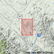
Telegraph Creek Formation. Exposed in eastern Lewis and Clark County, west-central Montana. Consists of interbedded gray and greenish-gray, tan-weathered, fine- to very fine-grained calcareous sandstone and light- to dark-gray fissile shale; some cross-bedding, ripple marks, and mud cracks. Contains light-gray septarian limestone concretions, as much as 3 feet across, near base. Thickness about 330 feet. Underlies Virgelle Sandstone; overlies Kevin Shale Member of Marias River Shale. Invertebrate fossils locally abundant in lower part; mainly CLIOSCAPHITES VERMIFORMIS (Meek and Hayden) and BACULITES CODYENSIS Reeside. Age is Late Cretaceous.
Source: Publication.
- Usage in publication:
-
- Telegraph Creek Formation*
- Modifications:
-
- Biostratigraphic dating
- Geochronologic dating
- AAPG geologic province:
-
- Williston basin
Summary:
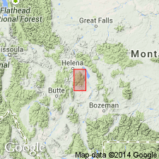
Telegraph Creek Formation. Sample collected from an 8-cm-thick bentonite, in the DESMOSCAPHITES BASSLERI ammonite zone, in lower part of Telegraph Creek Formation, in sec. 6, T. 14 N., R. 2 E., Petroleum Co., MT. K-Ar age on biotite 82.5 +/-0.8 Ma. Age is Late Cretaceous (Santonian).
Source: Modified from GNU records (USGS DDS-6; Denver GNULEX).
- Usage in publication:
-
- Telegraph Creek Formation*
- Modifications:
-
- Areal extent
- AAPG geologic province:
-
- Williston basin
Summary:
Telegraph Creek Formation. †Warm Creek Shale of Collier and Cathcart (1922, p. 172) and Knechtel (1959, p. 740-741) in north-central Montana abandoned. Rocks reallocated to (ascending) Belle Fourche Shale, Greenhorn Formation, Carlile Shale, Niobrara Formation, and Telegraph Creek Formation.
Source: Changes in stratigraphic nomenclature, 1975 (USGS Bull. 1422-A, p. A66-A67).
- Usage in publication:
-
- Telegraph Creek Beds*
- Modifications:
-
- Revised
- AAPG geologic province:
-
- Powder River basin
Summary:
T13 (fig. 3), T39 (fig. 12), T40 (fig. 13), T43. Telegraph Creek Beds of Gammon Member of Cody Shale. In Big Horn County, Montana, reduced in rank and assigned to basal part of Gammon. Consists of sandy shale enclosing calcareous concretions and a few thin beds of sandstone, thickness 785 to 850 feet. Overlies Niobrara Member of Cody Shale. Age is Late Cretaceous (middle Santonian to early Campanian; CLIOSCAPHITES VERMIFORMIS to SCAPHITES HIPPOCREPIS III zone; fossils identified by W.A. Cobban, USGS).
Source: Publication.
- Usage in publication:
-
- Telegraph Creek Formation*
- Modifications:
-
- Areal extent
- Dominant lithology:
-
- Mudstone
- Shale
- Sandstone
- AAPG geologic province:
-
- Montana folded belt
Summary:
Pg. B4, B6 (fig. 3). Telegraph Creek Formation. In Elkhorn Mountains area, Jefferson and Broadwater Counties, southwestern Montana, the coarsening-upward, transitional rocks between Cody Shale below and Eagle Sandstone above are assigned to Telegraph Creek Formation. Rocks previously included in lower part of Slim Sam Formation (Klepper and others, 1957). Trace fossils common. Age is Late Cretaceous (Coniacian to Santonian).
Source: Publication.
For more information, please contact Nancy Stamm, Geologic Names Committee Secretary.
Asterisk (*) indicates published by U.S. Geological Survey authors.
"No current usage" (†) implies that a name has been abandoned or has fallen into disuse. Former usage and, if known, replacement name given in parentheses ( ).
Slash (/) indicates name conflicts with nomenclatural guidelines (CSN, 1933; ACSN, 1961, 1970; NACSN, 1983, 2005, 2021). May be explained within brackets ([ ]).