

- Usage in publication:
-
- Tecolotito Member
- Modifications:
-
- Named
- Dominant lithology:
-
- Conglomerate
- Sandstone
- AAPG geologic province:
-
- Palo Duro basin
Summary:
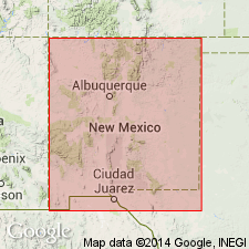
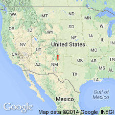
Named as basal member of three members of Santa Rosa Formation for town of Tecolotito, San Miguel Co, NM, Palo Duro basin. Type section designated and measured at NW1/4 NW1/4 NW1/4 NW1/4 sec 29, T12N, R17W, San Miguel Co. Assigned to middle sandstone member of Santa Rosa in earlier reports. Disconformably overlies Anton Chico Formation (new). Underlies Los Esteros Member (new) of Santa Rosa or the younger Tres Lagunas Member (new) of Santa Rosa throughout its areal extent surface and subsurface. At type consists of: 1) basal conglomerate of micritic limestone clasts as much as 18 cm in diameter in a sublitharenite matrix; conglomerate is coarse grained, poorly sorted, calcareous; and 2) gray to pale-orange (unweathered), gray-orange-pink (weathered), and light-brown, medium-grained, well-sorted, well-rounded, noncalcareous sandstone with trough crossbeds. Member is 15.6 m thick at type; may be as much as 34 m thick. Well exposed along Pecos River from Apache Springs (San Miguel Co) to Fort Sumner (De Baca Co). Where Anton Chico is missing, Tecolotito rests on Permian Bernal Formation. Can be traced to TX-NM State line; crops out locally in Canadian River Canyon, Quay Co. Correlated with Shinarump Member, Chinle Formation or with lower part, Tecovas Formation. Correlation chart. Of early Carnian, Late Triassic age.
Source: GNU records (USGS DDS-6; Denver GNULEX).
- Usage in publication:
-
- Tecolotito Member
- Modifications:
-
- Areal extent
- AAPG geologic province:
-
- Las Vegas-Raton basin
- Palo Duro basin
Summary:
The three members of the Santa Rosa Formation--the basal Tecolotito; middle or Los Esteros; and the upper, Tres Lagunas--can be recognized as far north as La Cueva, Mora Co, NM, Las Vegas-Raton basin. North of La Cueva, only the Tecolotito Member is thought to be present, and the Los Esteros and Tres Lagunas have pinched out. Correlation chart. Cross section. Identified in measured section at Montezuma Gap, Palo Duro basin and at La Cueva. Many previous workers have used Santa Rosa Sandstone in report area; few place the lower and upper contacts at the same horizon. Of Late Triassic, Carnian age.
Source: GNU records (USGS DDS-6; Denver GNULEX).
For more information, please contact Nancy Stamm, Geologic Names Committee Secretary.
Asterisk (*) indicates published by U.S. Geological Survey authors.
"No current usage" (†) implies that a name has been abandoned or has fallen into disuse. Former usage and, if known, replacement name given in parentheses ( ).
Slash (/) indicates name conflicts with nomenclatural guidelines (CSN, 1933; ACSN, 1961, 1970; NACSN, 1983, 2005, 2021). May be explained within brackets ([ ]).