

- Usage in publication:
-
- Taylor Ranch Member*
- Modifications:
-
- Named
- Dominant lithology:
-
- Conglomerate
- Limestone
- AAPG geologic province:
-
- Permian basin
Summary:
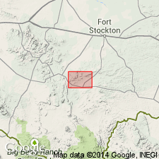
Named as a member of Hess Formation for what is now Bill Neal Ranch; former name on map by King (1931) was Taylor Ranch. Type section designated on southwest slope of hill capped by 5750 contour, lying between and slightly south of hills 5767 and 5821, northwest of Wolf Camp Hills, Hess Mountain quad, Glass Mountains, Brewster Co, TX in Permian basin. Includes the "fossil bed" (King, 1931) and the conglomerate that typically occurs just below it; this distinctive unit can be traced for many miles along mountain front. At type contains (ascending): 1) conglomerate, yellowish, with smooth matrix and limestone pebbles and cobbles as much as 3 inches in diameter, 2 ft; 2) limestone, which contains abundant limestone pebbles and cobbles, interbedded with fossiliferous shale, 33 ft; and 3) limestone, light brown, fossiliferous, with orange-brown chert nodules, 5 ft. Mapped from just east of the northwest-striking fault that cuts east end of Hess Ranch horst, eastward to just west of meridian 103, almost exactly 10 mi. Increasingly difficult to identify to east; fossils become less abundant to east, although the conglomerate persists. West of type locality, under nose of hill 5725, member contains several thick bioherms composed of the sponge HELIOSPONGIA, other sponges, and numerous brachiopods, gastropods, and pelecypods. Some of the brachiopods provide correlation with upper part of Skinner Ranch Formation farther west. Permian (Leonardian).
Source: GNU records (USGS DDS-6; Denver GNULEX).
For more information, please contact Nancy Stamm, Geologic Names Committee Secretary.
Asterisk (*) indicates published by U.S. Geological Survey authors.
"No current usage" (†) implies that a name has been abandoned or has fallen into disuse. Former usage and, if known, replacement name given in parentheses ( ).
Slash (/) indicates name conflicts with nomenclatural guidelines (CSN, 1933; ACSN, 1961, 1970; NACSN, 1983, 2005, 2021). May be explained within brackets ([ ]).