

- Usage in publication:
-
- Swisshelm formation
- Modifications:
-
- Named
- Dominant lithology:
-
- Sandstone
- Siltstone
- AAPG geologic province:
-
- Pedregosa basin
Summary:
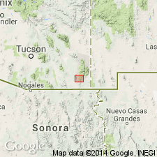
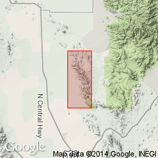
Named presumably for Swisshelm Mountains. Type section in NE1/4 sec 29, T21S, R28E, Cochise Co, AZ. Occurs in Swisshelm and Pedregosa Mountains, in Pedregosa basin. Sandstone and siltstone predominate throughout the lower part, and impure carbonate rocks in the upper part. 400-615 ft thick. Overlies El Paso limestone and is overlain by Escabrosa limestone. Is of Late Devonian age.
Source: GNU records (USGS DDS-6; Denver GNULEX).
- Usage in publication:
-
- Swisshelm Formation*
- Modifications:
-
- Areal extent
- Overview
- AAPG geologic province:
-
- Pedregosa basin
Summary:
Upper Devonian rocks vary sufficiently among ranges near Swisshelm Mountains, Cochise Co, AZ, Pedregosa basin so that correlative units have been given different names; though farther away, lithologies remain relatively uniform over large distances and use of some names is widespread. Swisshelm is present in most of Swisshelm Mountains and consists mostly of dolomite and some sandstone and marlstone. Correlative Upper Devonian rocks are called Percha Shale, a black shale occurring over wide area of southern NM, and Martin Formation which is present over wide area of southern and central AZ. Portal Formation, consisting of alternating thin beds of limestone and shale, occurs in area east of Sulphur Springs Valley (located between Dragoon and Swisshelm Mountains). In study area, rocks of Swisshelm lithology are present in thrust plate B (fig. 2); rocks of Percha lithology are present in thrust plate C on north end of Swisshelm Mountains, a distance of 11 km, suggesting that thrust plates have been tectonically telescoped.
Source: GNU records (USGS DDS-6; Denver GNULEX).
For more information, please contact Nancy Stamm, Geologic Names Committee Secretary.
Asterisk (*) indicates published by U.S. Geological Survey authors.
"No current usage" (†) implies that a name has been abandoned or has fallen into disuse. Former usage and, if known, replacement name given in parentheses ( ).
Slash (/) indicates name conflicts with nomenclatural guidelines (CSN, 1933; ACSN, 1961, 1970; NACSN, 1983, 2005, 2021). May be explained within brackets ([ ]).