

- Usage in publication:
-
- Sunbeam formation*
- Modifications:
-
- Original reference
- Dominant lithology:
-
- Silt
- Sand
- AAPG geologic province:
-
- Snake River basin
Summary:
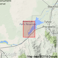
Pg. G26-G27, pl. 1. Sunbeam formation. Alluvial and colluvial deposits of silt and minor interstratified sand and gravel in southeastern part of American Falls quadrangle; mainly below altitude of about 4,750 feet and above American Falls lake beds and younger deposits. Separated from younger deposits by marginal scarp at elevation of about 4,430 feet. Thickness at least 100 feet. Age is middle and late Pleistocene.
Type area: series of cuts along Michaud Flats irrigation canal east of American Falls, in secs. 22, 23, 24, 27, and 28, T. 7 S., R. 31 E., Power Co., southeastern ID. Named for distribution adjacent to Sunbeam Creek, American Falls quadrangle, Power Co., southeastern ID.
Source: US geologic names lexicon (USGS Bull. 1350, p. 736).
- Usage in publication:
-
- Sunbeam Formation*
- Modifications:
-
- Mapped
- AAPG geologic province:
-
- Snake River basin
Summary:
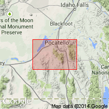
Sunbeam Formation. Alluvial and colluvial deposits below American Falls Lake Beds. Thickness <100 feet (30 m). Recognized in Power County, southeastern Idaho. Age is considered late Pleistocene. (Follows Carr and Trimble, 1963.)
Source: Publication.
For more information, please contact Nancy Stamm, Geologic Names Committee Secretary.
Asterisk (*) indicates published by U.S. Geological Survey authors.
"No current usage" (†) implies that a name has been abandoned or has fallen into disuse. Former usage and, if known, replacement name given in parentheses ( ).
Slash (/) indicates name conflicts with nomenclatural guidelines (CSN, 1933; ACSN, 1961, 1970; NACSN, 1983, 2005, 2021). May be explained within brackets ([ ]).