

- Usage in publication:
-
- Sturgeon quartzite
- Modifications:
-
- Not used
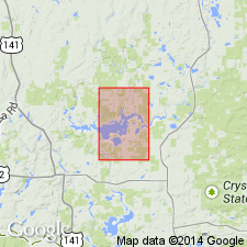
- Areal extent
- AAPG geologic province:
-
- Lake Superior region
Summary:
Is not used in the Kiernan quad, eastern Iron Co, MI (Lake Superior region). Quartz-sericite schist and slate exposed along the Fence River were placed in Sturgeon quartzite by Clements and Smyth (1899). These rocks differ from typical Sturgeon quartzite and are similar to quartz-sericite rocks elsewhere in the Randville dolomite; thus they are included at the base of the Randville in this report. The absence of the Sturgeon in the Kiernan area "is noteworthy because in the Pine Creek area of south-central Dickinson County, 30 miles southeast of the quadrangle, it has a thickness of as much as 2,000 feet."... Quartzite may be absent either because of nondeposition of the Sturgeon or because of the equivalence of the Randville with both the Sturgeon and the Randville elsewhere."
Source: GNU records (USGS DDS-6; Reston GNULEX).
- Usage in publication:
-
- Sturgeon quartzite*
- Modifications:
-
- Revised
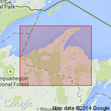
- Areal extent
- AAPG geologic province:
-
- Lake Superior region
Summary:
Revised and restricted to strata younger than East Branch arkose (new) to which it was previously assigned in central Dickinson Co, northeast MI in the Lake Superior region. Now reassigned to middle unit in Chocolay group (new) of Animikie series. Is absent in parts of Iron and Dickinson Cos either due to nondeposition or to its time-equivalence with upper unit of Chocolay group (Randville dolomite). Conformably overlies Fern Creek formation and conformably underlies Randville dolomite. Geologic sketch map and stratigraphic listing included. Age considered middle Precambrian.
Source: GNU records (USGS DDS-6; Reston GNULEX).
- Usage in publication:
-
- Sturgeon quartzite
- Modifications:
-
- Overview
- AAPG geologic province:
-
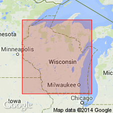
- Lake Superior region
Summary:
Occurs on map showing quartzites that may be related to the McCaslin quartzite (first used) in WI. Mapped areal extent in southern Dickinson Co, MI (Lake Superior region). Other quartzites shown on the map include: Baraboo, Barron, Flambeau, McCaslin, Palms, Rib Mountain, and Rudolph quartzites. Age is not stated.
Source: GNU records (USGS DDS-6; Reston GNULEX).
- Usage in publication:
-
- Sturgeon Quartzite*
- Modifications:
-
- Overview
- AAPG geologic province:
-
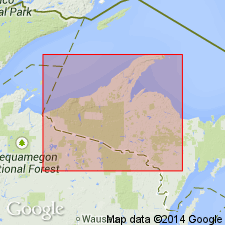
- Lake Superior region
Summary:
Pg. 2845 (fig. 2, stratigraphic chart compiled from Leith and others, 1935; James, 1958; Gair and Thaden, 1968). Sturgeon Quartzite of Chocolay Group of Marquette Range Supergroup (new; replaces †Animikie series of James, 1958, south of Lake Superior, in Michigan and Wisconsin). Present in Menominee Range, northwestern Michigan. Overlies Fern Creek Formation and underlies Randville Dolomite, both of Chocolay Group. Age is middle Precambrian.
Source: Publication.
For more information, please contact Nancy Stamm, Geologic Names Committee Secretary.
Asterisk (*) indicates published by U.S. Geological Survey authors.
"No current usage" (†) implies that a name has been abandoned or has fallen into disuse. Former usage and, if known, replacement name given in parentheses ( ).
Slash (/) indicates name conflicts with nomenclatural guidelines (CSN, 1933; ACSN, 1961, 1970; NACSN, 1983, 2005, 2021). May be explained within brackets ([ ]).