

- Usage in publication:
-
- Stone Cabin tuff
- Modifications:
-
- First used
- Dominant lithology:
-
- Ignimbrite
- AAPG geologic province:
-
- Great Basin province
Summary:
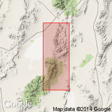
Shown in composite column of Tertiary volcanic rocks of Grant Range, Nye Co, NV. Described as crystal-vitric ignimbrite, upper two-thirds moderately to highly welded pale pink to pale purple, grading down abruptly into highly welded red-purple zone which in turn gives way downward to cavernous, lightly welded to nonwelded tuff at base. Thickness ranges from 540 to 690 ft. Underlies Currant tuff. Overlies dacite flows and breccia. Age is Tertiary.
Source: GNU records (USGS DDS-6; Menlo GNULEX).
- Usage in publication:
-
- Stone Cabin Formation
- Modifications:
-
- Named
- Dominant lithology:
-
- Ignimbrite
- Tuff
- AAPG geologic province:
-
- Great Basin province
Summary:
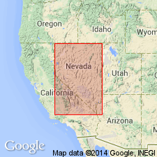
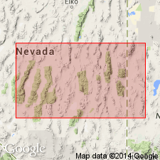
Named for abandoned cabin constructed of stone blocks; dirt road that leads from Currant through Grant Range to White River Valley passes by cabin. Type section designated as exposures 8.2 miles southeast of Currant, secs. 5 and 6, T. 9 N., R. 59 E., Nye County, Nevada. [Name first used by Cook (1960)]. Known extent is about 2500 sq mi in Grant Range, Nye County, and Egan Range, White Pine County, Nevada. Average thickness of 5 measured sections is 730 feet. Map shows location of sections. Correlation chart shows unit informally divided into (ascending); lower ignimbrite, sedimentary flows, and upper ignimbrite. Lower ignimbrite consists of lightly welded, crystal-vitric, pale gray tuff; upper ignimbrite is moderately welded, moderate pink crystal tuff which grades down into zone of highly welded pale red pink crystal-vitric tuff. Underlies Windous Butte Formation except in Grant Range West where unit underlies thin andesite flows and layers of volcanic sandstone. At type section overlies sandstone, dacite flows and breccia which in turn overlie Sheep Pass Formation (Eocene age). Age is Oligocene with 32 Ma (citing Armstrong, 1963) given as absolute age in correlation chart.
Source: GNU records (USGS DDS-6; Menlo GNULEX).
- Usage in publication:
-
- Stone Cabin Formation*
- Modifications:
-
- Adopted
- Areal extent
- Geochronologic dating
- AAPG geologic province:
-
- Great Basin province
Summary:
Lower sheet of Stone Cabin Formation of Cook (1965) "has been renamed the Calloway Well Formation by Scott (1966) and Armstrong (1970), a usage which is not here adopted." Upper cooling unit of Stone Cabin Formation occurs in Pancake, White Pine, and Grant Ranges, NV. Underlies tuff of Pancake Summit. Mean K-Ar age from biotite and sanidine from 4 samples from upper member of Stone Cabin Formation (collected at type locality and Big Louie Spring) yielded 34.1 Ma (ranging from 34.9 +/-0.9 to 33.2 +/-0.8 Ma).
Source: GNU records (USGS DDS-6; Menlo GNULEX).
- Usage in publication:
-
- Stone Cabin Formation*
- Modifications:
-
- Mapped
- AAPG geologic province:
-
- Great Basin province
Summary:
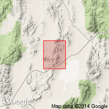
Mapped in Portuguese Mountain 15' quad, Nye Co, NV where following informal units are shown separately (ascending); lower unit (simple cooling unit, 0 to 250 ft thick, yellowish-gray to very light gray and pinkish-gray, nonwelded to partially welded tuff), bedded tuff and tuffaceous sediments, 0 to 250 ft thick, very pale orange to light-greenish-gray air-fall tuff), middle unit (compound cooling unit, 0 to 1500 ft thick, yellowish gray to grayish yellow, nonwelded to partially welded tuff), and upper unit (compound cooling unit, 0 to 1300 ft thick, very pale orange to grayish-orange partially welded tuff, fine sugary texture). Stone Cabin Formation contains abundant clear, dark smoky or amethyst quartz, slightly greater amount of allanite than most central NV rocks and variable amounts of lithic inclusions. Cross section shows unconformably overlies Chainman Shale(?). Underlies rhyolite lava and breccia of Oligocene age or quartz latite lava of Oligocene age or Quaternary alluvium. Shown as Oligocene age.
Source: GNU records (USGS DDS-6; Menlo GNULEX).
For more information, please contact Nancy Stamm, Geologic Names Committee Secretary.
Asterisk (*) indicates published by U.S. Geological Survey authors.
"No current usage" (†) implies that a name has been abandoned or has fallen into disuse. Former usage and, if known, replacement name given in parentheses ( ).
Slash (/) indicates name conflicts with nomenclatural guidelines (CSN, 1933; ACSN, 1961, 1970; NACSN, 1983, 2005, 2021). May be explained within brackets ([ ]).