

- Usage in publication:
-
- Stockton series
- Modifications:
-
- Named
- Dominant lithology:
-
- Conglomerate
- Sandstone
- AAPG geologic province:
-
- Newark basin
Summary:
Interbedded and repeated layers of coarse arkose conglomerate, yellow feldspathic sandstone, brown-red sandstone, and soft red argillaceous shale are named the Stockton series for exposures in quarries near Stockton, NJ. Unconformably overlies older crystalline rocks; conformably underlies the Lockatong series. Beds are repeated by faulting. Thickness is 4,700 ft (1,430 m). Age is Late Triassic.
Source: GNU records (USGS DDS-6; Reston GNULEX).
- Usage in publication:
-
- Stockton formation*
- Modifications:
-
- Revised
- AAPG geologic province:
-
- Newark basin
Summary:
The Triassic series in the Philadelphia district is represented by five divisions, the Norristown, Gwynedd, Lansdale, Perkasie, and Pottstown shales. It is footnoted that N.H. Darton, in a 1904 survey, divides the Triassic into three members, the Stockton formation, corresponding approximately to the Norristown shale, the Lockatong formation, containing the Gwynedd shale, and the Brunswick shale, containing the Lansdale, Perkasie, and Pottstown shales.
Source: GNU records (USGS DDS-6; Reston GNULEX).
- Usage in publication:
-
- Stockton formation*
- Modifications:
-
- Overview
- AAPG geologic province:
-
- Newark basin
Summary:
The classification of the Newark group, established in NJ, is here adopted by the U.S. Geological Survey in PA. It comprises the Stockton formation, Lockatong formation, and Brunswick shale, which are approximately equivalent to the Norristown, Gwynedd, and Lansdale shales, respectively, which have not been found acceptable because of their indefinite application.
Source: GNU records (USGS DDS-6; Reston GNULEX).
- Usage in publication:
-
- Stockton formation
- Modifications:
-
- Revised
- AAPG geologic province:
-
- Newark basin
Summary:
A composite section of the Stockton formation along both sides of the Delaware River is described. Informal members, in ascending order, are named: Lower Prallsville, Middle Prallsville, Upper Prallsville, red sandstone and shale, Cutalossa, and Raven Rock. Stockton rocks are of three types: conglomerate, hard sandstone, and soft sandstone.
Source: GNU records (USGS DDS-6; Reston GNULEX).
- Usage in publication:
-
- Stockton formation
- Modifications:
-
- Revised
- AAPG geologic province:
-
- Newark basin
Summary:
The Solebury member of the Stockton formation is named and described in the Delaware valley section.
Source: GNU records (USGS DDS-6; Reston GNULEX).
- Usage in publication:
-
- Stockton lithofacies
- Modifications:
-
- Revised
- AAPG geologic province:
-
- Newark basin
Summary:
The terms Stockton, Lockatong, and Brunswick lithofacies are used here because these units are intertonguing lithologic facies rather than distinct time stratigraphic units.
Source: GNU records (USGS DDS-6; Reston GNULEX).
- Usage in publication:
-
- Stockton formation
- Modifications:
-
- Areal extent
- AAPG geologic province:
-
- Newark basin
Summary:
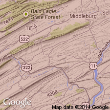
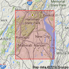
The Stockton formation is present in Rockland Co., NY.
Source: GNU records (USGS DDS-6; Reston GNULEX).
- Usage in publication:
-
- Stockton Formation
- Modifications:
-
- Age modified
- Biostratigraphic dating
- AAPG geologic province:
-
- Newark basin
Summary:
Sporomorph assemblages indicate a late Carnian age for the top of the Stockton. Middle Carnian megafossil plant assemblages lower in the Stockton place the middle-late Carnian boundary in the upper Stockton. The basal Stockton could be as old as Middle Triassic.
Source: GNU records (USGS DDS-6; Reston GNULEX).
- Usage in publication:
-
- Stockton Formation*
- Modifications:
-
- Overview
- AAPG geologic province:
-
- Newark basin
Summary:
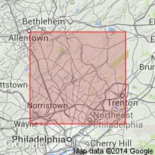
The Stockton Formation of the Newark Supergroup is divided into three informal members in Montgomery and eastern Chester Counties, Pennsylvania: the lower arkosic, middle arkosic, and upper shale members. The maximum thickness of the Stockton is 1,830 m (6,000 ft) in the center of the Newark basin, thinning in all directions to less than 250 m (820 ft). Interfingers laterally and gradationally with the overlying Lockatong Formation. To the west it unconformably underlies and is partially laterally correlative with the Hammer Creek Formation.
Source: GNU records (USGS DDS-6; Reston GNULEX).
- Usage in publication:
-
- Stockton Formation*
- Modifications:
-
- Overview
- AAPG geologic province:
-
- Newark basin
Summary:
The Lockatong Formation conformably overlies the Stockton Formation through most of the Newark basin in NJ and PA. Mapping in the northern part of the basin shows Stockton lithology both below and above the Lockatong and confirms that the Lockatong intertongues with the Stockton near their intrusion by the Palisade Diabase, and eventually pinches out northeast of Alpine, NJ. The Passaic Formation directly overlies the Stockton everywhere in the northern part of the Newark basin, and the boundary is defined where the rocks are dominantly light-tan to white arkosic sandstone below and dominantly red sandstone and siltstone above. The Stockton includes about 300 m of beds that had been mapped as Passaic (Brunswick) by Savage (1968).
Source: GNU records (USGS DDS-6; Reston GNULEX).
For more information, please contact Nancy Stamm, Geologic Names Committee Secretary.
Asterisk (*) indicates published by U.S. Geological Survey authors.
"No current usage" (†) implies that a name has been abandoned or has fallen into disuse. Former usage and, if known, replacement name given in parentheses ( ).
Slash (/) indicates name conflicts with nomenclatural guidelines (CSN, 1933; ACSN, 1961, 1970; NACSN, 1983, 2005, 2021). May be explained within brackets ([ ]).