

- Usage in publication:
-
- Star Point sandstone*
- Modifications:
-
- Original reference
- Dominant lithology:
-
- Sandstone
- AAPG geologic province:
-
- Paradox basin
Summary:
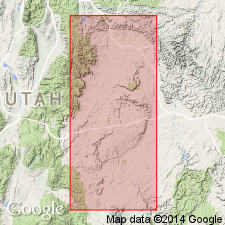
Pg. 442. Star Point sandstone of Mesaverde group. Basal formation of Mesaverde group. Thickness 200 to 450 feet in Wasatch Plateau and Book Cliffs, central eastern Utah. Conformably underlies Blackhawk formation and grades into underlying Mancos shale. It really represents the retreating or closing phase of Mancos sea and is more closely allied in origin with the Mancos than with the Mesaverde type of rocks but is included in Mesaverde in conformity with accepted practice of giving that name to the sandstones of Montana age immediately overlying Mancos shale. Star Point, a prominent headland of Wasatch Plateau southwest of Price is formed by this sandstone.
[Star Point, a striking headland headland of Gentry Mountain southwest of Price, and about 3 mi west of southwest corner of Castle Gate quadrangle, (in sec. 7, R. 8 E., T. 15 S., Scofield 15-min quadrangle), Carbon Co., central eastern UT.]
Source: US geologic names lexicons (USGS Bull. 896, p. 2055; USGS Bull. 1200, p. 3711).
- Usage in publication:
-
- Star Point sandstone*
- Modifications:
-
- Revised
- AAPG geologic province:
-
- Uinta basin
Summary:
Star Point sandstone, basal formation of Mesaverde group, revised in Uinta basin. Divided into three sandstone tongues which finger out into and are separated by shale of the Mancos shale; these are Panther (oldest), Storrs, and Spring Canyon tongues, all newly named. Overlies the Mancos shale; underlies Blackhawk formation. Age is Late Cretaceous. Report includes geologic map, cross section.
Source: Modified from GNU records (USGS DDS-6; Menlo GNULEX).

- Usage in publication:
-
- Star Point Sandstone*
- Modifications:
-
- Age modified
- AAPG geologic province:
-
- Uinta basin
- Paradox basin
Summary:
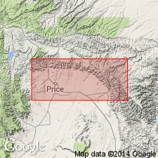
Is a unit of late Santonian to early Campanian age in the Paradox and Uinta basins. Palynomorphs identified in sec 12 and 11, T13S, R9E in Carbon Co in the Uinta basin. Intertongues with underlying Emery Sandstone Member and the underlying and partly equivalent Blue Gate Member of Mancos Shale, and with overlying Blackhawk Formation.
Source: GNU records (USGS DDS-6; Denver GNULEX).
For more information, please contact Nancy Stamm, Geologic Names Committee Secretary.
Asterisk (*) indicates published by U.S. Geological Survey authors.
"No current usage" (†) implies that a name has been abandoned or has fallen into disuse. Former usage and, if known, replacement name given in parentheses ( ).
Slash (/) indicates name conflicts with nomenclatural guidelines (CSN, 1933; ACSN, 1961, 1970; NACSN, 1983, 2005, 2021). May be explained within brackets ([ ]).