

- Usage in publication:
-
- St. Mary River series
- Modifications:
-
- Named
- Dominant lithology:
-
- Sandstone
- Shale
- Clay
Summary:
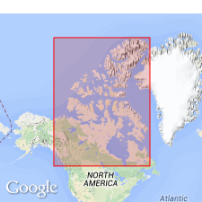
Rocks designated St. Mary River series are exposed for many miles on the Upper Belly River, the St. Mary, Waterton and Old Man Rivers, and Pincher Creek, Alberta, CN. Consists of interbedded gray or green sandstone, shale, and clay. Many ironstone nodules. Is one (of 4) units assigned to the Laramie--a general term for Upper Cretaceous or lower Eocene beds. Overlies unnamed yellow sandstone and shale. Underlies the newly named Willow Creek series. Contains fresh-water and brackish or marine mollusks. No type locality designated. Thickness not stated.
Source: GNU records (USGS DDS-6; Denver GNULEX).
- Usage in publication:
-
- St. Mary River formation*
- Modifications:
-
- Areal extent
- AAPG geologic province:
-
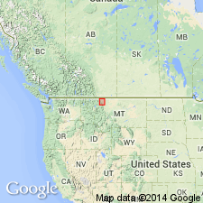
- Sweetgrass arch
Summary:
First paper to extend use of name into northwest MT, Glacier and Pondera Cos on the Sweetgrass arch. Was named and studied in St. Mary River area, Alberta, CN. Consists of irregularly bedded, gray but may be red or variegated in upper part, fresh and brackish water clays and sandstones. Clay is the predominant lithology. The sandstones are partly indurated and not persistent. Is 900 ft thick along Little Rocky Coulee in T35N, R9W and T36N, R10W. Is separated from Bearpaw shale by 360 ft of magnetite-bearing sandstone. Overlain by Willow Creek formation. Assigned to the Late Cretaceous or Eocene.
Source: GNU records (USGS DDS-6; Denver GNULEX).
- Usage in publication:
-
- St. Mary River Formation
- Modifications:
-
- Overview
- AAPG geologic province:
-
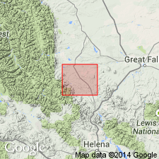
- Montana folded belt
Summary:
Is mapped with Willow Creek Formation in Lewis and Clark Co, MT in Montana folded belt province. Undifferentiated unit fills Swallow Canyon and Dry Creek synclines as indicated by penetrating wells. Total undifferentiated thickness is 3,700-2,000 ft. Three facies are distinguished: 1) lower, lagoonal facies (1,200-800 ft thick) includes dominantly gray and calcareous shale, shaly mudstone, and muddy sandstone; locally with interbedded thin beds of black, nodular-weathering limestone, and thin layers of yellow-brown (10YR 6/2), shaly mudstone and muddy sandstone; 2) middle, variegated shale-mudstone facies (2,050-800 ft thick)--in Swallow Canyon syncline light olive-gray shale grades upward to interbedded olive-gray and grayish red, shaly mudstone; both are generally sandy and calcareous, and contain feldspar and biotite--in Dry Creek syncline grayish red mudstone is interbedded with light gray, non-resistant, calcareous mudstone; thin beds of pink-weathering, nodular limestone; scattered beds of muddy sandstone; and conglomerate; 3) upper, sandy facies (800+ ft thick)--sandstones first become predominant--greenish gray (5GY 6/1) sandstone beds as much as 80 ft thick, broadly lenticular and interstratified with beds of olive-gray and reddish mudstone, which become thinner and fewer upward. Fossils include brackish-water pelecypods and charophytes and ostracods in basal beds; reptile bones and pelecypods in middle facies. Late Cretaceous age.
Source: GNU records (USGS DDS-6; Denver GNULEX).
- Usage in publication:
-
- St. Mary River Formation*
- Modifications:
-
- Overview
- AAPG geologic province:
-
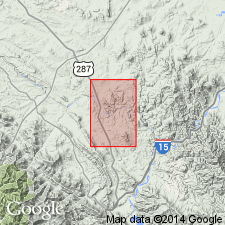
- Montana folded belt
Summary:
Is mapped in eastern Lewis and Clark Co, MT in Montana folded belt province. Overlies eastern facies of Two Medicine Formation; underlies Adel Mountain Volcanics. Is grayish-green, olive-gray, brown, and yellowish-brown calcareous mudstone siltstone, and sandstone; brown sandstones locally conglomeratic with small rounded pebbles of andesite, latite, and welded rhyolitic tuff; CRASSOSTREA GLABRA (Meek and Hayden) abundant in upper part; constitutes lowermost part of formation; maximum exposed thickness about 60 ft. Age is Late Cretaceous.
Source: GNU records (USGS DDS-6; Denver GNULEX).
For more information, please contact Nancy Stamm, Geologic Names Committee Secretary.
Asterisk (*) indicates published by U.S. Geological Survey authors.
"No current usage" (†) implies that a name has been abandoned or has fallen into disuse. Former usage and, if known, replacement name given in parentheses ( ).
Slash (/) indicates name conflicts with nomenclatural guidelines (CSN, 1933; ACSN, 1961, 1970; NACSN, 1983, 2005, 2021). May be explained within brackets ([ ]).