

- Usage in publication:
-
- Sprole Silt*
- Modifications:
-
- Areal extent
- AAPG geologic province:
-
- Williston basin
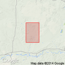
Summary:
Is mapped as formation in southeast corner of quad, sec 24, T29N, R51E, and sec 19, T29N, R52E, Roosevelt Co, MT in the northwestern Williston basin. Is northernmost mapped occurrence of unit. Occurs in limited area below altitude of 2,150 ft. Is Wisconsin age (Pleistocene).
Source: GNU records (USGS DDS-6; Denver GNULEX).
- Usage in publication:
-
- Sprole Silt*
- Modifications:
-
- Areal extent
- AAPG geologic province:
-
- Williston basin
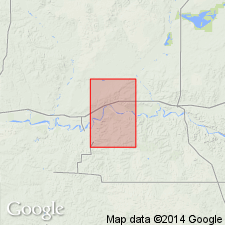
Summary:
Is mapped as formation in northwest corner of quad, secs 19, 20, 29, 30, T29N, R52E, Roosevelt Co, MT in the northwestern Williston basin. Is easternmost mapped occurrence of unit. Occurs in limited area at altitude of about 2,100 ft. Limited distribution beyond outcrops is based on artificial exposures and on test drilling. Is Wisconsin age (Pleistocene).
Source: GNU records (USGS DDS-6; Denver GNULEX).
- Usage in publication:
-
- Sprole Silt*
- Modifications:
-
- Named
- Dominant lithology:
-
- Silt
- AAPG geologic province:
-
- Williston basin
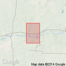
Summary:
Mapped and named as formation for exposures 2 mi northwest of Sprole, a siding on the Great Northern RR. Type locality in NW1/4 SW1/4 sec 3, T27N, R51E, Roosevelt Co, MT in northwestern Williston basin. Measured and estimated thickness ranges from 60 to 100 ft, thinning to west where not mapped locally. Silt is yellowish gray, brown, or reddish brown, clayey, plastic, thin bedded, and locally limonitic. Is locally much folded and faulted, probably by ice shove. Lower half is well stratified silt and clay, and contains pebbles; bedding is less pronounced in upper half. In some areas the silt has little structure and resembles loess. Pleistocene age determined on basis of stratigraphic position; at type locality it overlies at least 6 ft of Wiota Gravels and underlies 15 ft of till, both of Wisconsin age. Silt was deposited in a lake formed when ice advanced and blocked the Missouri River. Unit not found above altitude of 2,200 ft--the assumed upper limit of the lake, which may have been 15 mi wide and may have extended 60 mi west of the type locality to Nashua; it may also have extended a short distance up the Poplar River valley.
Source: GNU records (USGS DDS-6; Denver GNULEX).
For more information, please contact Nancy Stamm, Geologic Names Committee Secretary.
Asterisk (*) indicates published by U.S. Geological Survey authors.
"No current usage" (†) implies that a name has been abandoned or has fallen into disuse. Former usage and, if known, replacement name given in parentheses ( ).
Slash (/) indicates name conflicts with nomenclatural guidelines (CSN, 1933; ACSN, 1961, 1970; NACSN, 1983, 2005, 2021). May be explained within brackets ([ ]).