

- Usage in publication:
-
- Spiketon Formation*
- Modifications:
-
- Named
- Dominant lithology:
-
- Sandstone
- Shale
- Siltstone
- Coal
- AAPG geologic province:
-
- Puget Sound province
Summary:
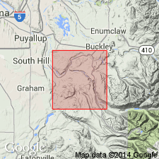
Is uppermost of three formations --Carbonado, Northcraft, and Spiketon --that compose Puget Group. Named for abandoned coal-mining community of Spiketon, near which is type locality along valley walls of Prairie Creek in SE/4 sec.15 T19N R6E, Pierce Co, WA. Consists of sequence of alternating beds of light-gray arkosic sandstone, gray to brown or black siltstone, mudstone, shale, carbonaceous shale, and coal. Is about 3600 ft thick and includes upper part of Willis and Smith's (1899) Burnett Formation (abandoned). [Conformably(?)] overlies Northcraft Formation. Conformably underlies Okanapecosh Formation. Is indistinguishable from Carbonado Formation except where the two are separated by Northcraft Formation. Assigned late(?) Eocene age.
Source: GNU records (USGS DDS-6; Menlo GNULEX).
For more information, please contact Nancy Stamm, Geologic Names Committee Secretary.
Asterisk (*) indicates published by U.S. Geological Survey authors.
"No current usage" (†) implies that a name has been abandoned or has fallen into disuse. Former usage and, if known, replacement name given in parentheses ( ).
Slash (/) indicates name conflicts with nomenclatural guidelines (CSN, 1933; ACSN, 1961, 1970; NACSN, 1983, 2005, 2021). May be explained within brackets ([ ]).