

- Usage in publication:
-
- Spearhead rhyolite*
- Modifications:
-
- Named
- Dominant lithology:
-
- Rhyolite
- AAPG geologic province:
-
- Great Basin province
Summary:
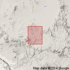
The youngest rhyolite in the Goldfield area, Esmeralda Co, NV in the Great Basin province is named Spearhead rhyolite. Mapped at southwest edge of district around edge of Malpais mesa. Probably named for Spearhead Point. No type section designated. Geologic map. Columnar sections. Consists of two flows of pink, brown to pale-green, porous rhyolite with abundant pumice fragments about 100 ft thick. Has phenocrysts of quartz and orthoclase, and a curly eutaxitic glass which in some specimens shows incipient devitrification. Biotite, hornblende, and green pyroxene are among the rarer phenocrysts. Conformably overlies the Pozo formation (new) and unconformably below Rabbit Spring formation (new). Provisionally assigned to the Pliocene.
Source: GNU records (USGS DDS-6; Denver GNULEX).
- Usage in publication:
-
- Spearhead Member*
- Modifications:
-
- Revised
- Overview
- AAPG geologic province:
-
- Great Basin province
Summary:
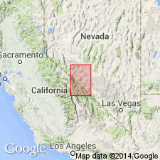
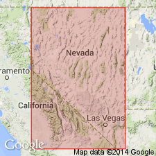
Assigned as the lower member (of six members) of Thirsty Canyon Tuff (new). Ransome's (1909) Spearhead Rhyolite is part of a large composite sheet that forms the lower part of Thirsty Canyon Tuff (new). Includes a simple cooling unit 20-80 ft thick near Goldfield, Esmeralda Co, NV, Great Basin province. To south additional ash flows and a compound cooling unit are included in Spearhead. South of Gold Flat in Nye Co, NV, a lower compound cooling unit informally termed the rhyolite of Pillar Spring included. Where two compound cooling units are distinguishable, they are designated lower and upper parts. Upper part has numerous red to brown lenses of scoriaceous to massive devitrified glass commonly several ft in diameter and as much as 1 ft thick. Is variable in lithology, ranging from shard tuffs to tuffs with abundant pumice, lithic fragments, and phenocrysts, and from air-fall tuffs and poorly welded ash-flow tuffs to densely welded vitric and devitrified ash-flow tuffs. Both lower and upper parts are lithic-, pumice-, and crystal-poor shard tuff. Lower part has a maximum of about 400 ft; upper part is almost 300 ft thick. Present volume of Spearhead exceeds that of all other members of Thirsty Canyon. Distribution map. Pliocene age. Has a K-Ar age of 7.5 m.y. Underlies Trail Ridge Member (new) of Thirsty Canyon.
Source: GNU records (USGS DDS-6; Denver GNULEX).
- Usage in publication:
-
- Spearhead Member*
- Modifications:
-
- Mapped
- AAPG geologic province:
-
- Great Basin province
Summary:
Mapped in Buckboard Mesa 7.5' quad, Nye Co, NV where only upper ash-flow tuff exposed. Simple cooling unit consists of vapor-phase zone grading downward to devitrified welded zone and further downward to vitric non-welded basal zone. Is as much as 150 ft thick. Underlies Trail Ridge Member and Quaternary alluvium. Assigned to Pliocene age.
Source: GNU records (USGS DDS-6; Menlo GNULEX).
- Usage in publication:
-
- Spearhead Member*
- Modifications:
-
- Mapped
- AAPG geologic province:
-
- Great Basin province
Summary:
Mapped in Timber Mountain 7.5' quad, Nye Co, NV where thickness is up to 120 ft. Underlies Trail Ridge Member and Quaternary alluvium. Overlies Timber Mountain Tuff. Interlayered with Tertiary gravels and tuffaceous deposits. Assigned Pliocene age.
Source: GNU records (USGS DDS-6; Menlo GNULEX).
- Usage in publication:
-
- Spearhead Member*
- Modifications:
-
- Mapped
- AAPG geologic province:
-
- Great Basin province
Summary:
Mapped in Silent Butte 7.5' quad, Nye Co, NV where it is composed of two units. Is as much as 400 ft thick. Upper unit is simple cooling unit, purple to maroon-gray densely welded ash-flow; lower unit is gray to pink-gray ash-flow tuff. Unconformably overlies Timber Mountain Tuff and Pliocene rhyolite; underlies Trail Ridge Member. Assigned a Pliocene age.
Source: GNU records (USGS DDS-6; Menlo GNULEX).
- Usage in publication:
-
- Spearhead member*
- Modifications:
-
- Mapped
- AAPG geologic province:
-
- Great Basin province
Summary:
Mapped in Thirsty Canyon SE 7.5' quad, Nye Co, NV. It is composite sheet of ash-flow tuff and three simple cooling units in northeastern part of quad coalesce to south and west into one compound unit. Is as much as 300 ft thick. Unconformably overlies basalt and tuff and underlies Trail Ridge Member. Assigned a Pliocene age.
Source: GNU records (USGS DDS-6; Menlo GNULEX).
- Usage in publication:
-
- Spearhead Member*
- Modifications:
-
- Mapped
- AAPG geologic province:
-
- Great Basin province
Summary:
Mapped in Thirsty Canyon 7.5' quad, Nye Co, NV where it is as much as 890 ft thick. Unconformably overlies trachyandesite and Timber Mountain Tuff; underlies Trail Ridge Member of Thirsty Canyon Tuff. Assigned a Pliocene age.
Source: GNU records (USGS DDS-6; Menlo GNULEX).
- Usage in publication:
-
- Spearhead Member*
- Modifications:
-
- Mapped
- AAPG geologic province:
-
- Great Basin province
Summary:
Mapped in Scrugham Peak 7.5-min quadrangle, Nye County, Nevada. Consists of upper ash-flow as much as 250 ft thick and a lower ash-flow tuff as much as 375 ft thick. Underlies Trail Ridge Member and unconformably overlies Timber Mountain Tuff but locally zeolite air-fall and ash-flow tuff separate them. (Uppermost part of the ash-fall is related to Thirsty Canyon Tuff.) Assigned Pliocene age.
Source: GNU records (USGS DDS-6; Menlo GNULEX).
- Usage in publication:
-
- Spearhead Member*
- Modifications:
-
- Mapped
- AAPG geologic province:
-
- Great Basin province
Summary:
Mapped in Trail Ridge 7.5' quad, Nye Co, NV where it is as much as 150 ft thick. Spearhead and Rocket Wash Members are not divided in some sections. Overlies Rocket Wash Member (new) of Thirsty Canyon Tuff; unconformably overlies Grouse Canyon Member of Belted Range Tuff; underlies Trail Ridge Member of Thirsty Canyon Tuff. Assigned to Pliocene age.
Source: GNU records (USGS DDS-6; Menlo GNULEX).
- Usage in publication:
-
- Spearhead Member*
- Modifications:
-
- Revised
- AAPG geologic province:
-
- Great Basin province
Summary:
The two parts of the Spearhead Member of Thirsty Canyon Tuff, designated the upper and lower parts, are thought to be distinct ash-flow sheets, rather than a single composite sheet as originally thought. The lower sheet is reversely polarized with the remanent vector having high inclination. The upper sheet has a subhorizontal, south-directed stable thermoremanent magnetization. Lower part is newly named Rocket Wash Member of Thirsty Canyon Tuff. Name Spearhead restricted to the former upper part of Spearhead. As restricted, Spearhead Member is divisible into: 1) a lower unit with no large or scoriaceous blocks of pumice; 2) an orange to brick-red color where devitrified, a slope-forming middle unit; and 3) an upper unit of dark-brown, partly to densely welded, cliff-forming tuff characterized by numerous blocks of black, brown scoriaceous pumice as much as 3 ft in diameter. Of mid-Pliocene age. Erupted from the Black Mountain center, Nye Co, NV in the Great Basin province.
Source: GNU records (USGS DDS-6; Denver GNULEX).
- Usage in publication:
-
- Spearhead Member*
- Modifications:
-
- Areal extent
- AAPG geologic province:
-
- Great Basin province
Summary:
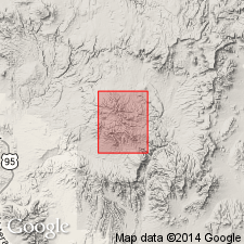
Spearhead and Trail Ridge Members geographically extended into eastern end of Slate Ridge area, southern Esmeralda Co, NV, their farthest westward extent.
Source: GNU records (USGS DDS-6; Menlo GNULEX).
- Usage in publication:
-
- Spearhead Member*
- Modifications:
-
- Geochronologic dating
- AAPG geologic province:
-
- Great Basin province
Summary:
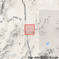
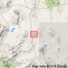
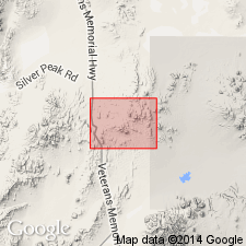
[Spearhead Member of Thirsty Canyon Tuff.] Samples from type Spearhead "Rhyolite," near Rabbit Spring at foot of Malpais Mesa, just south of Spearhead Point, Lat. 37 deg. 41 min. 40 sec. N., Long. 117 deg. 14 min. 20 sec. W., Esmeralda County, Nevada, yielded K-Ar ages (sanidine and whole rock) of 6.7 +/-0.1 and 6.8 +/-0.14 Ma.
Source: Modified from GNU records (USGS DDS-6; Menlo GNULEX).
- Usage in publication:
-
- Spearhead Member*
- Modifications:
-
- Geochronologic dating
- AAPG geologic province:
-
- Great Basin province
Summary:
Assigned Miocene or Pliocene age based on isotopic age (about 7 Ma) in Goldfield area.
Source: GNU records (USGS DDS-6; Menlo GNULEX).
- Usage in publication:
-
- Spearhead Member*
- Modifications:
-
- Areal extent
- AAPG geologic province:
-
- Great Basin province
Summary:
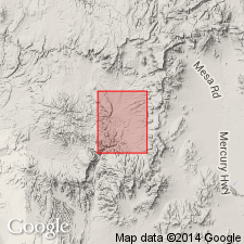
Geographically extended SE from Goldfield into sec 19, T3S, R44E (lat 37 deg 40'N, long 117 deg 05'W) Nye Co., NV. Assigned a Miocene or Pliocene age.
Source: GNU records (USGS DDS-6; Menlo GNULEX).
- Usage in publication:
-
- Spearhead Member*
- Modifications:
-
- Geochronologic dating
- AAPG geologic province:
-
- Great Basin province
Summary:
K-Ar ages on hypogene alunite and fission-track ages on annealed apatite give late Miocene or early Pliocene age.
Source: GNU records (USGS DDS-6; Menlo GNULEX).
- Usage in publication:
-
- Spearhead Member*
- Modifications:
-
- Revised
- Geochronologic dating
- AAPG geologic province:
-
- Great Basin province
Summary:
Spearhead Member removed from Thirsty Canyon Tuff as its basal member and reassigned to the newly named Stonewall Flat Tuff as its basal member. Underlies the newly named Civet Cat Canyon Member of Stonewall. Consists of moderately to densely welded rhyolitic ash-flow tuff. One or more flows of slightly to nonwelded tuff present at top of member in Civet Cat Canyon. Southeast of Stonewall Mountain, the member is composed of largely or entirely of nonwelded to slightly welded tuff. Is red, brown or gray where moderately to densely welded. Has 5 to 8 percent phenocrysts, largely sodic sanidine with minor amounts of quartz and sodic plagioclase, traces of iron-rich clinopyroxene, fayalite, sodic amphibole, and Fe-Ti oxides. Two K-Ar ages of 6.3 +/-0.2 Ma on phenocrystic sanidine. Derived from the Stonewall Mountain volcanic center, Nye Co, NV in the Great Basin province. Of late Miocene age. Stratigraphic chart.
Source: GNU records (USGS DDS-6; Denver GNULEX).
For more information, please contact Nancy Stamm, Geologic Names Committee Secretary.
Asterisk (*) indicates published by U.S. Geological Survey authors.
"No current usage" (†) implies that a name has been abandoned or has fallen into disuse. Former usage and, if known, replacement name given in parentheses ( ).
Slash (/) indicates name conflicts with nomenclatural guidelines (CSN, 1933; ACSN, 1961, 1970; NACSN, 1983, 2005, 2021). May be explained within brackets ([ ]).