

- Usage in publication:
-
- Simmler formation
- Modifications:
-
- Named
- Dominant lithology:
-
- Sandstone
- Conglomerate
- AAPG geologic province:
-
- California Coast Ranges province
Summary:
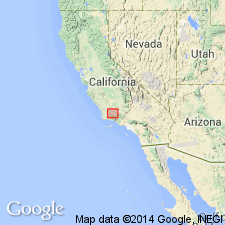
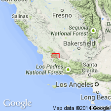
Named after the settlement of Simmler. Type locality: T10N R25W, 4-5 miles northeast of Cuyama, east of Cuyama ranch quad, southeast Caliente Range, southeast San Luis Obispo Co. At type about 3000 ft thick; overlies Pattiway Formation with slight angular unconformity; conformably overlain by Soda Lake sandstone member of Vaqueros Formation. At type chiefly sandstone with interbeds of silt; 30 ft basal conglomerate. Continental deposits. Oligocene(?) and perhaps lowermost Miocene age based on stratigraphic position between Pattiway (Eocene?) and Vaqueros (lower Miocene) Formations. Occurs in northwestern Caliente Range in vicinity of Soda Lake (T31S R19E) with same thickness and lithology as type; base unexposed. Occurs in northern Cuyama Badlands, 3000 ft thick, coarsens to conglomerate and fanglomerate, lies conformably between Pattiway and Vaqueros Formations. Occurs in western Cuyama Valley and La Panza Range as conglomerate and sandstone, unconformably on Cretaceous sediments or granitic basement, about 3000 ft thick, previously mapped as "Redrock Canyon sandstone member of Santa Margarita" by English (1916), nonmarine Vaqueros by Eaton and others (1941), "Sespe formation" by Clements (1950).
Source: GNU records (USGS DDS-6; Menlo GNULEX).
- Usage in publication:
-
- Simmler Formation*
- Modifications:
-
- Age modified
- AAPG geologic province:
-
- California Coast Ranges province
Summary:
Red and green colors and lack of marine fossils suggest entirely terrestrial deposition and may contain some lacustrine beds. Is unfossiliferous except for sparse plant remains and bone fragments; possible age range is late Eocene to early Miocene; conformable relationship with overlying Zemorrian Vaqueros and unconformable relationship with underlying sequence suggest most likely Oligocene age; probably mainly Zemorrian and possibly (in part) Refugian [note: Dibblee does not give any evidence to support stage calls]. Probably correlative with Berry Formation (Thorup, 1943) of Salinas Valley and Sespe Formation (of Watts, 1897) of the Santa Ynez Mountains and Ventura basin on basis of similar lithology and stratigraphic position. In addition to units mentioned in Hill (1958), mapped as Oligocene(?) red beds by Vedder and Brown (1968).
Source: GNU records (USGS DDS-6; Menlo GNULEX).
- Usage in publication:
-
- Simmler Formation*
- Modifications:
-
- Age modified
- AAPG geologic province:
-
- California Coast Ranges province
Summary:
Occurs in Caliente and La Panza Ranges and Cuyama Valley area (including Cuyama Badlands). Age range is late Eocene to Oligocene. Overlies Paleocene Pattiway Formation with slight angular unconformity or granitic or gneissic basement or Upper Cretaceous-lower Tertiary marine sequence with early to middle Eocene fossils. Conformably underlies Vaqueros Formation whose base is Zemorrian [Zemorrian was then considered Oligocene, but Poore (1980) shows Zemorrian is in part Miocene; therefore could be as young as early Miocene]. Since Vaqueros is marine, contact is time transgressive. Two measured sections given (one southeast, one northwest Caliente Range). In type area divided into 4 units. Thickness varies: 950 m in type area (minimum); 1150 m in southeastern Caliente Range; 1050+ m in northwestern Caliente Range; conglomerate facies discontinuous southwest of thrust fault and varies 0-200m.
Source: GNU records (USGS DDS-6; Menlo GNULEX).
- Usage in publication:
-
- Simmler Formation*
- Modifications:
-
- Age modified
- Geochronologic dating
- AAPG geologic province:
-
- California Coast Ranges province
Summary:
Age revised to upper Oligocene or lower Miocene on basis of dated basalt flow (22.9 +/-0.7 and 23.4 +/-0.8 m.y. K-Ar) in lower to middle part of unit in the Cuyama Gorge block [note: about 30 km from type area]. Occurs as 3 fault-bounded outcrops representing two depositional blocks or basins; western two part Cuyama Gorge block and eastern La Panza block. La Panza block overlain conformably by lower Miocene part of Vaqueros Formation, whereas these strata are missing on the Cuyama Gorge block. Less than 200 m thick in La Panza block, 1200+ m in Cuyama Gorge block. [Possible age range: late Eocene to early Miocene -date does not come from base, can not rule out pre-late Oligocene age]
Source: GNU records (USGS DDS-6; Menlo GNULEX).
For more information, please contact Nancy Stamm, Geologic Names Committee Secretary.
Asterisk (*) indicates published by U.S. Geological Survey authors.
"No current usage" (†) implies that a name has been abandoned or has fallen into disuse. Former usage and, if known, replacement name given in parentheses ( ).
Slash (/) indicates name conflicts with nomenclatural guidelines (CSN, 1933; ACSN, 1961, 1970; NACSN, 1983, 2005, 2021). May be explained within brackets ([ ]).