

- Usage in publication:
-
- Siksikpuk formation*
- Modifications:
-
- Named
- Biostratigraphic dating
- Dominant lithology:
-
- Shale
- Siltstone
- AAPG geologic province:
-
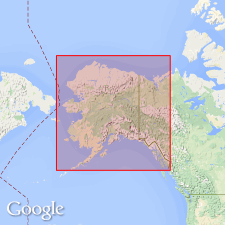
- Alaska Northern region
Summary:
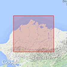
Named from Siksikpuk River, Composite type section designated in two separate outcrops, basal part in cutbank on east side of Shimo Creek (68 deg 17'N, 151 deg 53'W) and upper part in cutbank on east side of tributary to Tiglukpuk Creek (68 deg 17'N, 151 deg 48'W), central Brooks Range, northern AK. Has been mapped from Anaktuvuk River as far west as Kiligwa River. Exposed on Tiglukpuk Creek, tributary to Siksikpuk River. Composed chiefly of variegated green, gray, and dark red shale and siltstone that locally are calcareous, cherty, or ferruginous. Is 354 ft thick at type. Appears to disconformably overlie Lisburne group; disconformably underlies Shublik formation. Corals, brachiopods, and gastropods from basal 50 ft suggest probable Permian(?) age.
Source: GNU records (USGS DDS-6; Menlo GNULEX).
- Usage in publication:
-
- Siksikpuk Formation*
- Modifications:
-
- Revised
- Age modified
- Biostratigraphic dating
- AAPG geologic province:
-
- Alaska Northern region
Summary:
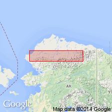
Type locality designated as secs.21 and 23 T12S R1E on east side of tributary of Tiglukpuk Creek, tributary of Siksikpuk River, Brooks Range, northern AK. Siksikpuk Formation is assigned as lower unit of Etivluk Group (new). Upper unit of group is Otuk Formation (new). Microfossils indicate longer age span for unit than in earlier studies. Siksikpuk is here considered to be Pennsylvanian, Permian, and Early Triassic in age.
Source: GNU records (USGS DDS-6; Menlo GNULEX).
- Usage in publication:
-
- Siksikpuk Formation*
- Modifications:
-
- Age modified
- Revised
- AAPG geologic province:
-
- Alaska Northern region
Summary:
Siksikpuk Formation stratigraphically restricted (rocks in Picnic allochthon reassigned to Imnaitchiak Chert of Etivluk Group) following usage of Mull and others (1987). Age is Permian based on megafossil and conodonts (Adams and Siok, 1989). [Unit thereby conforms to original definition of Patton (1957)].
Source: GNU records (USGS DDS-6; Menlo GNULEX).
For more information, please contact Nancy Stamm, Geologic Names Committee Secretary.
Asterisk (*) indicates published by U.S. Geological Survey authors.
"No current usage" (†) implies that a name has been abandoned or has fallen into disuse. Former usage and, if known, replacement name given in parentheses ( ).
Slash (/) indicates name conflicts with nomenclatural guidelines (CSN, 1933; ACSN, 1961, 1970; NACSN, 1983, 2005, 2021). May be explained within brackets ([ ]).