

- Usage in publication:
-
- Sierrite limestone
- Modifications:
-
- Areal extent
- AAPG geologic province:
-
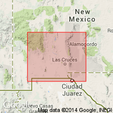
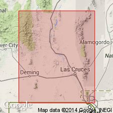
- Orogrande basin
Summary:
Pg. 2201 (table). Sierrite limestone, lower formation of El Paso group. On table only. Thickness from fraction of a foot to 250 feet. Underlies Bat Cave limestone (new); overlies Bliss sandstone. [No lithologic description included.] Age is Early Ordovician.
Source: US geologic names lexicon (USGS Bull. 1200, p. 3598-3599); supplemental information from GNU records (USGS DDS-6; Denver GNULEX).
- Usage in publication:
-
- Sierrite limestone
- Modifications:
-
- Named
- Dominant lithology:
-
- Limestone
- Chert
- AAPG geologic province:
-
- Orogrande basin
Summary:
Pg. 42-45, fig. 4. Sierrite limestone of El Paso group. Thin- to medium-bedded, the thin beds and laminations result in a distinctive banded appearance. Laminations commonly consist of alternating layers of limestone and chert with latter generally the thinner. Chert laminations are brown weathering, whereas limestone generally weathers medium-gray. On fresh surfaces, Sierrite limestone is medium-gray to dark-gray with slight brownish cast. Most beds are microgranular, but fine- to medium-grained textures are common. Limestone entirely calcite at type locality. Chert is light-gray to white on fresh surfaces. Except for chert laminations, formation is almost exclusively limestone. At Molinas Canyon section in southern end of the range, a few thin lentils of brick-red shale present about 35 feet above base of formation. Thickness 167 feet at type locality. Conformable with confining formations. Lower formation of El Paso group. Type section and areal distribution indicated.
Type section (Cable Canyon section): opposite Sierrite Mine, in sec. 10 (unsurveyed), T. 16 S., R. 4 W., on north side of canyon [Flordillo Canyon, approx. Lat. 32 deg. 55 min. 45 sec. N., Long. 107 deg. 14 min. 00 sec. W., Apache Gap 7.5-min quadrangle], Caballo Mountains, Sierra Co., southwestern NM. Named from Sierrite Mine. Crops
out all along west face of Caballo Mountains, in west face of Mud Springs
Mountains, and in west faee of south Red Hills, at south end of Nakaye
Mountain, and ill west face of Red House Mountain, southwestern NM.
[See also Hayes and Cone, 1975, USGS Prof. Paper 873, loc. 15.]
Crops out all along the west faces of Caballo Mountains, Mud Springs Mountains, south Red Hills, Red Mountain, and along south end of Nakaye Mountain. Forms a sharp cliff above the slopes of underlying Bliss formation; contact is conformable. Overlain conformably by Bat Cave formation. Medium-gray to brown outcrops contrast with darker Bliss and lighter, slope-forming Bat Cave. Is 127-165 ft thick; thickness fairly uniform throughout area. Thin- to medium-bedded, presents massively ledged outcrop due to firm bonding of layers. Often weathers slabby. Banded appearance due to thin beds and laminations of alternating limestone and irregular chert layers. Limestone weathers medium gray; chert weathers brown. Irregular chert laminations result in embossed reticulations on the bedding planes. Stromatolites due not occur in the limestone. Depositional environment was quiet, shallow sea which covered shelf area of Sonoran trough; the deposits appear to have accumulated slowly by rhythmical chemical precipitation of calcium carbonate and silica. Few fossils found. Is of Canadian, Early Ordovician age.
Source: GNU records (USGS DDS-6; Denver GNULEX).
- Usage in publication:
-
- Sierrite Member
- Modifications:
-
- Areal extent
- AAPG geologic province:
-
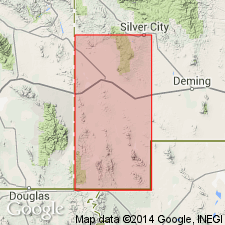
- Pedregosa basin
Summary:
Is the lower member of the El Paso Formation. Sections measured: in Mescal Canyon, NE1/4 SE1/4 sec 29, T30S, R15W, 345 ft thick; in Ram Gorge, sec 20, T30S, R15W, 204 ft thick; and in Chaney Canyon, secs 31 and 36, T30S, R16W, 256 ft thick. Overlies Bliss Formation conformably. Underlies Bat Cave Member of El Paso. Assigned to Canadian Series of the Ordovician. Has trilobite, fauna, cystoid plates, and linguloid brachiopods.
Source: GNU records (USGS DDS-6; Denver GNULEX).
- Usage in publication:
-
- Sierrite Formation*
- Modifications:
-
- Areal extent
- AAPG geologic province:
-
- Orogrande basin
Summary:
Name extended into map area from the Caballo Mountains. Mapped as the lower formation of the El Paso Group on the west flank of the Mud Springs Mountains, Sierra Co, NM in the Orogrande basin, where it overlies Bliss Sandstone and underlies Bat Cave Formation, upper formation of the El Paso. This name is used in preference to Hitt Canyon Formation, basal formation of El Paso Group that was used in this area by Hayes and Cone (1975, USGS PP 873). The contacts of the Hitt Canyon and the overlying McKelligon Limestone of the El Paso Group do not coincide with contacts of the Sierrite and Bat Cave Formations of the El Paso mapped in this report. Consists of gray, fine to very fine grained, thin- to medium-bedded limestone that alternates with brown-weathering chert. Forms cliffs and steep slopes. Equivalent to lower member of Hitt Canyon. Assigned to the Early Ordovician.
Source: GNU records (USGS DDS-6; Denver GNULEX).

- Usage in publication:
-
- Sierrite Member
- Modifications:
-
- Not used
- AAPG geologic province:
-
- Pedregosa basin
Summary:
Sierrite Member of El Paso Formation. Not recognized in Big Hatchet Mountains, Hidalgo County, New Mexico; previously described by Zeller (1965).
Source: Publication.
For more information, please contact Nancy Stamm, Geologic Names Committee Secretary.
Asterisk (*) indicates published by U.S. Geological Survey authors.
"No current usage" (†) implies that a name has been abandoned or has fallen into disuse. Former usage and, if known, replacement name given in parentheses ( ).
Slash (/) indicates name conflicts with nomenclatural guidelines (CSN, 1933; ACSN, 1961, 1970; NACSN, 1983, 2005, 2021). May be explained within brackets ([ ]).