

- Usage in publication:
-
- Shumagin Formation
- Modifications:
-
- Named
- Biostratigraphic dating
- Dominant lithology:
-
- Sandstone
- Siltstone
- Shale
- Breccia
- AAPG geologic province:
-
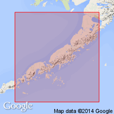
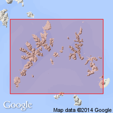
- Alaska Southwestern region
Summary:
Pt. 1, p. 63-67, 183, 187; Pt. 2, maps. Shumagin Formation. Consists of dark-gray interbedded subgraywacke and graywacke sandstones and conglomerates, black to dark-gray siltstones, shales, and slates. All rocks show characteristics of flysch deposits. Thickness impossible to determine accurately; relatively undeformed strata dipping northwestward north and south of Falmouth Harbor indicate at least 10,000 feet of strata. This is minimum figure, actual thickness may be several times this figure. No sedimentary rocks younger or older than Shumagin noted on Shumagin or Sanak Islands. Probably constitutes bulk of extensive Shumagin-Kodiak Shelf; now known from Sanak Islands to Kodiak Island. Intruded by Shumagin batholith of Paleocene age. Sparse fauna establish age only as Jurassic or Cretaceous. Distinct lithology and presence of sparse fossils reported to be early Senonian suggest that Shumagin is largely or entirely of Cretaceous age.
Named for occurrence on Shumagin Islands, southwestern AK.
Source: US geologic names lexicon (USGS Bull. 1350, p. 691); supplemental information from GNU records (USGS DDS-6; Menlo GNULEX).
- Usage in publication:
-
- Shumagin Formation*
- Modifications:
-
- Age modified
- Biostratigraphic dating
- AAPG geologic province:
-
- Alaska Southwestern region
Summary:
Type area designated as typical exposures on Nagai Island. Type section considered to be Burk's (1965) section on north shore of Falmouth Harbor. INOCERAMUS KUSIROENSIS collected from Shumagin establishes age of unit as Late Cretaceous (Maestrichtian) (Jones and Clark, 1973).
Source: GNU records (USGS DDS-6; Menlo GNULEX).
For more information, please contact Nancy Stamm, Geologic Names Committee Secretary.
Asterisk (*) indicates published by U.S. Geological Survey authors.
"No current usage" (†) implies that a name has been abandoned or has fallen into disuse. Former usage and, if known, replacement name given in parentheses ( ).
Slash (/) indicates name conflicts with nomenclatural guidelines (CSN, 1933; ACSN, 1961, 1970; NACSN, 1983, 2005, 2021). May be explained within brackets ([ ]).