

- Usage in publication:
-
- Shire Member*
- Modifications:
-
- Named
- Reference
- Dominant lithology:
-
- Claystone
- Sandstone
- AAPG geologic province:
-
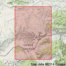
- Piceance basin
Summary:
Named as upper member of Wasatch Formation for exposures along Shire Gulch in NE1/4 sec 19, T9S, R96W, the type locality, in Mesa Co, CO in Piceance basin. Reference section designated at SE1/4 sec 13, T9S, R97W and S1/2 sec 18, T9S, R96W. Composed principally of lavender, purple and red claystone. Some lenticular poorly bedded brown sandstone. Is about 900 ft thick at type; thins to about 600 ft in subsurface beneath Grand Mesa; thickens to 1,800 ft in wells south of Grand Valley. Probable equivalent along Grand Hogback has an exposed thickness in excess 4,000 ft. Overlies Molina Member; underlies and intertongues with Green River Formation. Early Eocene mammals found in lower part at type locality.
Source: GNU records (USGS DDS-6; Denver GNULEX).
- Usage in publication:
-
- Shire Member*
- Modifications:
-
- Biostratigraphic dating
- AAPG geologic province:
-
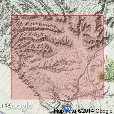
- Piceance basin
Summary:
Is uppermost of three members of Wasatch Formation. Study area is in DeBeque area, Mesa Co, CO, southwest Piceance basin. Age diagnostic palynomorphs collected from Shire suggest a middle Eocene age. Fossils include PLATYCARYA (early to early middle Eocene), CARYA (late Paleocene to Oligocene), INTRATRIPOROPOLLENITES (earliest to mid-middle Eocene), Bombacaceae (late early to early-middle Eocene), PISTILLIPOLLENITES (late Paleocene to early-middle Eocene), and TRIUMFETTA (middle Eocene). Cross section. Conformably overlies Molina Member of Wasatch; conformably underlies Douglas Creek Member of Green River Formation.
Source: GNU records (USGS DDS-6; Denver GNULEX).
- Usage in publication:
-
- Shire Member*
- Modifications:
-
- Mapped 1:24k
- Age modified
- Dominant lithology:
-
- Mudstone
- Sandstone
- AAPG geologic province:
-
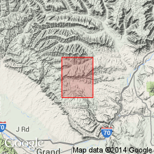
- Piceance basin
Summary:
Mapped in northern two-thirds of quad, Garfield and Mesa Cos, CO, Piceance basin. Is uppermost of three members of Wasatch Formation. Is mapped both undivided and divided. Shire is divided into lower and upper parts where Cow Ridge Member of Green River Formation is present. Consists of mostly nonlaminated gray, purple, and maroon mudstone; contains a few thin, lenticular sandstone units. Sandstone is fine to coarse grained and moderately to poorly sorted; sandstone units are 35 ft or less thick. Shown in correlation diagram to overlie Atwell Gulch Member of Wasatch and, in lower part, to interfinger with Molina Member (age modified tentatively) of Wasatch; conformably underlies Douglas Creek Member of Green River. Thickness is 475-675 ft. Measured section. Assigned Paleocene and Eocene age. [Age presumably assigned on basis of interfingering of lower part of Shire with Molina. Molina assigned Paleocene and Eocene age in this report based on tentative age assignment of Johnson and May (1978).]
Source: GNU records (USGS DDS-6; Denver GNULEX).
For more information, please contact Nancy Stamm, Geologic Names Committee Secretary.
Asterisk (*) indicates published by U.S. Geological Survey authors.
"No current usage" (†) implies that a name has been abandoned or has fallen into disuse. Former usage and, if known, replacement name given in parentheses ( ).
Slash (/) indicates name conflicts with nomenclatural guidelines (CSN, 1933; ACSN, 1961, 1970; NACSN, 1983, 2005, 2021). May be explained within brackets ([ ]).