

- Usage in publication:
-
- Shelter formation*
- Modifications:
-
- Named
- Dominant lithology:
-
- Conglomerate
- Graywacke
- Greenstone
- AAPG geologic province:
-
- Alaska Southeastern region
Summary:
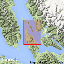
Named for exposures that extend the length of Shelter Island, Juneau (B-3) quad, southeastern AK. Also crops out at north end of Portland Island. Consists of conglomerate with interlayered pebbly graywacke, graywacke, and greenstone. Conglomerate and graywacke are about 500 to 1000 ft thick. Overlying greenstone is at least several 100 ft thick. Strata as exposed on Shelter Island may grade by facies change into Symonds formation on Douglas Island, may pass between that island and Colt Island or both. Age given as Early Cretaceous(?).
Source: GNU records (USGS DDS-6; Menlo GNULEX).
For more information, please contact Nancy Stamm, Geologic Names Committee Secretary.
Asterisk (*) indicates published by U.S. Geological Survey authors.
"No current usage" (†) implies that a name has been abandoned or has fallen into disuse. Former usage and, if known, replacement name given in parentheses ( ).
Slash (/) indicates name conflicts with nomenclatural guidelines (CSN, 1933; ACSN, 1961, 1970; NACSN, 1983, 2005, 2021). May be explained within brackets ([ ]).