

- Usage in publication:
-
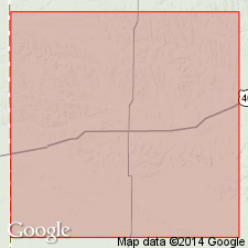
- Sharon Springs shale member
- Modifications:
-
- Original reference
- Dominant lithology:
-
- Shale
- AAPG geologic province:
-
- Anadarko basin
Summary:
Sharon Springs shale member of Pierre shale. Basal member of Pierre shale in Wallace County, northwestern Kansas, and its lithology differs widely from that of rest of formation. Upper 65 feet consists of flaky, somewhat bituminous black shale and, rarely, porous light-gray shale, both with abundant fish scales, gigantic septarian and smaller ordinary tough limestone concretions, also abundant soft concentric concretions, and very few thin bentonite streaks. Lower 90 feet consists of flaky, somewhat bituminous black shale with abundant small fish bones and scales, also gray, somewhat rusty shale; thin rusty limonite streaks rare; concretions nearly absent. Underlies Weskan shale member of Pierre and overlies Niobrara chalk. Is believed to extend into Nebraska and South Dakota. Does not seem to be developed west and south of western Kansas. [Mapped at and around Sharon Springs, Wallace County, northwestern Kansas.]
[Sharon Springs member of Pierre shale adopted by the USGS (ca. 1938). Recognized in Logan and Wallace Counties, northwestern Kansas. Age is Late Cretaceous.]
Source: US geologic names lexicon (USGS Bull. 896, p. 1969).
- Usage in publication:
-
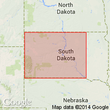
- Sharon Springs member
- Modifications:
-
- Areal extent
- AAPG geologic province:
-
- Chadron arch
- Williston basin
Summary:
Name extended for a member of Pierre shale to outcrops on southeast side of Black Hills, Fall River, Custer, and Pennington Cos, SD on Chadron arch and in Williston basin. Consists of dark-gray to black fissile shale containing abundant fish remains. It weathers to steep buttresses along drainage lines, and to a low, bare ridge where relief is less. Beds are characterized by many bentonites, ranging in thickness from a fraction of an inch to over three and one-half feet. As many as 35 beds, most of them less than two inches thick, have been counted in a single exposure. Several zones of large biscuit shaped concretions averaging perhaps 1 x 3 feet characterize upper part of member. Member has not been traced north of vicinity of Rapid City, Pennington Co, SD. Probably represented in northeastern WY by Pedro bentonite zone at base of Gammon [ferruginous] member of Pierre. Thickness in Fall River Co is 150 to perhaps over 200 ft. Section given in sec 2, T8S, R6E, Fall River Co. Lies conformably on Niobrara formation; is sharply, but apparently gradationally, overlain by unnamed brownish-gray shale in Pierre formation. Late Cretaceous in age.
Source: GNU records (USGS DDS-6; Denver GNULEX).

- Usage in publication:
-
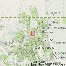
- Sharon Springs Member*
- Modifications:
-
- Overview
- AAPG geologic province:
-
- Powder River basin
Summary:
Is a member of Pierre Shale at Red Bird, Niobrara Co, WY in the Powder River basin. Assigned an early and late Campanian age. Correlation with other units of the same Late Cretaceous age in south-central WY shown on Table 1.
Source: GNU records (USGS DDS-6; Denver GNULEX).
- Usage in publication:
-
- Sharon Springs Member*
- Modifications:
-
- Areal extent
- Overview
- AAPG geologic province:
-
- North Park basin
Summary:
Is extended from the Great Plains into the Kremmling area, CO, North Park basin as a member in the lower part of Pierre Shale. Crops out about 1,100 ft above base of Pierre. Is a buttress-weathering shale and bentonite-bearing (as many as 8 thin beds in lower part) member. Bentonite beds traceable by their frothy appearance, scattered selenite and calcite crystals. Base of member chosen at lowest bentonite bed; top of member chosen at top of buttress shale. Is generally 45 ft thick. Is of early and late Campanian, or Late Cretaceous age. Correlation with Mancos Shale of Hamilton area, CO shown on fig. 2.
Source: GNU records (USGS DDS-6; Denver GNULEX).
- Usage in publication:
-
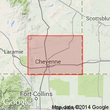
- Sharon Springs Member*
- Modifications:
-
- Overview
- AAPG geologic province:
-
- Denver basin
Summary:
Nomenclature applied to divisions of the Pierre Shale in exposures at Francis Ranch, secs 7-10 and 15-16, T14N, R69W and in subsurface in Apache Corp. 1 Polo Ranch, sec 14, T14N, R68W, Laramie Co, WY, Denver basin modified. Term: 1) Gammon Ferruginous Member replaces use of lower transition zone; 2) Mitten Black Shale Member replaces use of rusty zone; 3) Hygiene replaces use of the subsurface Sussex; 4) Rocky Ridge, Larimer, and Richard Sandstone Members replace use of the subsurface Parkman. Terry Sandstone Member of Pierre in the Fort Collins, CO area is equivalent to the subsurface Sussex and is not present at Francis Ranch or in the Apache Corp. well. Use of Shannon, Sussex, and Parkman is discontinued in the Denver basin because the sandstones of the Denver basin are not time-equivalents or time-transgressive facies of the Shannon, Sussex, or Parkman of the Powder River basin. As modified, divisions of Pierre are (ascending): Gammon, Sharon Springs, Mitten, Hygiene Members, unnamed interval, Rocky Ridge Sandstone Member, unnamed interval, Larimer Sandstone Member, unnamed interval, Richard Sandstone Member, unnamed interval, units A, B, C, unnamed interval. Pierre overlies Niobrara Formation and underlies Fox Hills Sandstone. Of Campanian age. Measured section; nomenclature chart.
Source: GNU records (USGS DDS-6; Denver GNULEX).
- Usage in publication:
-
- Sharon Springs Member*
- Modifications:
-
- Areal extent
- AAPG geologic province:
-
- Las Vegas-Raton basin
Summary:
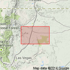
Areally extended as a member--one of four members--of the Upper Cretaceous Pierre Shale into northeast NM. Is mapped in the northwest part of quad, northwest of town of Raton, Colfax Co in the Las Vegas-Raton basin. Has several bentonite beds that are probably equivalent to Ardmore Bentonite Beds. Overlies lower member of Pierre. Underlies middle member of Pierre.
Source: GNU records (USGS DDS-6; Denver GNULEX).
For more information, please contact Nancy Stamm, Geologic Names Committee Secretary.
Asterisk (*) indicates published by U.S. Geological Survey authors.
"No current usage" (†) implies that a name has been abandoned or has fallen into disuse. Former usage and, if known, replacement name given in parentheses ( ).
Slash (/) indicates name conflicts with nomenclatural guidelines (CSN, 1933; ACSN, 1961, 1970; NACSN, 1983, 2005, 2021). May be explained within brackets ([ ]).