

- Usage in publication:
-
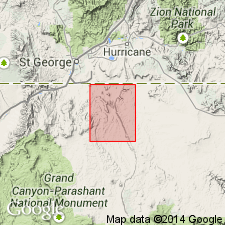
- Seegmiller Mountain Basalt*
- Modifications:
-
- Named
- Mapped 1:31,680
- Dominant lithology:
-
- Basalt
- AAPG geologic province:
-
- Plateau sedimentary province
Summary:
Named for occurrence at Seegmiller Mountain which is its designated type area and is located in T40N, R11W, northern Mohave Co, AZ, Plateau sedimentary province (west-central part of map area). Name informally used by earlier workers. Consists mainly of basalt flows and includes related intrusive dike or plug and cinder deposits; each of three units are separately mapped. Basalt flows have dark gray, finely crystalline, aphanitic groundmass, and sparse olivine and unknown black phenocrysts; surfaces are blocky; about 40 m thick. Intrusive dike or plug is dark-gray finely crystalline olivine basalt with aphanitic groundmass; weathers blue-gray; contains black pyroxene crystals; includes black to red scoria and grades to scoriaceous cinder deposits at vent surface on Seegmiller Mountain. Cinder deposits up to 10 m thick. About 1 m.y. younger than newly named Black Rock Canyon Basalt that outcrops northeast of Seegmiller Mountain. Basalt rests on Tertiary erosion surface that slopes gently northwest and south from vent area; flowed mostly northwest over Shnabkaib Member of Moenkopi Formation. Younger than Petrified Forest Member of Chinle; older than Quaternary surficial deposits and Pleistocene basalts including newly named East Mesa and West Mesa Basalts. K-Ar age of 2.35 +/-0.31 to 2.44 +/-0.51 Ma (Pliocene) determined by Reynolds and others (1986, AZ Bur. Geol. Min. Tech. Bull. 197) on basalt just west of map area.
Source: GNU records (USGS DDS-6; Denver GNULEX).
For more information, please contact Nancy Stamm, Geologic Names Committee Secretary.
Asterisk (*) indicates published by U.S. Geological Survey authors.
"No current usage" (†) implies that a name has been abandoned or has fallen into disuse. Former usage and, if known, replacement name given in parentheses ( ).
Slash (/) indicates name conflicts with nomenclatural guidelines (CSN, 1933; ACSN, 1961, 1970; NACSN, 1983, 2005, 2021). May be explained within brackets ([ ]).